

Bagging 4 peaks on the Buckhorn to Mt Worthington traverse from Big Quilcene/Marmot Pass
Buckhorn Mountain – Northeast Buckhorn – Iron Mountain – Mount Worthington
I’m sensing a pattern developing. Actually, it’s not developing, it’s a pattern – period. We’ve been making these single-day pushes all summer long. It fills the day, and there is nothing left on the table.
October 19, 2023
The Motivation
With a spell of cooling and wet weather, the forecast was looking promising starting Wednesday and continuing through Friday. Thursday and Friday seemed to be the best with at least one day of dry weather preceding. I was after Buckhorn Mountain and Mount Worthington; 2 of the remaining 3 peaks I needed for the Mountaineers Clubhouse pin – a peak bagging award consisting of 10 peaks in the Olympics. Of course, those two peaks are separated by two others. Normally, Mt. Worthington is accessed from Buckhorn Lake and the Tubal Cain trail. But thats another hour drive north. It’s better to try to get both from Big Quilcene Trailhead. We decided on Thursday and left Friday open in case we wanted to climb something else. In the end, I needed Friday as rest.

Quick Stats
- 7:04AM – Start
- 8:15AM – Rock Shelter – possible way trail to Iron 2.75 miles
- 9:30AM – Water just before Mystery Camp, 5 miles, 3000′ gain
- 11:05AM – Buckhorn Summit, 6.6 miles, 4,600′ gain
- 12:03PM – NE Buckhorn, 4,700′ gain, 6.7 miles (too steep for accurate recording)
- 12:40PM – Base of Iron just after traversing ridge saddle. Lunch here. 6.86 miles 🙂
- 1::15PM – Iron Summit (Met up with Kayla and Katie)
- 4:00PM – Begin descent from Worthington Summit. Lots of chatting between Iron and Worthington
- 6:00PM – Back on trail from direct descent
- 7:03PM – Back at car. About 30 minutes by headlamp
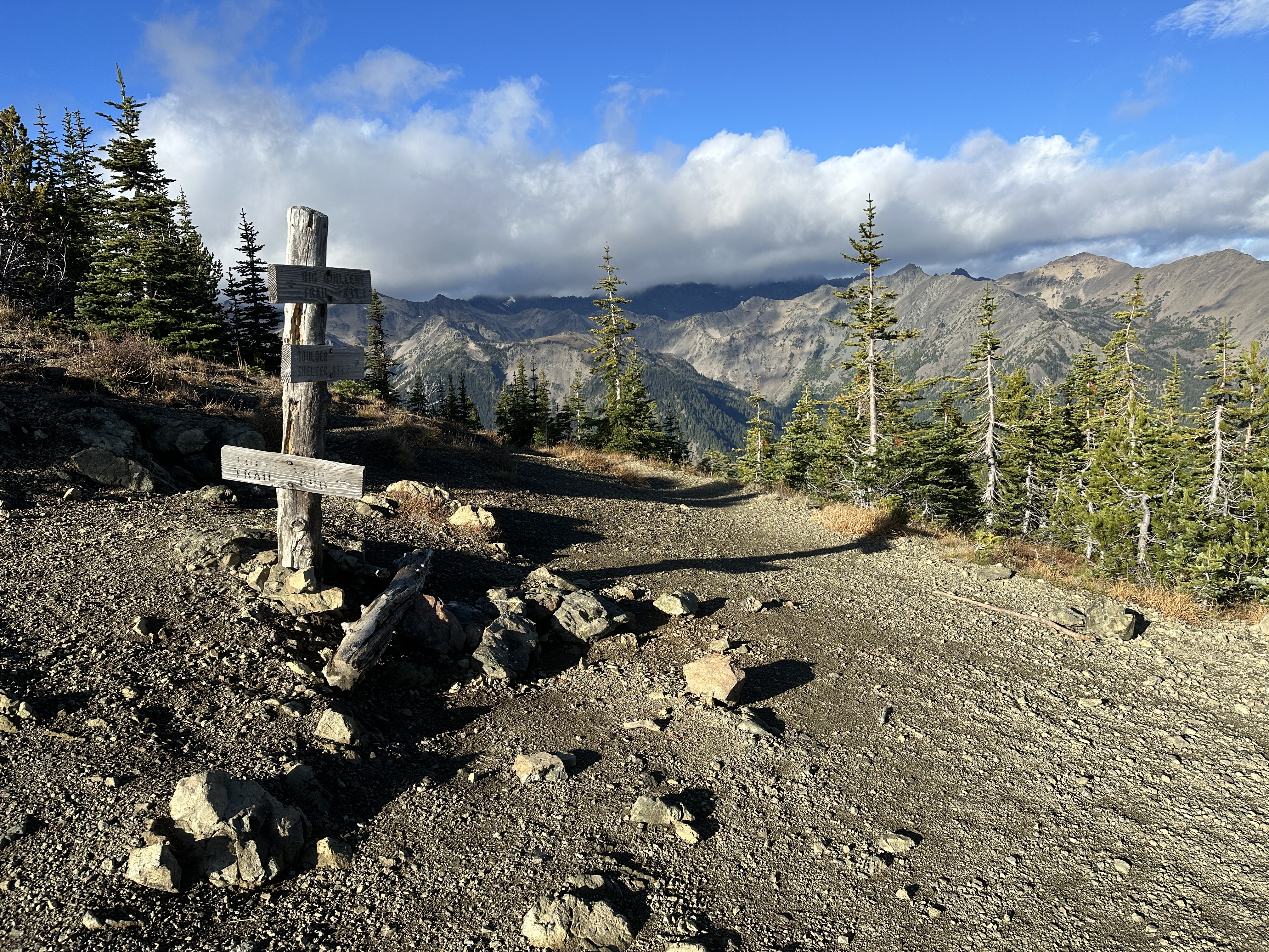
Approach
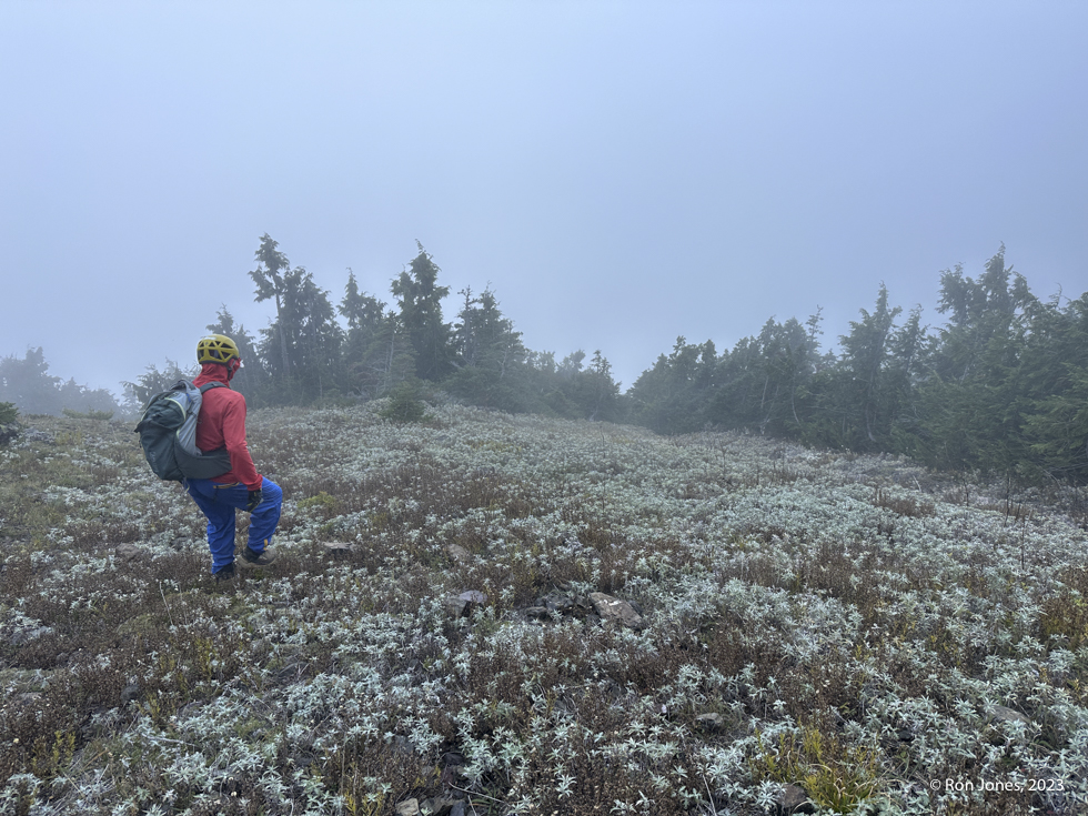
After 85 miles and two hours driving we arrived at the Big Quilcene Trailhead to an empty parking lot. It was dark. We were hiking by 7:04AM, with headlamps. We used lights for about 20 minutes. The weather was cool but not cold. Lon wore shorts, I wore long pants. We both wore trail shoes given the extended trail miles.

.
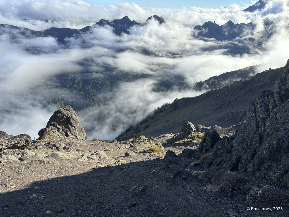
At roughly 2.75 miles we arrived at Shelter Rock camp which is about where way trails seem to branch off – the area we expected to descent to from between Iron and Worthington. Which we ultimately did, albeit probably closer to mile 2.5 which was okay. The trail steepens at mile 2.75 and continues to mile 4.5 where it’s the last opportunity to water up, which we did. From there it’s another mile or so to Marmot Pass. When we topped out on the pass we were presented with some ominous clouds coming over the first ridge to the west, and a strong westerly blowing.
We were honestly worried about the clouds and possible rain. But even though they were blowing our way, they were also dissipating. We were prepared to retreat after Buckhorn, which is a walkup scramble, but the weather held and even got better.
The Traverse


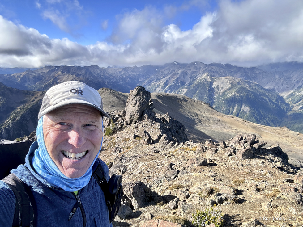
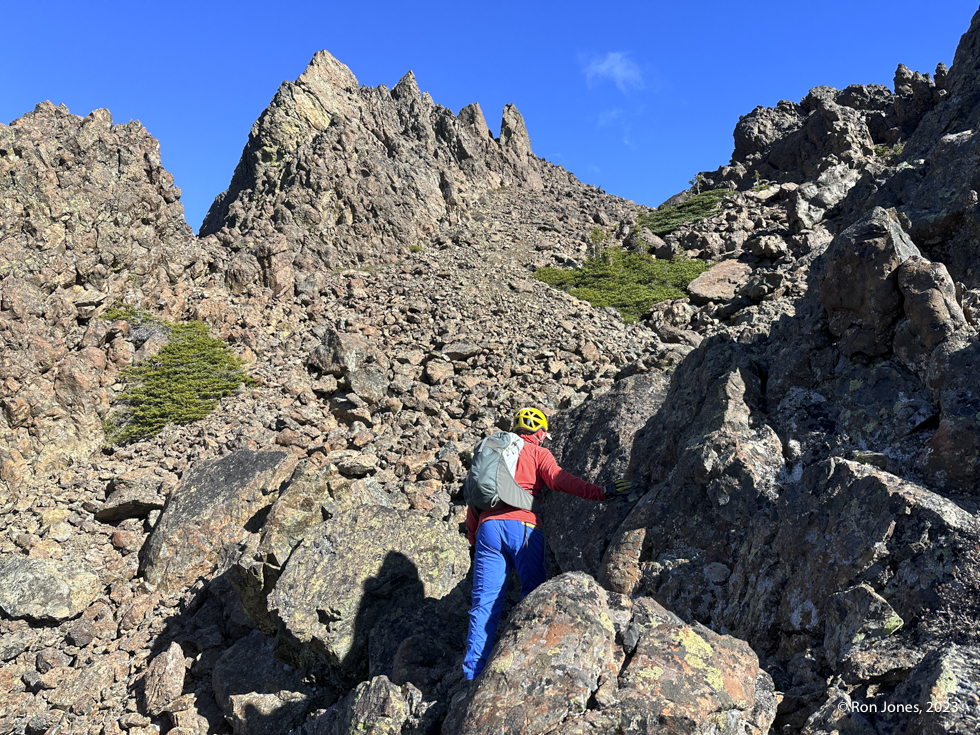
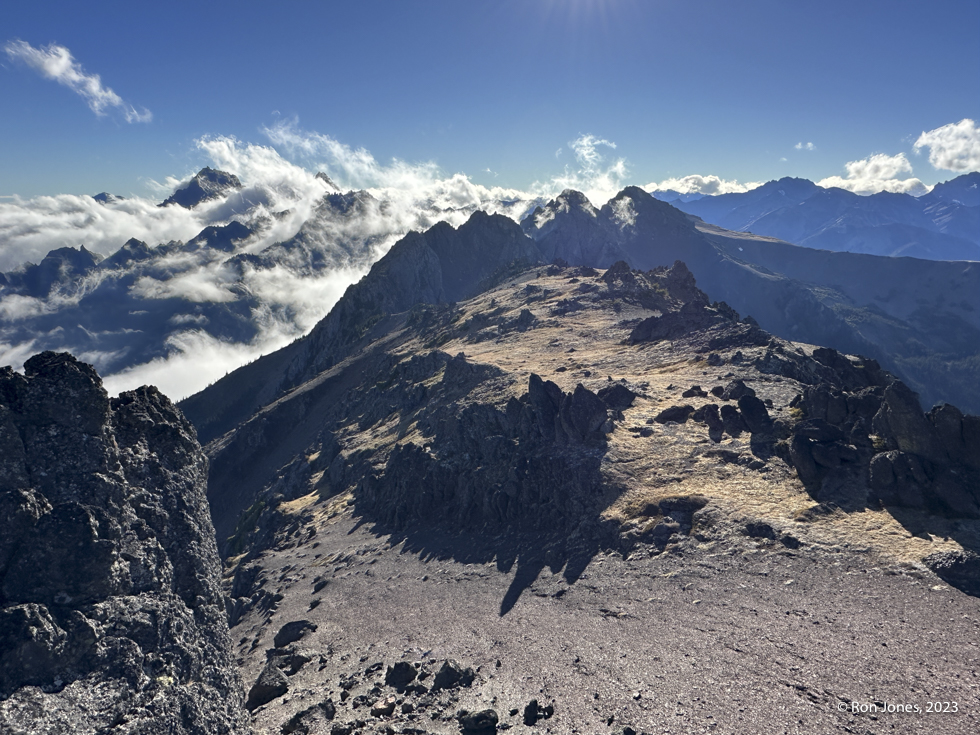
The images below begin with looking east to NE Buckhorn and beyond, followed by the look back at Buckhorn. And finally, the two images of us on the summit of NE Buckhorn. It was sketchy loose across that saddle. Note in the video. I frankly can’t remember our exact route, but it more or less presents itself as you go. The top left image below is a better representation of the scree slope. The images looking back skew the perspective, making the scree slope look like a triple black diamond ski run.
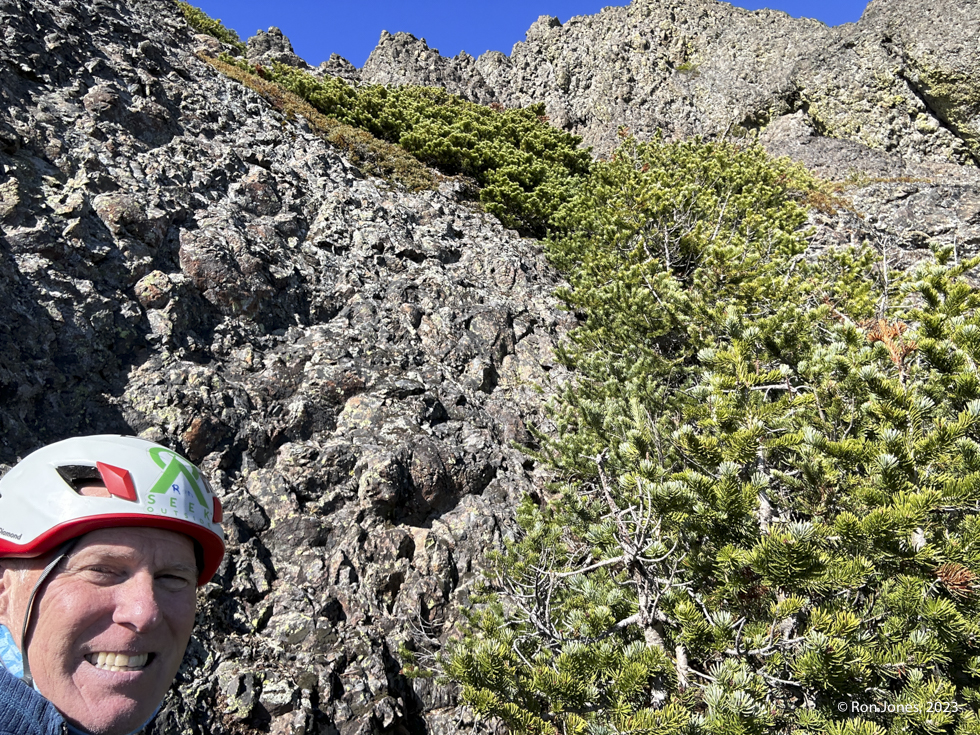
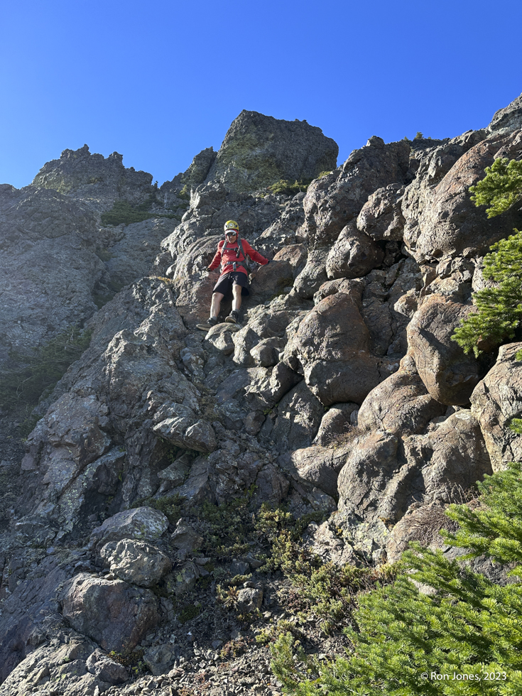
The section between Buckhorn and the summit of Iron was the most challenging portion of the traverse. Each down climb required attention to micro routing and not over committing. The ridge traverses, especially the first one required careful footing.

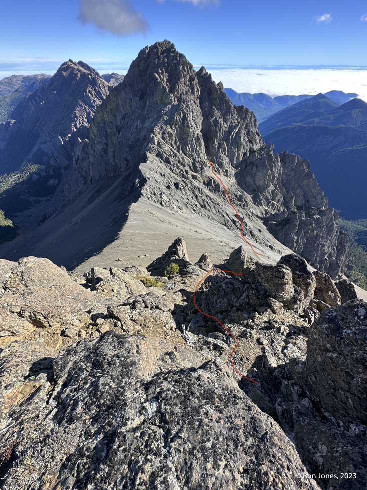


Descending NE Buckhorn was just a matter of working a series of chutes and ledges. We were never certain a route would go. Working together, we’d scout over lip here, or down a chute a ways there, being careful to not overcommit and go with what seemed like “go” route. We came to a couple spots where we each took a slightly different line, whether it was crab crawling a narrow chute with loose grit, or a steep face and full-on veggie belay. Amazingly we kept finding yet another option to continue, the whole time thinking we’d cliff out. Looking back on the images, I can’t even pick out our route off the south side of NE Buckhorn. Just know it works. But, you have to be comfortable with some exposure, loose stuff, near hanging veggie belay, and have patience.
I’d found this report on NW Hikers of two guys who did the traverse in 2011. Their beta seemed reasonably accurate. The one thing we didn’t do was drop to the north side of the the saddle ridge between Buckhorn and NE Buckhorn.


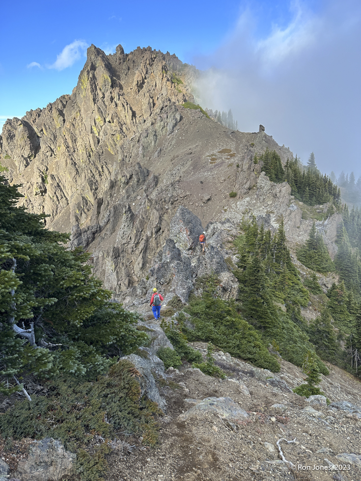
We made pretty quick work of the traverse to Worthington because Kayla and Katie had already made over ½ the traverse. They did Iron first. About ⅓ of it was a way trail of sorts. The secret was not to stay too high. Follow the obvious line – right!!!
A short stop to clean shoes and Kayla blew a lace. Lon had a leather lace that was too thick. But my first aid/general repair kit came in handy with a short length of dyneema cord!


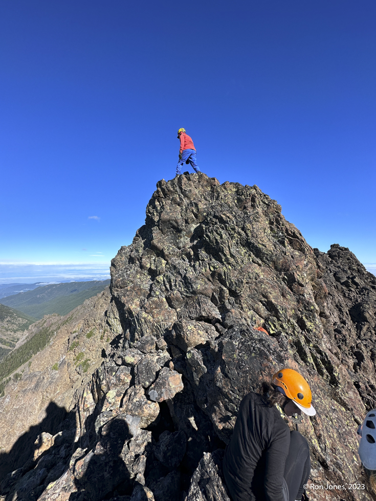
We had all four of us on the summit. There is a slot to sit two in. And one or two can be on the angled slab, or another shelf, where Lon is standing below.


It was now 4PM and we needed to be back on trail by dark. Lon went of the NE corner of the block. I went back down the face. We said our goodbyes. Using my Rocky Talkies, Lon and I were able to communicate. I caught him after we both had a quite pleasurable scree ski. Ultimately, Kayla and Katie would descend back to their car on the north slope, and we’d descend the south slope.


The Route and Summary
It was a sweet route in the end. With more daylight and less chatting, it would be possible to tag East Worthington too. As you can see in the image from the OMCG, there are routes down from the ridge. Based on what I saw and experienced, those routes are a lot more scree than we had. Another option is to camp at Shelter Rock or Mystery Camp and get an early start for the traverse.
It was an absolute pleasure to connect with, and then scramble a bit with Kayla and Katie. Kayla moves like a goat in the Mountains – fluid and quick. This was the second time we connected with a stranger and ended up scrambling together. And on both occasions, in an area or trail that one would not expect to see another person, let alone someone doing more or less the same thing or with the same interest.


