
A planned roll of the dice and it didn’t come up craps!

September 16, 2023
Sometimes it takes a crazy idea. The plan was to bag three peaks in one longish scramble – Cloudy Peak, Boulder Ridge, and Mount Buckhorn. But why? Well, for me, each one completed meant another peak toward one of a couple “peak pins” or badges within the Mountaineers organization. Additionally it’s a workout and challenge. And for friend, Lon, well, it’s a workout and challenge 🙂
After reviewing beta from various trip reports on peakbagger, the Mountaineers website, and other sources we could find, it seemed like it might be possible to work our way back to Boulder Ridge from Cloudy Peak, then grab Buckhorn. However, this was banking on the ability to successfully traverse an unknown ridge. It also meant we’d begin with the peak furthest away, which begins with mostly trail, then more or less work our way closer to the trailhead. Let’s just say, it was a “plan”.
The trailhead to Big Quilcene is no trivial matter from Olympia. It’s a solid 2 hour and 15 minute drive, a lot of it on Highway 101. But will a long section on paved and gravel forest roads too. Fortunately they are in good shape.

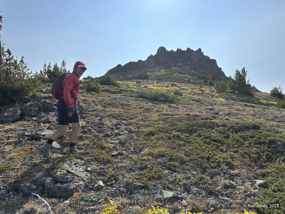
We began hiking at 6:45AM. Could have started 15 minutes earlier. maybe 30. With so many trail miles we both wore our trail shoes. I use Hoka Speedgoats. Forgot what Lon wore on that day. I think the hightop Lone Peak’s. We made good time up the trail to Marmot Pass arriving at 9:05AM for the roughly 5.5 mile trek. A short break and we continued to Boulder Shelter, arriving at 9:50AM. The stream was still running even after no measurable rain all summer. We filled up on water. For me that meant a full liter plus 20 ounces. That was on top of the 20 ounce gatorade I was carrying. It’s still good trail up to a tarn at 8 miles from the TH. From the tarn it was a steep boot path to the saddle above Charlia Lakes where one scrambles off trail to Cloudy Peak. We arrived at the saddle at 11:20AM, 8.5 miles.


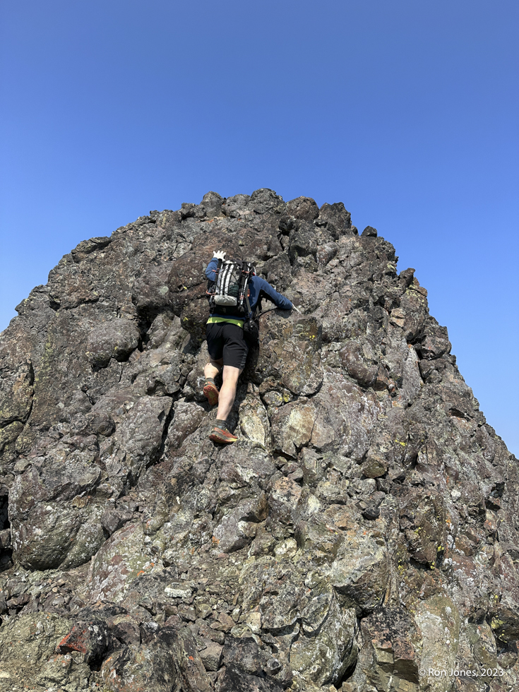
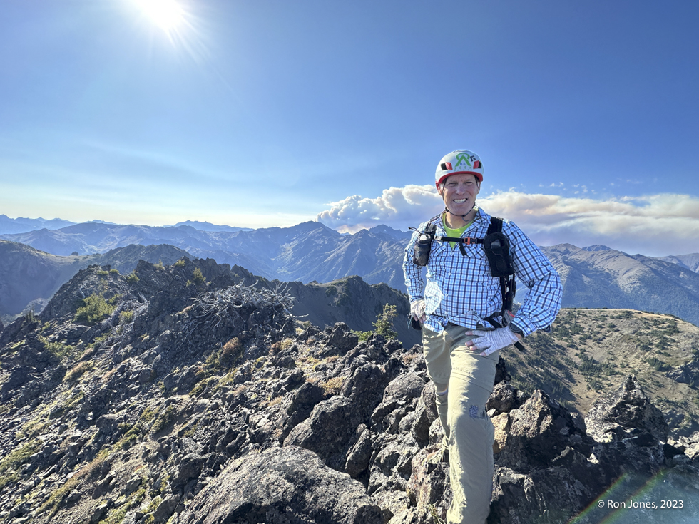
We should have already had our helmets on. We went ahead and put them on for the summit and descent. The climb up the block was not bad. The rock felt pretty secure. It’s a long way down off the either side. And even where climbing one could end up cascading left or right which would be very bad.


Image below – working our way back to the saddle and looking at Boulder Ridge. We thought we might try the traverse but after looking at it from this vantage point, we decided to try going up from Charlia Lakes was the best option. We didn’t consider the line I drew on the right. It was a very steep ascent up from the lake to a saddle. At the top we were canopy walking on the alpine juniper. And then faced a steep scree descent that is above Boulder Shelter (a long way above), then the ascent up to Boulder Ridge. This was our big dice roll. It was noon on the summit of Cloudy Peak. We’d been out for 5.5 hours, hiked 9 miles, and gained 5,500′. We really needed this to work out to avoid a really long trail walk back. We decided that if we made the saddle and it didn’t look safe, we’d backtrack. Luckily, it was not that bad.


Climbing up from Charlia Lake was steep, often on exposed scree slopes and then topping out by bashing through thick alpine juniper, at times walking suspended off the ground on a thick canopy. Lon and I took two slightly divergent routes for the last 50 vertical but ended up in the same spot. What a relief to see that it would be possible to descend into a bowl and climb out. Well, we weren’t 100 percent sure we could climb out, but ultimately it worked. Once on Boulder Ridge, we crossed to the north and dropped down a ways to traverse, finally ending up in the bowl/basin that allows one to ascend toward the summit. One climbs up out of the basin, staying high (very loose talus here) and under a huge chockstone, through a gap to the south east ridge, then wrap back north to the summit. The route is quite involved.


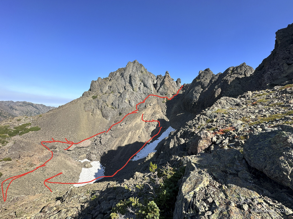
The image below shows where we came over the ridge and dropped down, skirted the basin and climbed toward the chockstone. On our return we took a more direct route through the basin and continued toward Marmot Pass to the north.

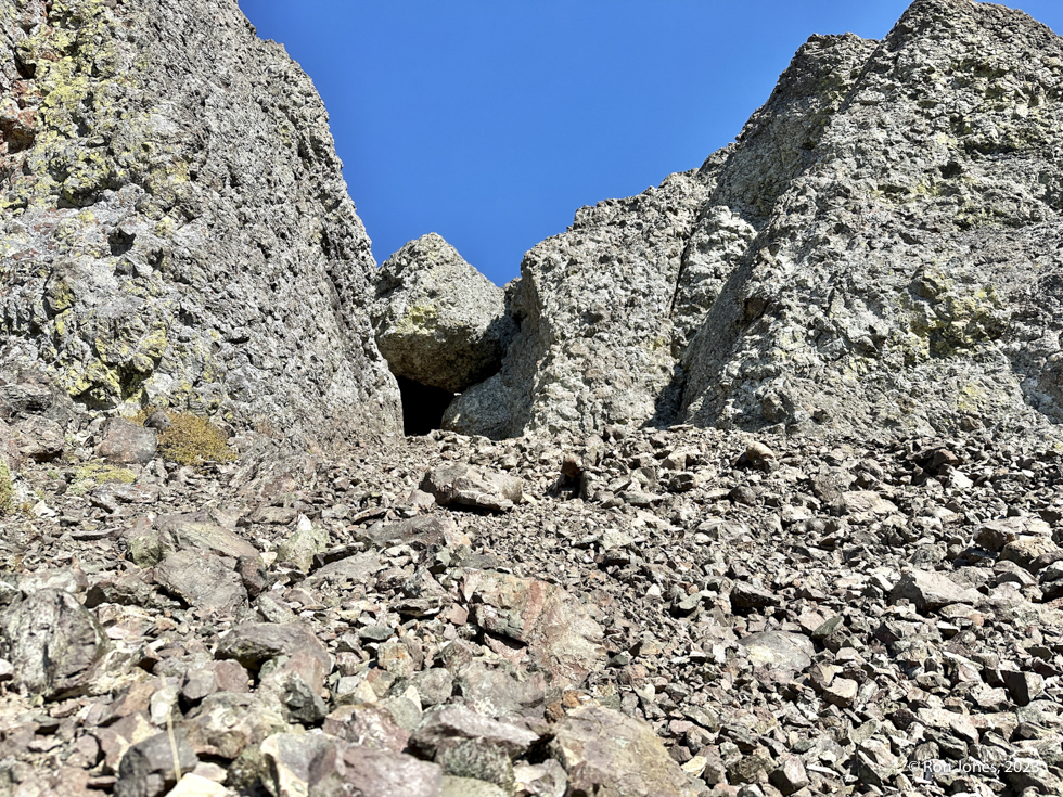
The rather large, “raiders of the lost ark” chockstone”. Continue past it toward a narrow gap. Past the right side of photo.
You can see the smoke from fires in the west Olympics started by lightning a few days earlier. It was a sad sight to see. The park chose to let them burn. Fortunately, rains came not too many day later. Once again, a summit and no summit register.


We didn’t linger on the summit. In fact we never lingered very long in any spot. We’d now covered almost 11 miles, 7,000′ of gain in 9 hours and 20 minutes. We still had to get off this thing, back to Marmot Pass (about 1 mile away), then descend the trail 5.5 miles to the car.
The images below my watch show where we tried to find a different way back that avoided the basin but not luck. So we went through the basin. It was a bit sketch, but doable.


Below, looking towad Marmot Pass (far right), and our traverse back to the ridge, which we gained at the left notch with trees. From that point it was easy walking.


We used headlamps for about minutes at the end. We pushed as far as we could without them. Our day ended at 8:07PM. 13 hours and 20 minutes. 17.7 miles. We had to give up on bagging Buckhorn. We felt a real sense of with this day and two peaks.
As I am finally writing up this post, it’s a month and two days after the scramble. Tomorrow, October 19, we head back up to bag Buckhorn, East Buckhorn, Iron, and Mount Worthington. Well, we will try. We are hoping to make it a lollipop of sorts from Big Quilcene. We only have 11 hours of daylight to play with. It’s about 12 miles. The gain should be less than 6,000′.
I am reasonably positive we are the first to link up these two peaks in the way we did. But who knows, maybe it’s been done before. I’m gaining more confidence, but not losing any respect for these Olympic Mountain Peaks.
Our route below. If you wanted a gpx track, feel free to reach out.


Do you ever roll the dice on adventures?
With safety in mind of course 🙂

