

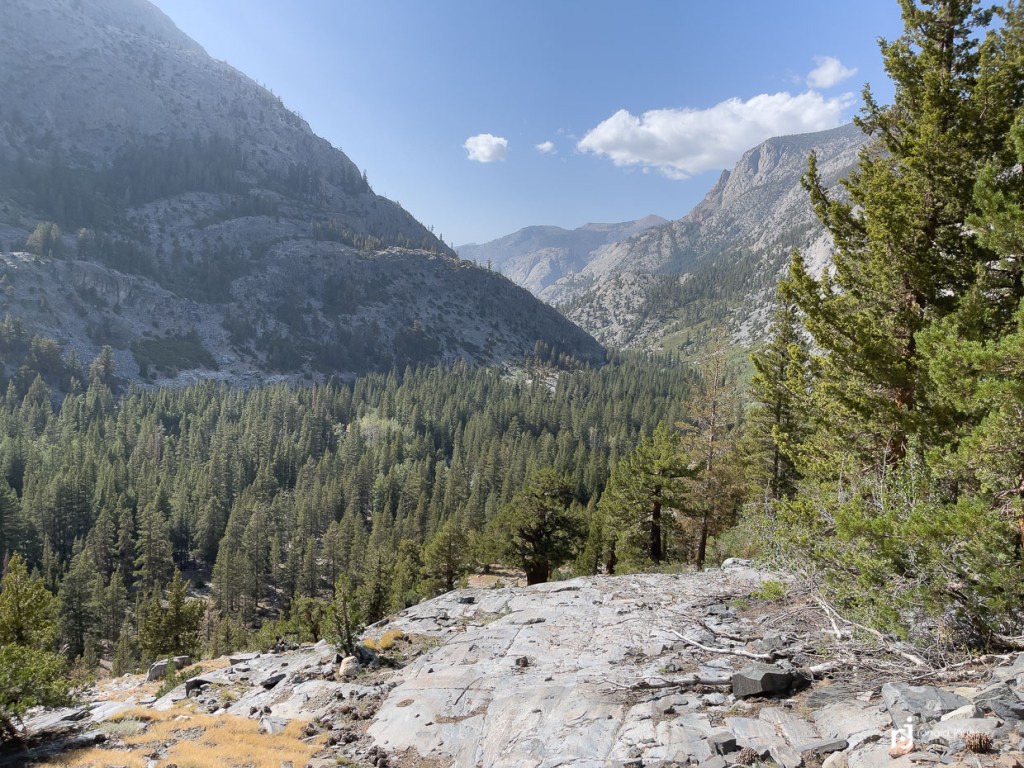
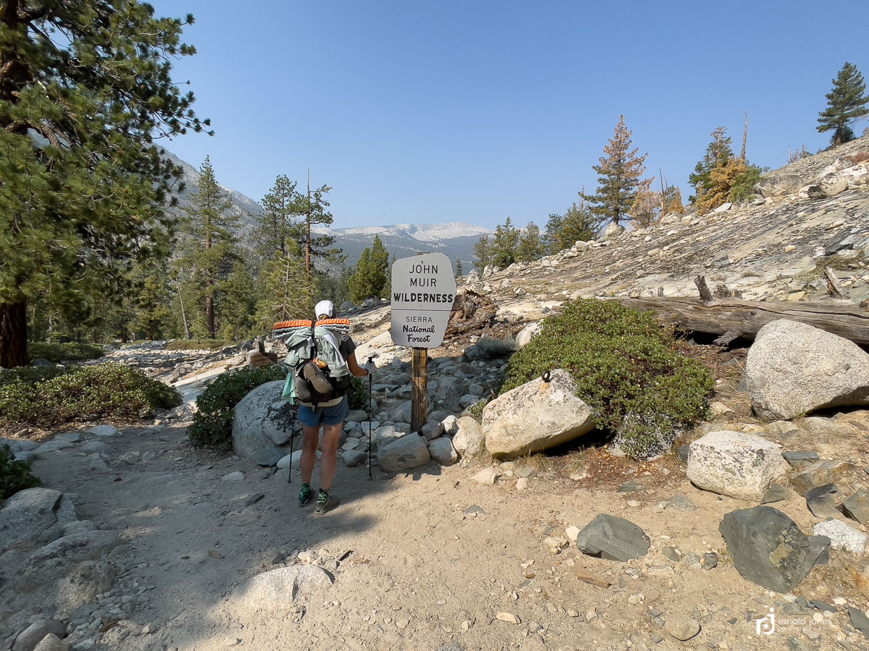
Leaving Wanda Lake just below Muir Pass meant we were leaving behind what I’d considered to be the big passes of the trip. No more 12,000 footers. And the scenery would begin to change some too. A little less of the fully exposed barren granite landscape, and more foliage and trees. Day 10 would drop us down into Evolution Valley, ultimately to the San Joaquin River, around 8,000′, only to spend the next day hiking back up and over Seldon Pass (11,000′) to camp at Marie Lake.
Evolution Valley – JMT Day 10

The fritos really added to the beef stick, string cheese, tomato paste tortilla roll-up! Even so, I really wanted a bean and rice burrito for some reason. With hot sauce and some guacamole of course!
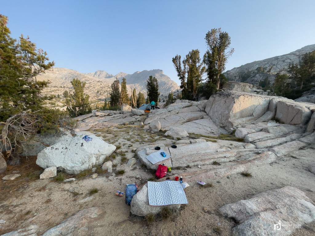
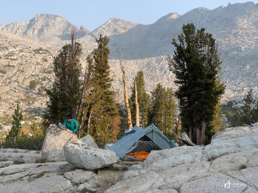
We slept good even though we were at 11,500′ and the moon was still shining bright most of the night like someone had a spotlight shining down on us. Our trip began just after the new moon on August 7. For the first 3-5 days it was a barely visible waxing crescent. By the 18th it was a waxing gibbous at over 80%. It would be full by Saturday and Sunday.
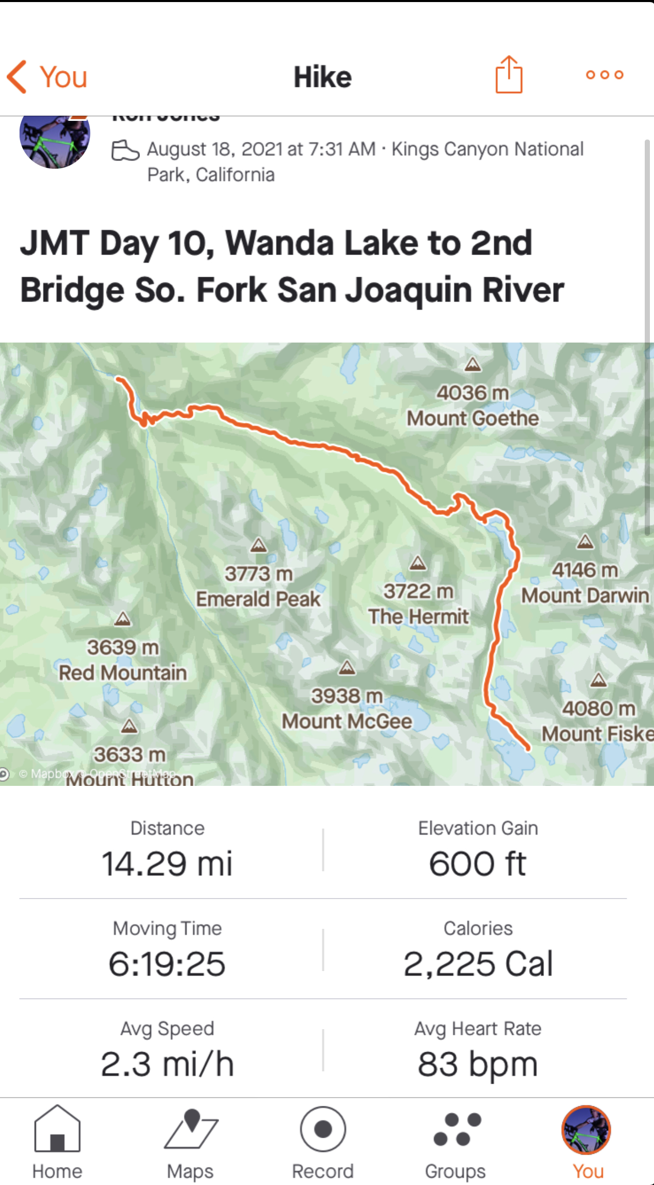
Once again, we were not out of camp super early but we were not too concerned. Today was a lot of downhill – about 3,000′ or so. But some uphill too. A whopping 600′.
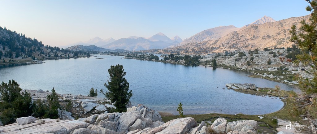
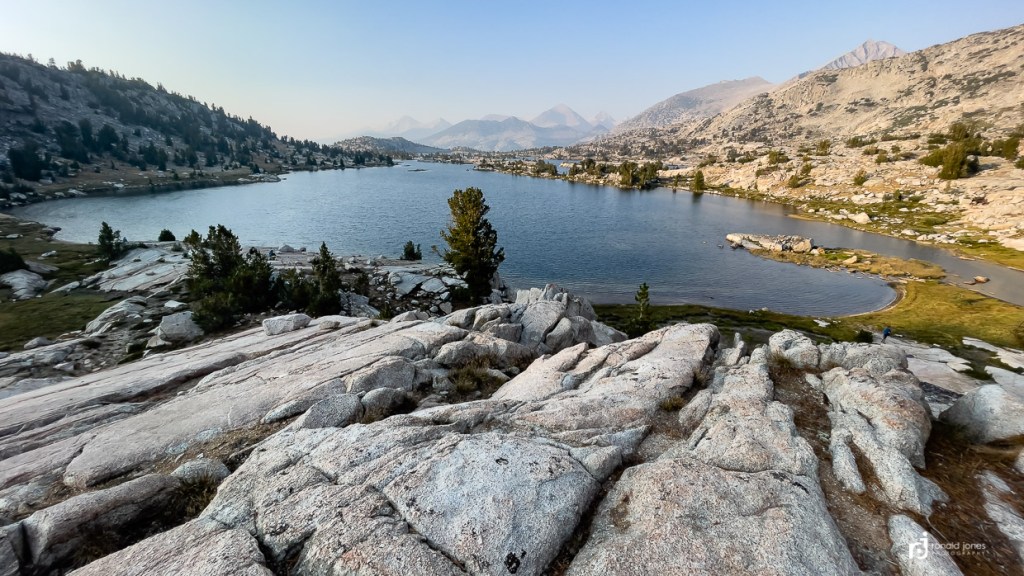
It was chilly but the wind had calmed overnight. When we got to the far end of Lake Wanda, we were happy to have camped at the other end. There were quite a few developed sites, but somewhat on top of each other and more exposed than where we camped.
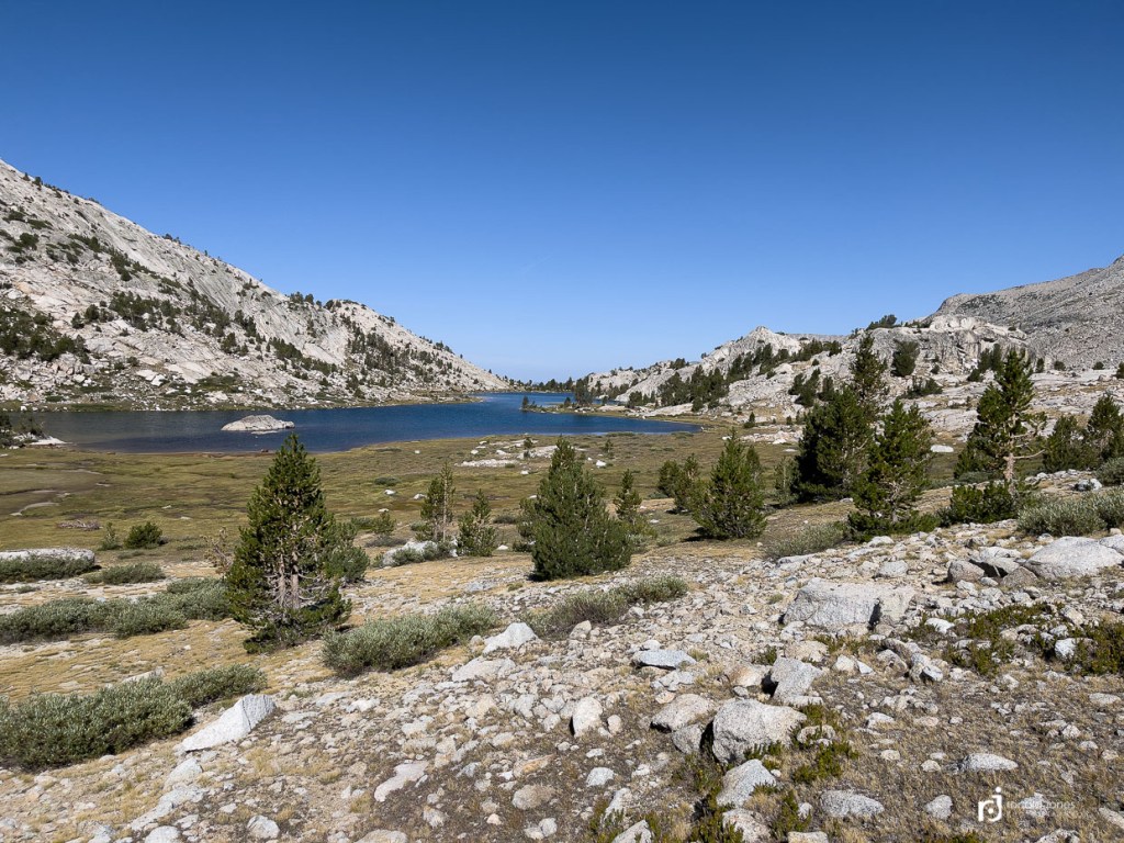
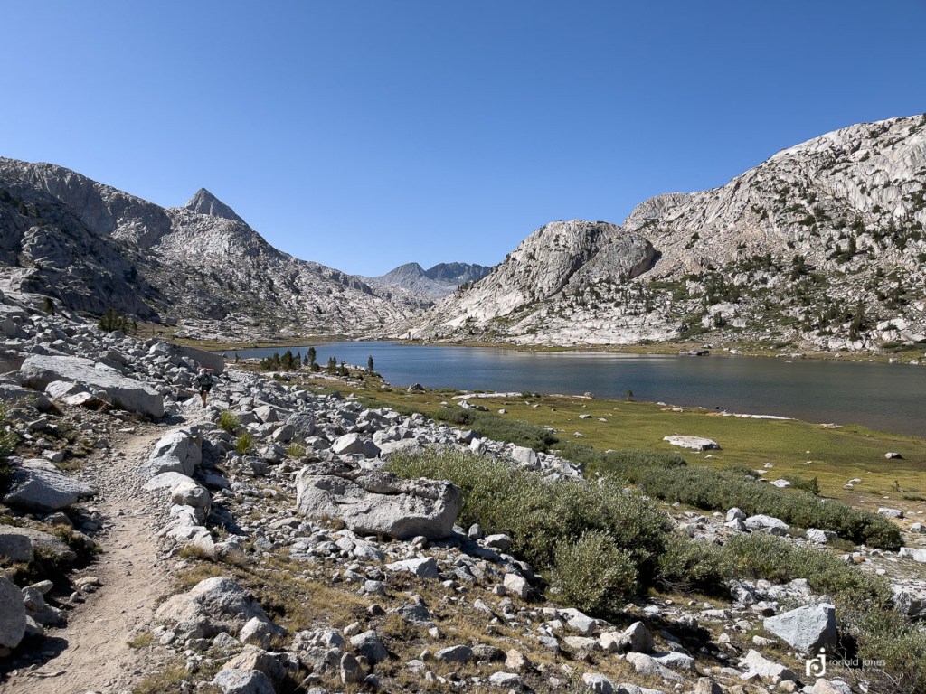
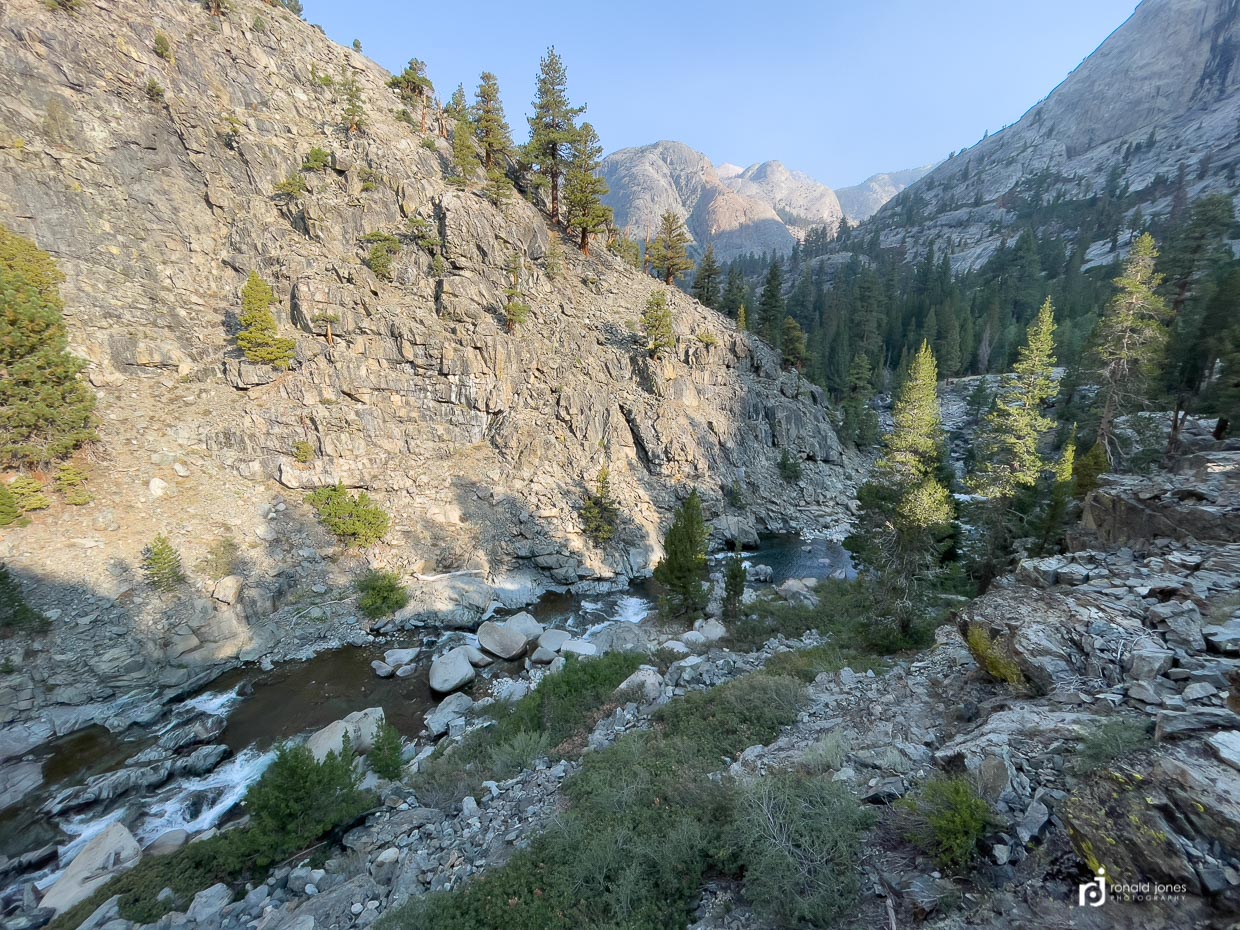
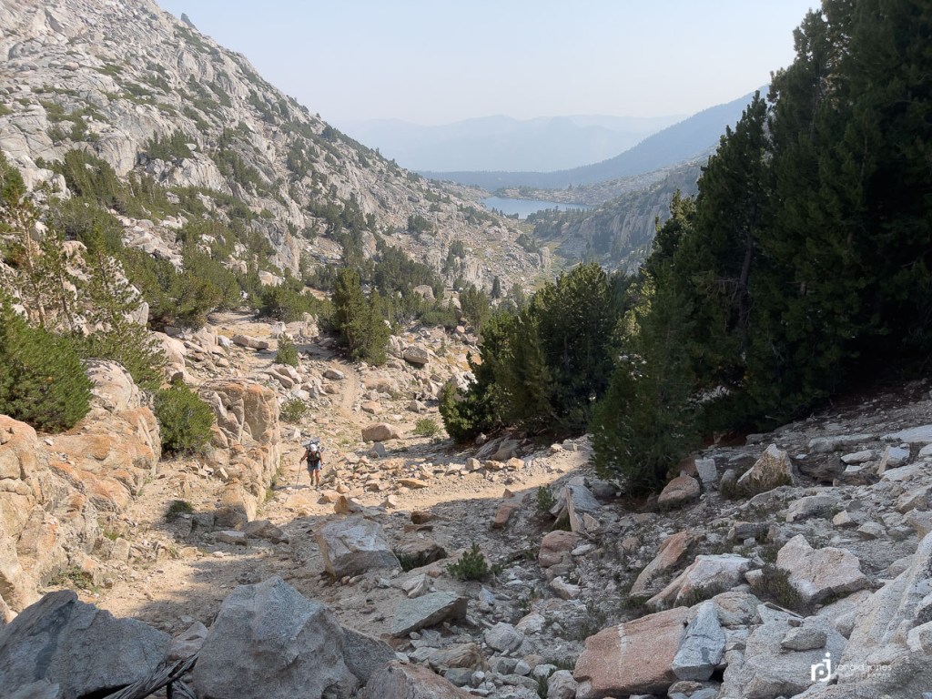
The views of Evolution Valley and Evolution Lake were amazing in the soft morning light. The coolness wore off once the sun was hitting us. It actually took a little while to work our way down to Evolution Lake where we chatted with a couple different hikers, and walked over to a spot for a nice break. One of the hikers, a woman, was sitting, eating a snack and reading. She said she had come through the are a year or two ago but there was a storm and she had to keep moving, so she was taking the opportunity to soak in the sun and views. I could definitely see this location being popular. It would be a nice place to hang for a while. But, we have miles to burn to keep our schedule.


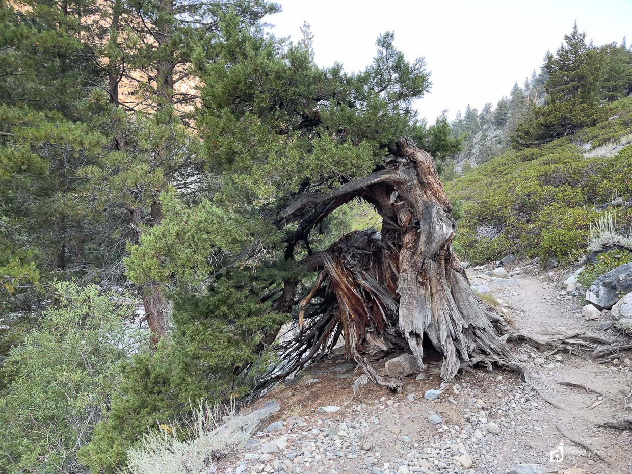
We did our best to take in the scenery before dropping into more of a forested area. Someone mentioned to make sure and check out McClure Meadow. We saw both Colby and McClure from the trail just within the forest. We didn’t take the time to actually walk out into them. We did take the time to find another fantastic spot along Evolution Creek. We took off our shoes, had lunch and rinsed off a bit. And took the time to enjoy. Largely, this entire section, with exception of the lakes and creek, was quite boring. We passed the ranger station which was well off trail. The sign leading to the station basically said, don’t bug us unless it’s a real emergency! Not the actual words, but it did say, emergencies only.
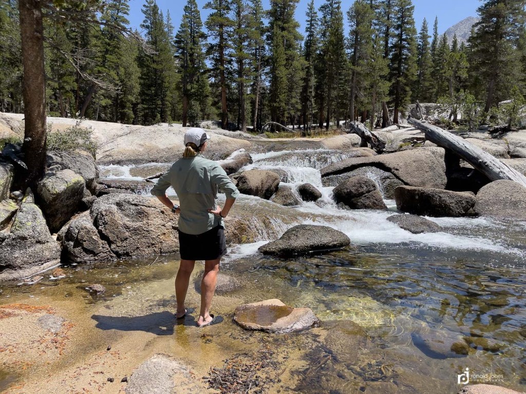

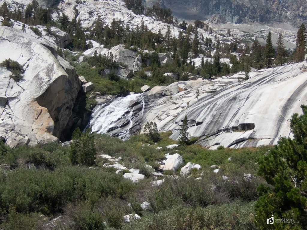
It seemed like the forest would go forever. Occasionally easy walking, other times more loose sand with little boulders. We stopped to get water at a creek and low and behold, it was click and clack. Brief pleasantries were exchanged, they asked how far we were headed, I said, “as far as we can get”. We met them again at the crossing of Evolution Creek. The only place on the JMT where we had to get our feet wet. In early season, this is one of the scary river crossings. I’ve seen videos of hikers actually swimming across. Not so bad except it’s not far to the water fall! When it’s running that strong, I believe they hike up a ways. I did’t get a photo of it, because as we neared, I noticed Click and Clack had just crossed. They were putting their shoes back on. Not wanting to spend any extra time in their vicinity, I said to Jean, “let’s do this with shoes”, and went to the shallow riffle section that was about ankle deep, and walked across. About 50′ or so. And kept walking. A little further down, I had stopped to take a photo of the water fall, and a woman said, there is a better place to get water. I was standing 25′ above the water near a sharp cliff/canyon. I said, I’m getting a photo of the waterfall. She said, “oh”. And about that time, here comes Click and Clack. So we motored on just ahead of them. It started to become a game for me. I moved quickly down the trail. At times almost jogging, more like skipping, which I can do pretty well. Jean doesn’t move quite that fast and they passed her. I got quite a ways ahead and figured I should wait for Jean. I found a nice spot with two very large trees about 10′ apart, next to the trail up against an embankment. I stood in waiting. Click, or maybe it was Clack (the faster and better hiker of the two) was nearly upon me when he saw me standing. He nearly stepped out of his shoes! It was quite comical. OH! There you are!:”, to which I replied, “yep.”
We were descending down a steep trail to the canyon floor where the San Joaquin River flows. Down at the bottom right at the river was a camping area that was quite busy. Click and Clack pulled into a site. We kept walking, crossed the river, and went another mile or two to the next bridge where we found camping in what looked like an outfitters camp. A hiker headed the opposite direction had alerted us to it. Had said it was a bit more private than what we had been looking at. When we dropped into the site, there were two woman setting up camp. We asked if they minded if we join them, and they were welcoming. There were a lot of little tent sites and semi-private. It was close to water. A group of young men arrived about an hour later and set up closer to them. They were all headed SOBO and seemed to know each other.


Trail Magic and As Far As We Can Get – JMT Day #11
While we didn’t always get as early as a start as hoped, we always got out of camp well before anyone else if we camped near folks. usually we were leaving before their shelters were down.
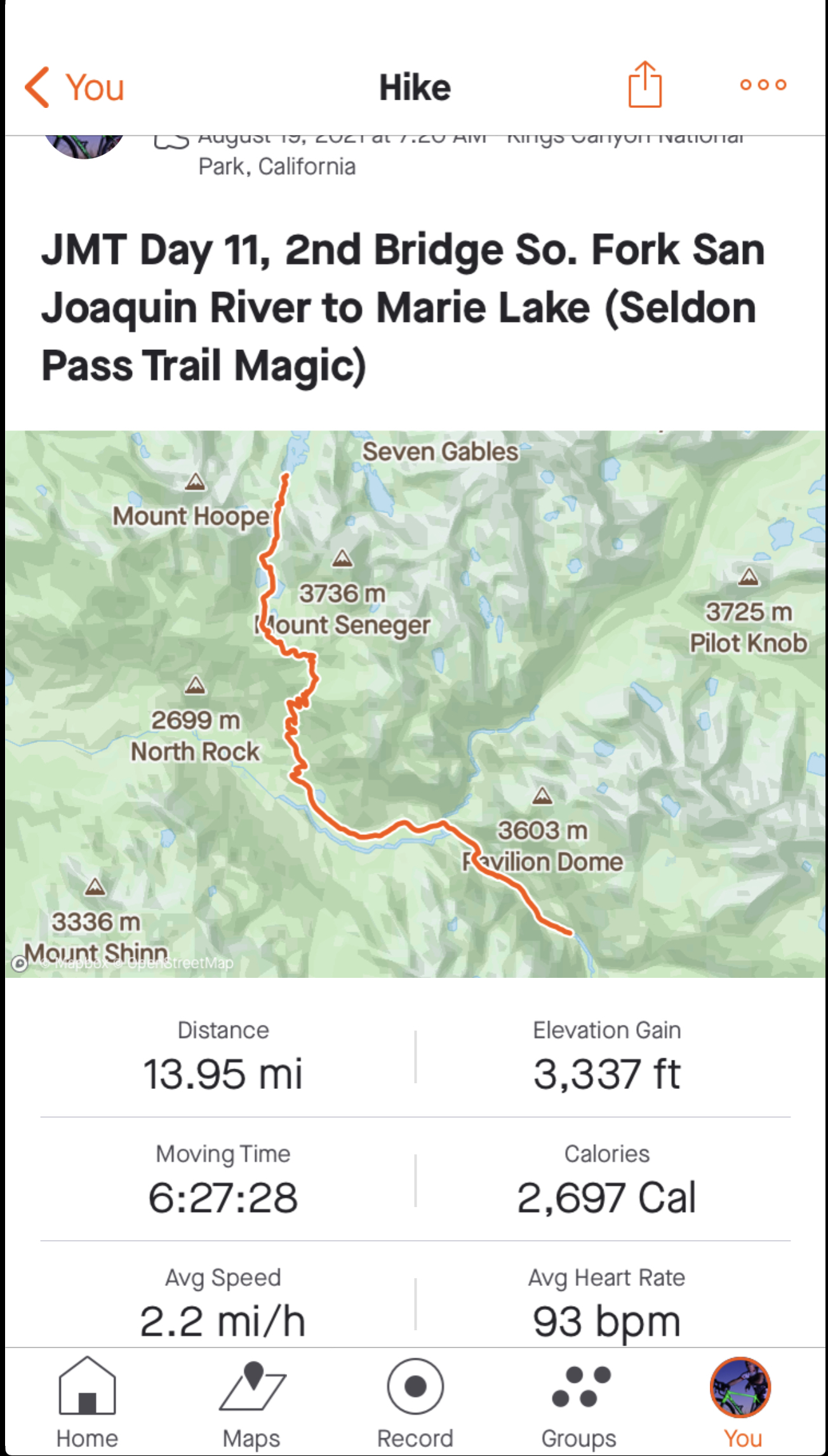


It was a beautiful cool morning again. It was downhill, flat and up slightly. We were headed to a junction where folks either head down to Muir Trail Ranch (MTR) if NOBO, or come out of if SOBO. MTR is a popular resupply place for through hikers and it’s a rustic roads end resort for folks. It has far fewer amenities than VVR, which is our destination tomorrow, Friday. At one point, I start to wonder if I missed a trail junction because be begin descending in earnest. I start checking guthook and gaia and all seems okay. but boy, are we dropping. Then we see the junction sign. Whew! And immediately being climbing. It’s really warmed up. I can smell smoke slightly. And there is a definite haze. We begin to move in and out of trees. We pass an enormous manzanita patch as we climb switchbacks. Paused from a break, here come our friends, Click and Clack. Like bad pennies, these two. Once again, it’s game on. I swiftly move up trail and find a spot where I can double back out of sight. It works. About 15 minutes later, I see them stopped at a switchback looking down. I’m sure they saw me. And I’m sure they were wondering how they passed me after they passed Jean.


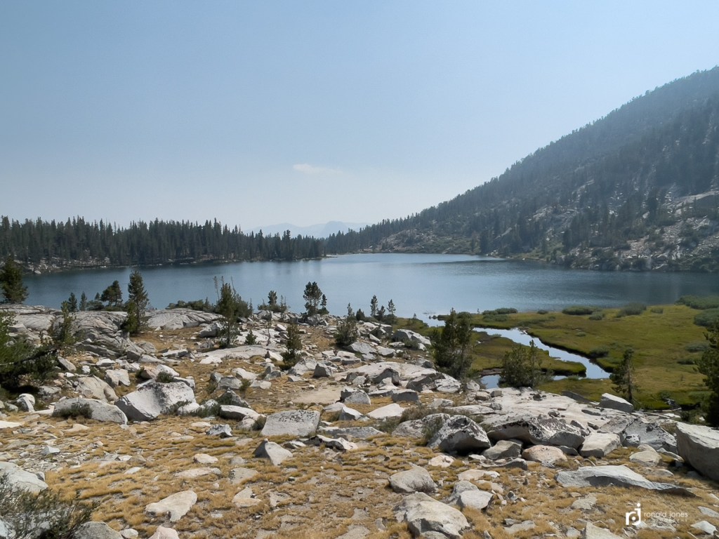
It was a fairly long haul getting up to Sallie Keys Lakes, where there is camping. Really beautiful spot. But apparently, I didn’t get photos at Sallie Keys. We stopped to water up at the lake, and noticed a chunk of tyvek someone had cut for a ground cloth was laying between the trail and the lake. It was a pieced about 25″ wide, as if it was for cowboy camping. I folded it up and placed it on near the trail, opposite the lake side. I almost took it, thinking someone maybe had it out and forgot it. Didn’t want to leave trash. But there were tents around so figured someone would take care of it. As it turns out, it belonged to a guy we’d meet on Seldon Pass, and he was returning to his camp. Yeah! I hope it was there when he got back. He said it was his tent ground cloth and has been known to blow out from underneath. Hmm. Secure it ~
As we started walking again, we noticed a camp up higher above us in the trees. It was a white ‘mid’ type shelter. Click and Clack! Again! Our luck! We exchanged pleasantries, and then, me having had enough of their banter, dished out some unpleasantries. It really began when white pack guy (the fit/fast hiker) asked how far we were going, and I responded “as far as we can get!” He really did not like that answer. And said, “you always say that.” For which I responded, “because it’s the truth and while we have some general sense each day, we really don’t know, or have not put a stop point for each day. Today, our goal is to get over Seldon Pass and as close to VVR as we can.” His buddy, black pack guy (the slow one) started going on about how his friend never hikes with more than one liter of water, but the section after Marie Lake, he’ll be carrying at least three liters.” This is when I knew they were really trying to mess with us, but not in a fun way. I knew from looking at the map that Bear Creek followed the trail for about 5-7 miles. So I just said, we’d be fine, there will be plenty of water for our needs, for which white pack guy makes the statement/question, “so you’ve hiked this trail before and know it then?” “You know Bear Ridge then, it’s try as a bone you know?” I responded, “nope, in fact this has been our very first backpack trip ever, and you two are full of B.S.”, and walked off. Jean was not too pleased with me, but at that point, they needed an attitude correction. I don’t know what they said after that. And thankfully, that was the last time we saw them. Out of the entire trip, which was one of the most friendly and respectful trails I’ve hike, with people always nice, courteous, and with exception of literally a couple times in 20 days hiking, everyone always gave way to the uphill hiker. At least offered. These two on the other hand, were different. They were the only ones who offered information unsolicited. And it was always wrong. And the strong hiker, had apparently hiked the JMT, three or four other times.
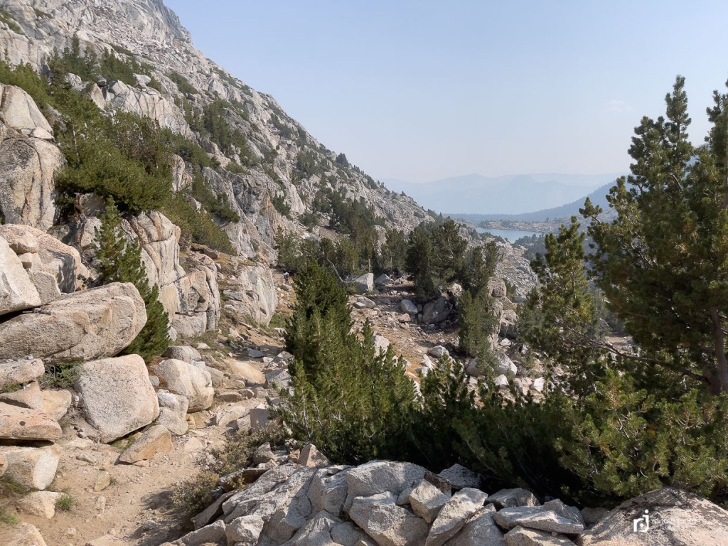
We were close to Seldon Pass. Much earlier in the day, a guy headed SOBO had said there was trail magic on Seldon Pass. That some young kids were cooking burgers, hot dogs and beers. Each time we passed by a SOBO hiker or group, we heard about the burgers and beer. I was not holding out hope because it was getting late in the day. We passed by Heart Lake and then the final push up Seldon at just shy of 11,000′
Looking back to Heart Lake 
Outflow of Heart Lake 
Seldon Pass – Up there! 

Here she comes! 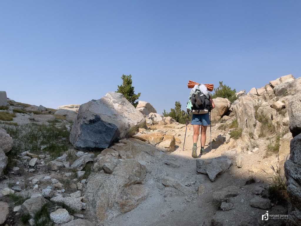
Almost there!
And guess what? It was true, which we believe it was, but also and more importantly, they were still there!
We made atop Seldon Pass about 4:15PM. We were met by three young men and a young women. Let’s just say, post-college age. Two from Boston, two from Madison Wisconsin. They had flown to Fresno, rented a car, drove to MTR where they had to take a boat, then walk four miles to MTR proper. Then hike 10 miles up to Sallie Keyes where they camped the night before, and then hiked up in the dark with a small propane BBQ, a cooler with hot dogs, beef burgers, beyond burgers, bean burgers, cheese and beer. Sadly, all the beer was gone. But two beef burgers remained. As well as the other food options. We said two cheeseburgers please. And they offered to make us coffee and we obliged. It was drip coffee too! And when asked, I decided to take mine with sugar! The burgers were simple. Catsup and cheese on a bun. But oh so good!
As it turns out, the young man with the pink apron, had received trail magic on his JMT in this exact spot four years earlier. And this year, his dad was SOBO, and he surprised his dad. We are pretty sure, it was his dad that first told us about the trail magic. Frankly, I’m speechless about it. We talked for a while as we ate. We didn’t scarf it down which is very unlike me. We totally savored it. And I forgot to get a photo. But I found one on Pexels dot com.
Another hiker, an older gent arrived heading SOBO. He was a pure entertainer and we all enjoyed it. He had the last two hot dogs. As we were leaving, they were packing up.

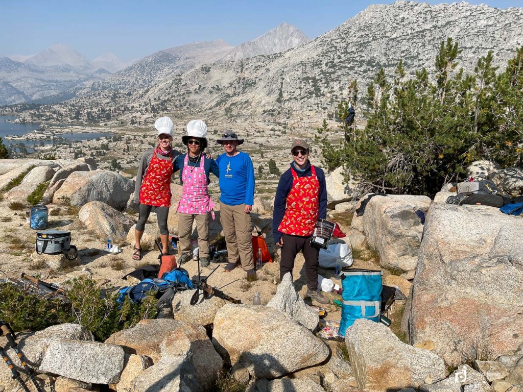
Trail Magic Crew 
His shirt was fitting, physically, and metaphorically. 
He entertained us. 
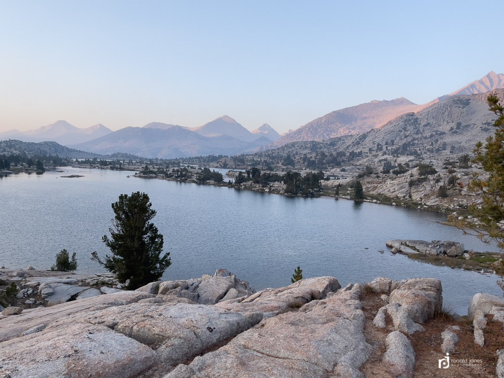
And that is Marie Lake. Once we descend the switchbacks, we’ll find camp. As far as we can get!
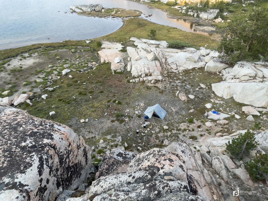
It only took a few minutes to get down to the lake. We decided to grab a nice spot, well above the lake and away from other hikers. I went down to the lake and got enough water for that evening and the next morning. We didn’t have a lot of time in the sun, and missed getting into what was finally some warmish water, but it was a great campsite. There was some smoke haze, but we got some time relaxing. Even had a dehydrated meal. And just enjoyed what would be Jean’s last evening on trail. It was possibly our best campsite of the trip.


See the Nemo Switchback pad on Amazon
I was going to include our 12th day to VVR, but decided to hold off and include that one with the stories of VVR. As a teaser, we really didn’t have a long dry section that next day. There had been reported, up to roughly 9 miles dry, but it wasn’t true. The climb to Bear Ridge on the JMT had a spring just before the junction, and Bear Ridge had a strong creek running ½ way down.

