

Days six through nine were a series of very long descents to below 9,000′, usually close to 8,000′, followed by a longish approach and a final steep climb to a pass summit. It went like this; climb to or very near 12,000′, then spend the next 7-10 miles dropping back to 8,000′-8,500′, only to gain it all back. We’d climb Glen, Pinchot, Mather, and the namesake, Muir.
In my opinion, and in hindsight, I view the JMT from Horseshoe Meadow to Yosemite as having eight segments. But within these segments are micro-segments or zones. The eight segments is a way to break down the trip into smaller bite-size chunks, and have a focal point for a few days ahead. It helps with goal-setting and being able to keep a schedule. The list below is not necessarily a good fit for actual trail contours, scenery geology, flora and fauna. Within each there were what I’d describe as micro-climates or micro zones.
- Horseshoe Meadow to Whitney Summit and descent
- Crabtree Meadow to Charlotte Lake
- Charlotte Lake to Muir Pass/Lake Wanda
- Evolution Valley (Lake Wanda) to VVR
- VVR to Reds Meadow
- Reds Meadow to Tuoleme Meadow
- Tuoleme Meadow to JMT Junction below Clouds Rest
- JMT Junction below Clouds Rest to Happy Isles, Yosemite Valley
In this post:
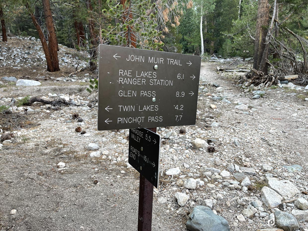
- Day 6 – Charlotte Lake to Woods Creek
- Day 7 – Woods Creek to South Fork Kings River
- Day 8 – South Fork Kings River to Middle Fork Kings River
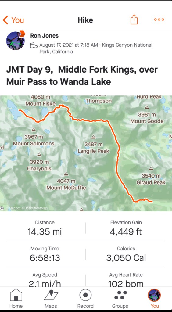
- Day 9 – Middle Fork Kings River to Wanda Lake
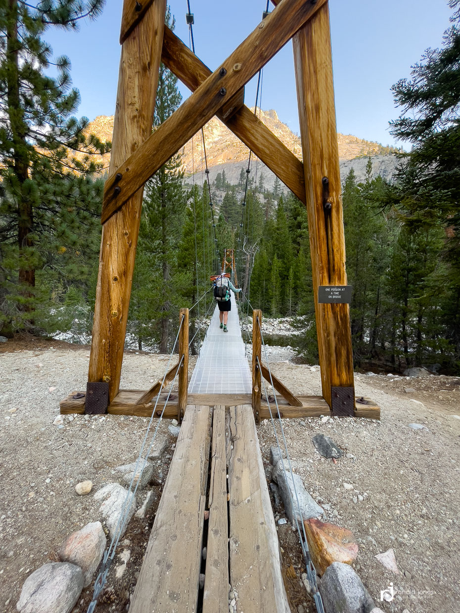
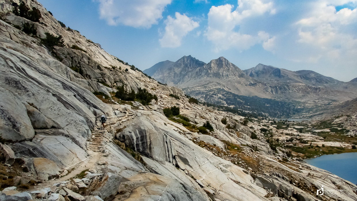
Day 6 – Charlotte Lake to Woods Creek Suspension Bridge – 13 Miles
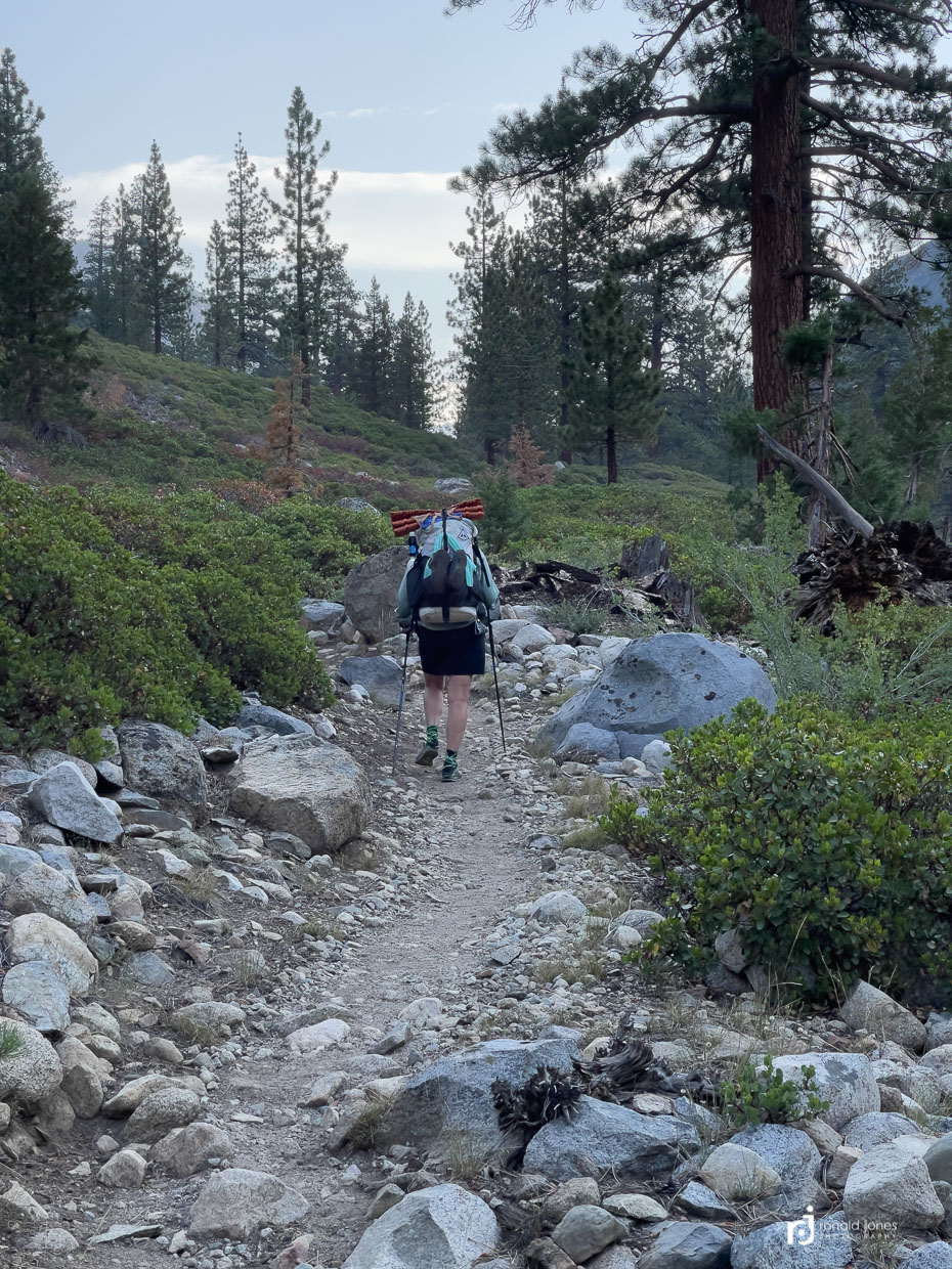
It’s Saturday morning. No cartoons. Just the krinkle of dymeema and the thermarest pad material (think potato chip bags), and the very sad sound of air mattresses deflating (pffffffffff…….), stuffing gear into the dyneema packs and the tell-tale “woooomph” of the stove being lit. We got out of camp a little late this day, as we did other days too. My Strava file shows I started my watch at 7:19AM. Yikes. This day had over 11 hours elapsed time. We took one very long break, but all the other times were short stops. It’s amazing how much time adds up in the end. Stop to wait. Look at a view. Make a photo. Get some water. Grab a snack. The dreaded social vortex!
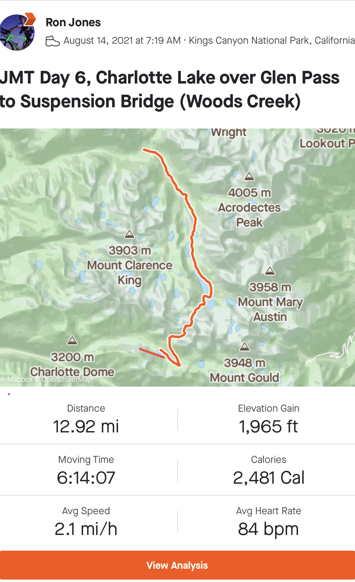
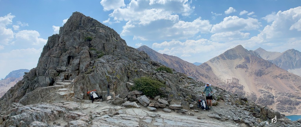
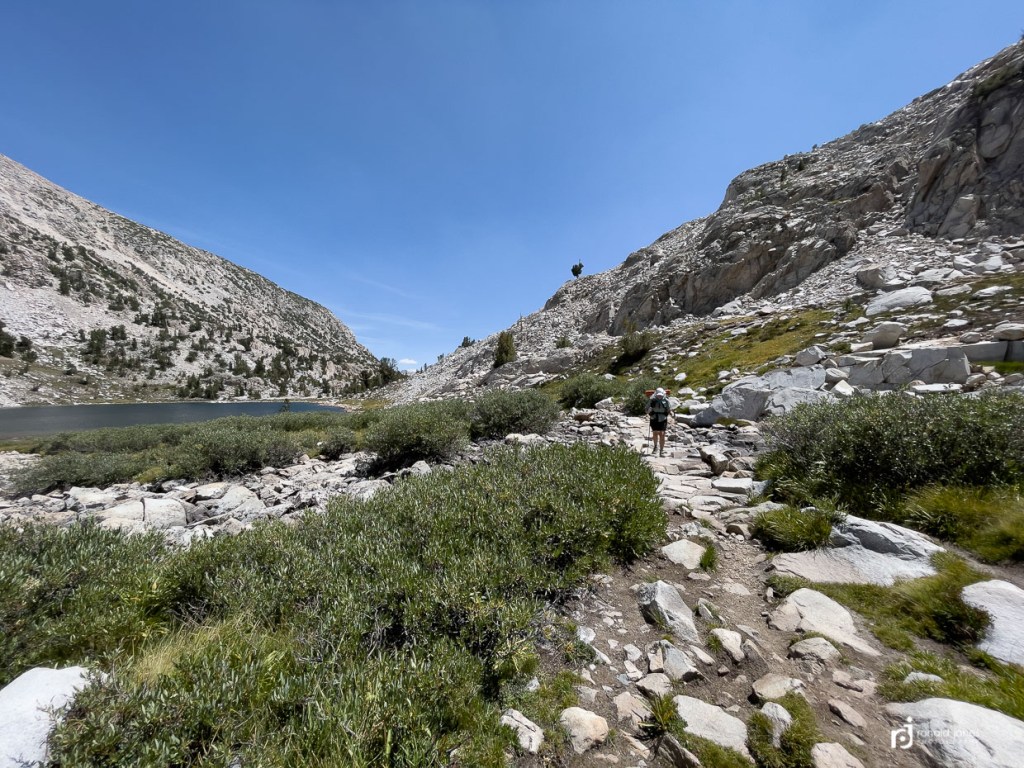
Our packs are heavy again after being loaded with seven days of food. I was going to take us off-trail up behind the ranger shack to an old use trail. This would put us on the Glen Pass approach in one mile and cut off a one mile backtrack and 2 miles to where the use trail connects, but the terrain did not look inviting with heavy packs.
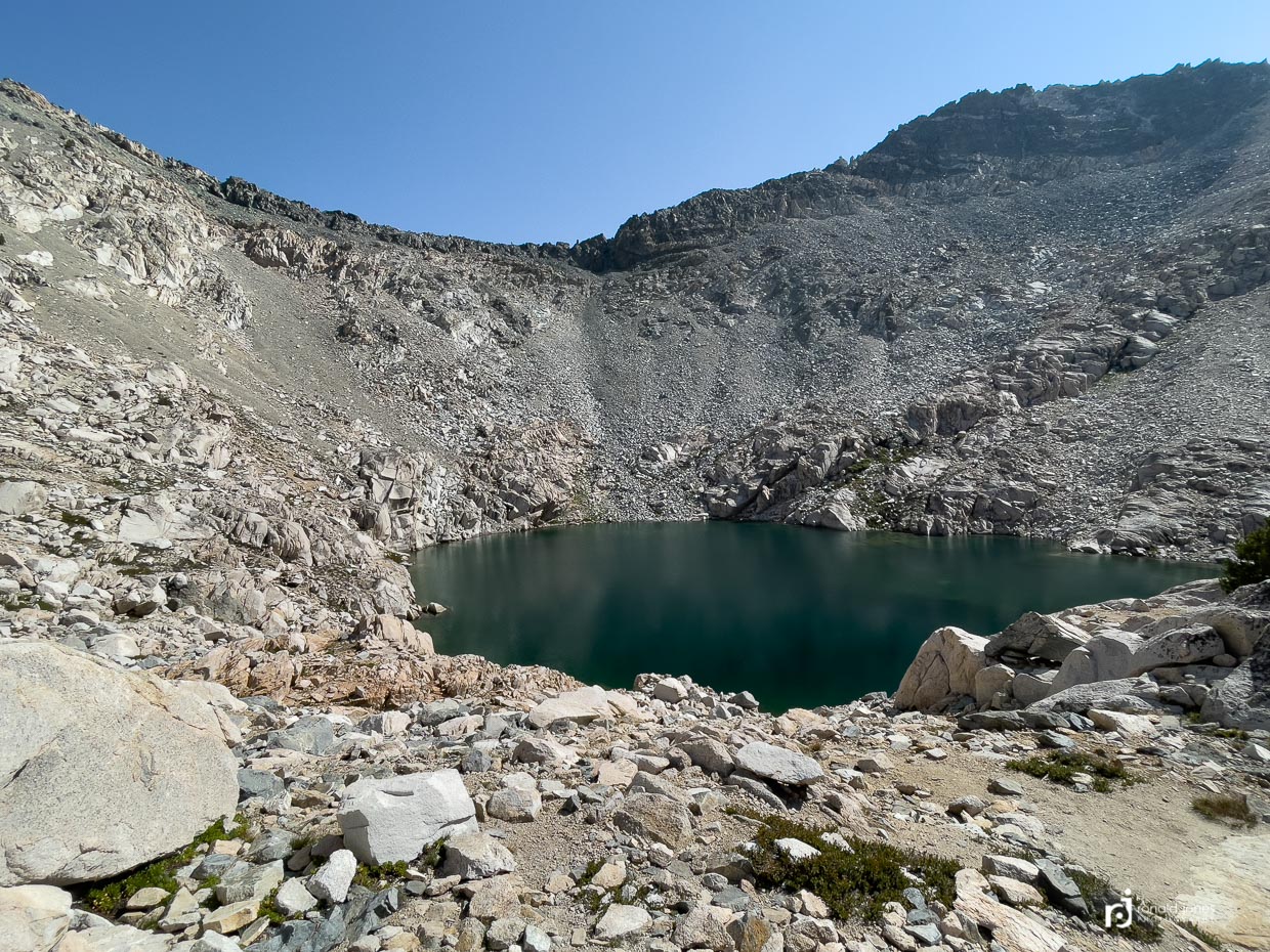
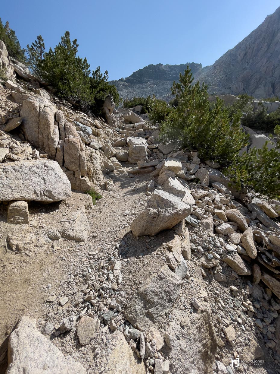
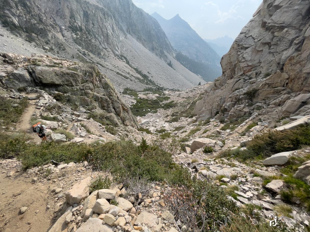
Glen Pass was pretty straight forward. Gentle approach and then, BAM! UP! There is a lake at the base of the steep part. We could have watered up but ended up carrying some extra water because people had told us the lake was inaccessible. More false information. Choice words…. #%&!@! It would have been an easy scramble. I guess some folks don’t pay close attention, or have zero abilities off the cozy comfort of a beaten path.
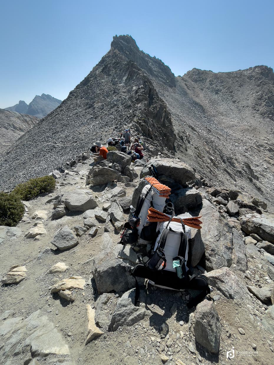
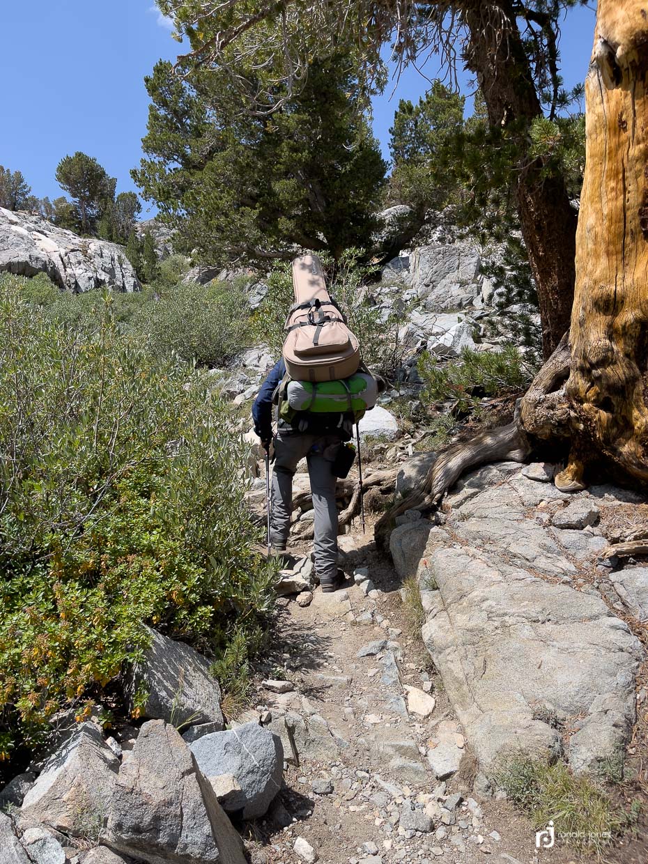
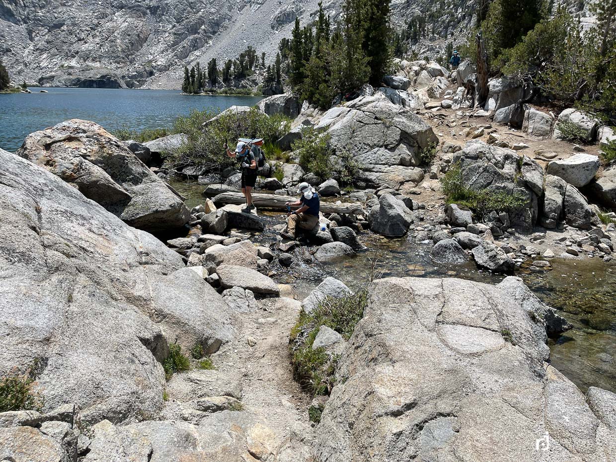
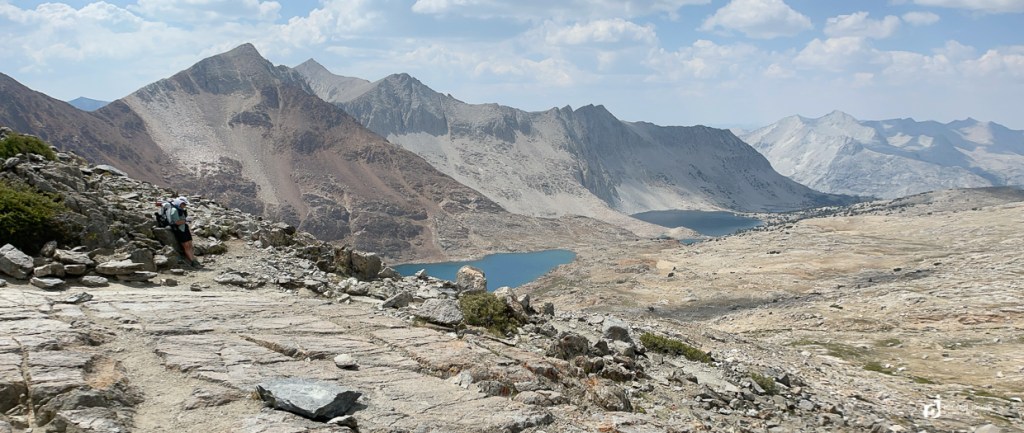
Our packs enjoyed some down time on top of Glen Pass. The descent to Rae Lakes was long. I mean long. It required careful footsteps. I really felt for those headed SOBO. Especially as the day was heating up. Saw a guy carrying a ginormous guitar. And then some bozo was filtering water in the middle of the stream crossing. Dude – move to the side!
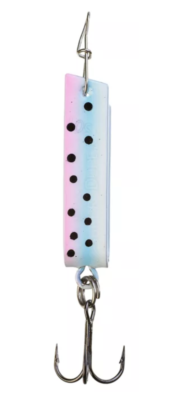
Super Duper – as in fishing lure!
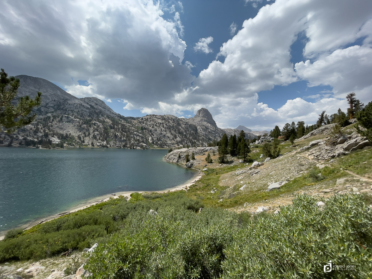
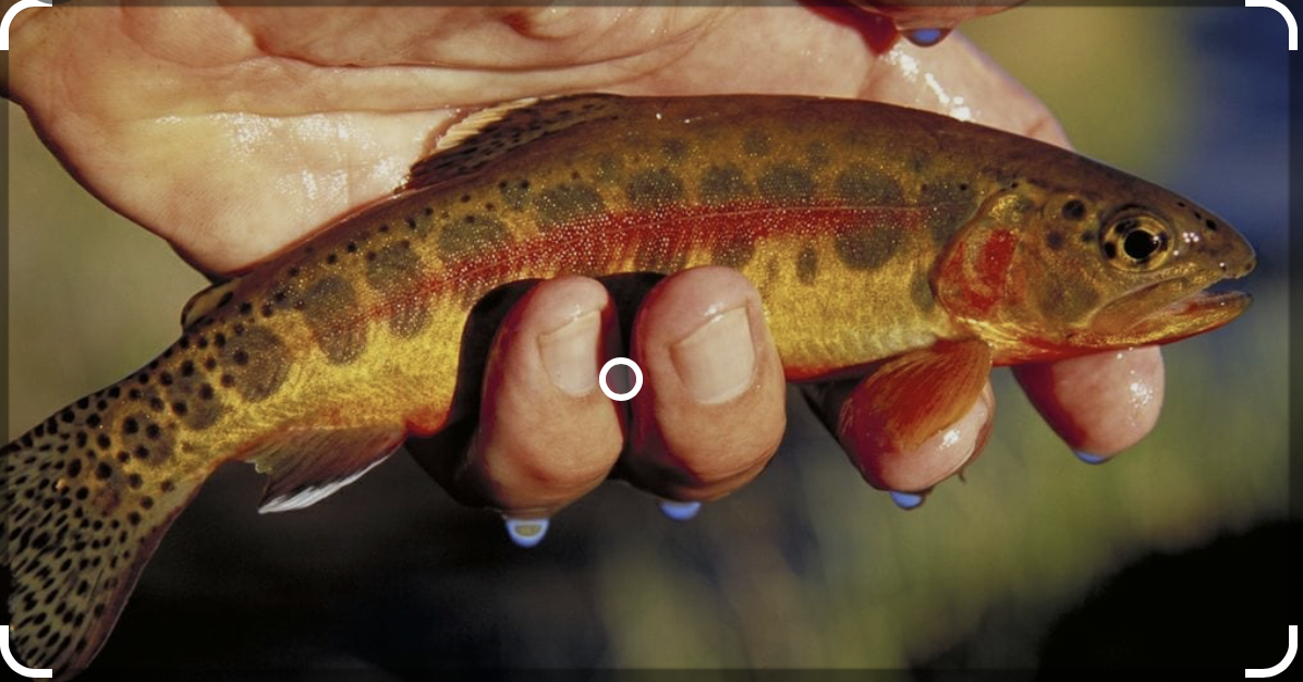
We were both dehydrated and wanted a break. it was already around 11:00AM or so. We found a spot by upper Rae Lake. We unfortunately picked the same spot a couple guys were fishing, but they didn’t mind. It gave us entertainment, as it probably did them. They were hiking a section of JMT and fishing for golden, and other trout. They were having a little fish-off competition. One guy ended up winning, 16 to 4. They were catch and release. They offered us fish for dinner but we had a long way to go and didn’t want to deal with smelly fish in bear country. I didn’t get a photo, but they guy showed us a brook trout he caught. It was very pretty. The secret was a lure they called a ‘super duper’, I guess it’s a classic, old-school lure. The guy who only caught 4 (actually 5, but he lost #6 which meant he lost one from his tally) had lost one of his ‘super duper’ lures, and was using a different lure. Clearly not as good. Lure and golden trout photos are not mine, but from a royalty free site.
And finally – Camp!
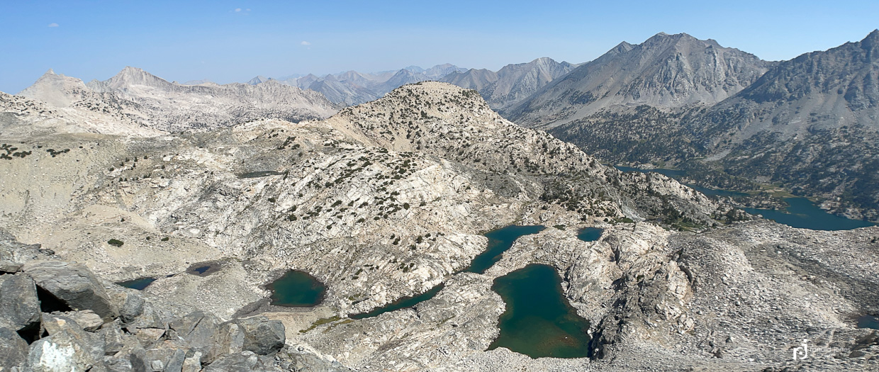
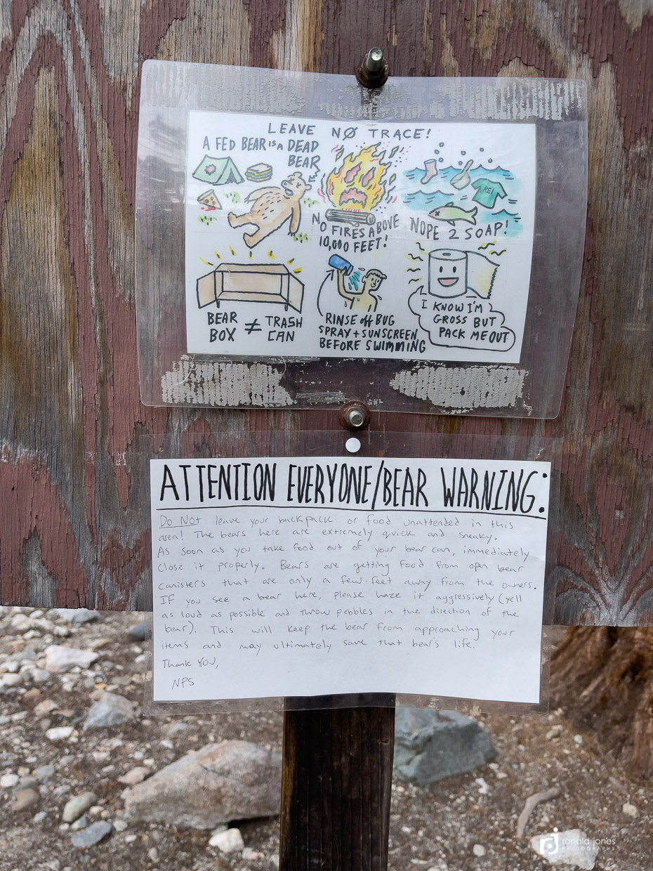
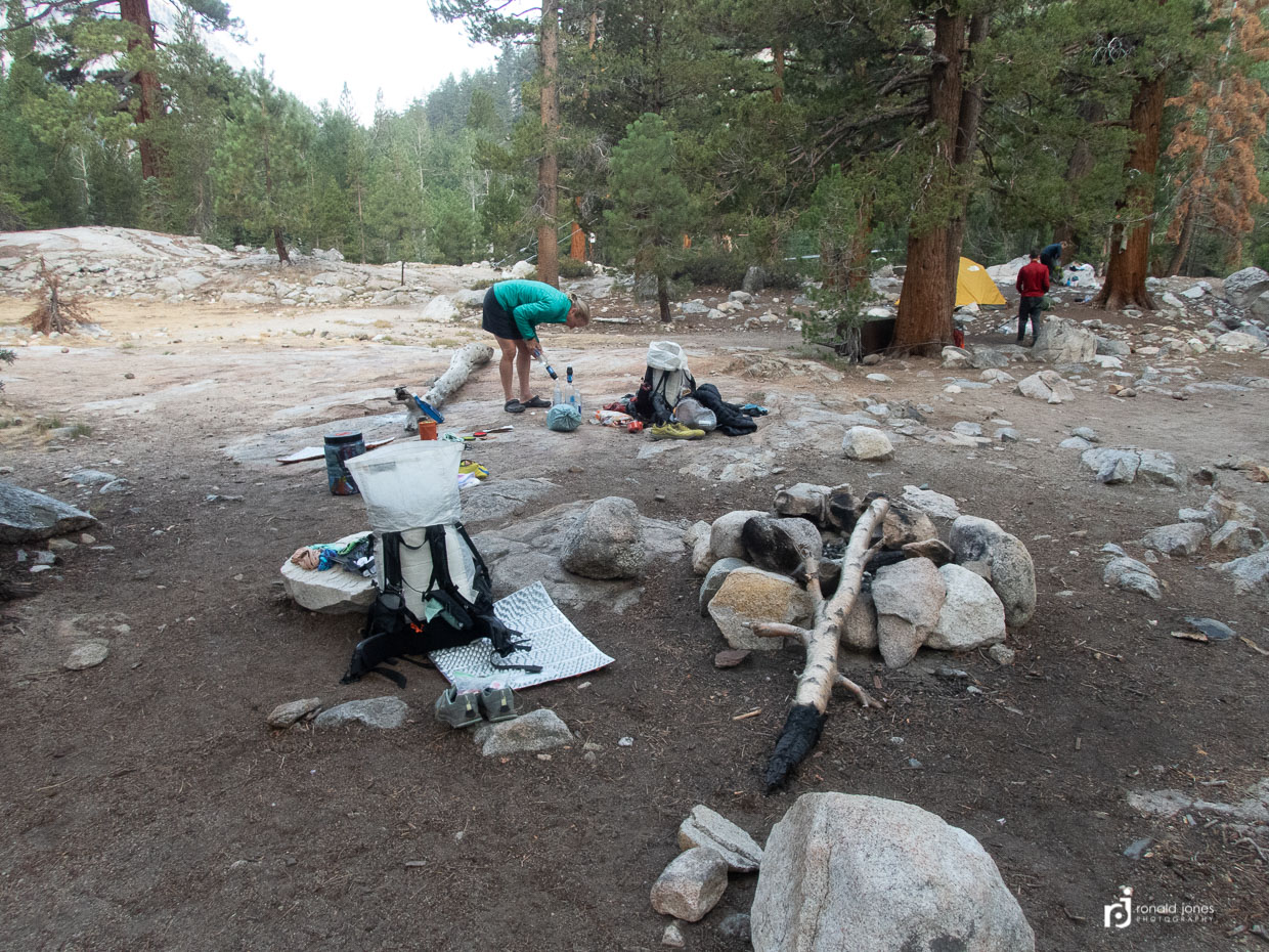
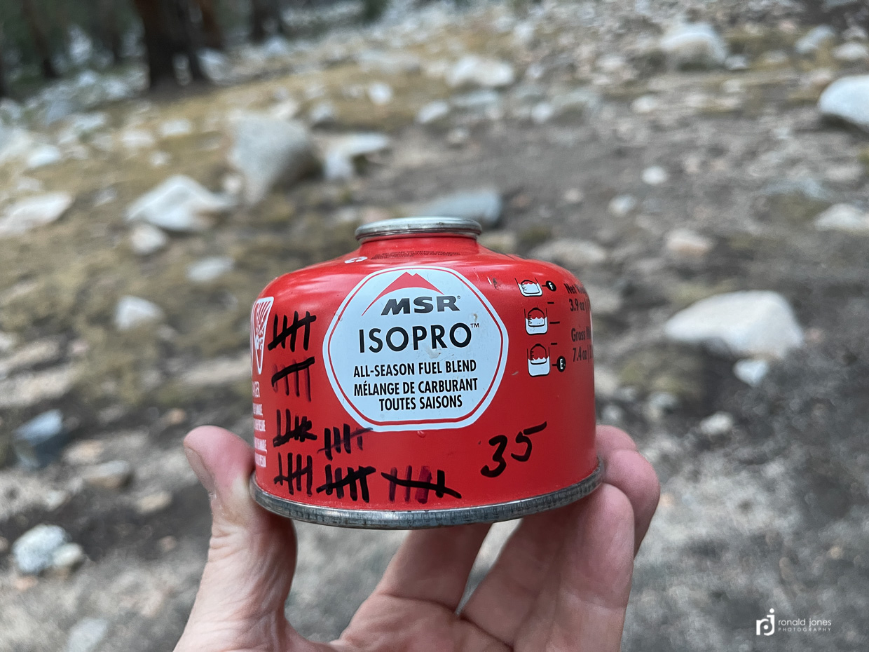
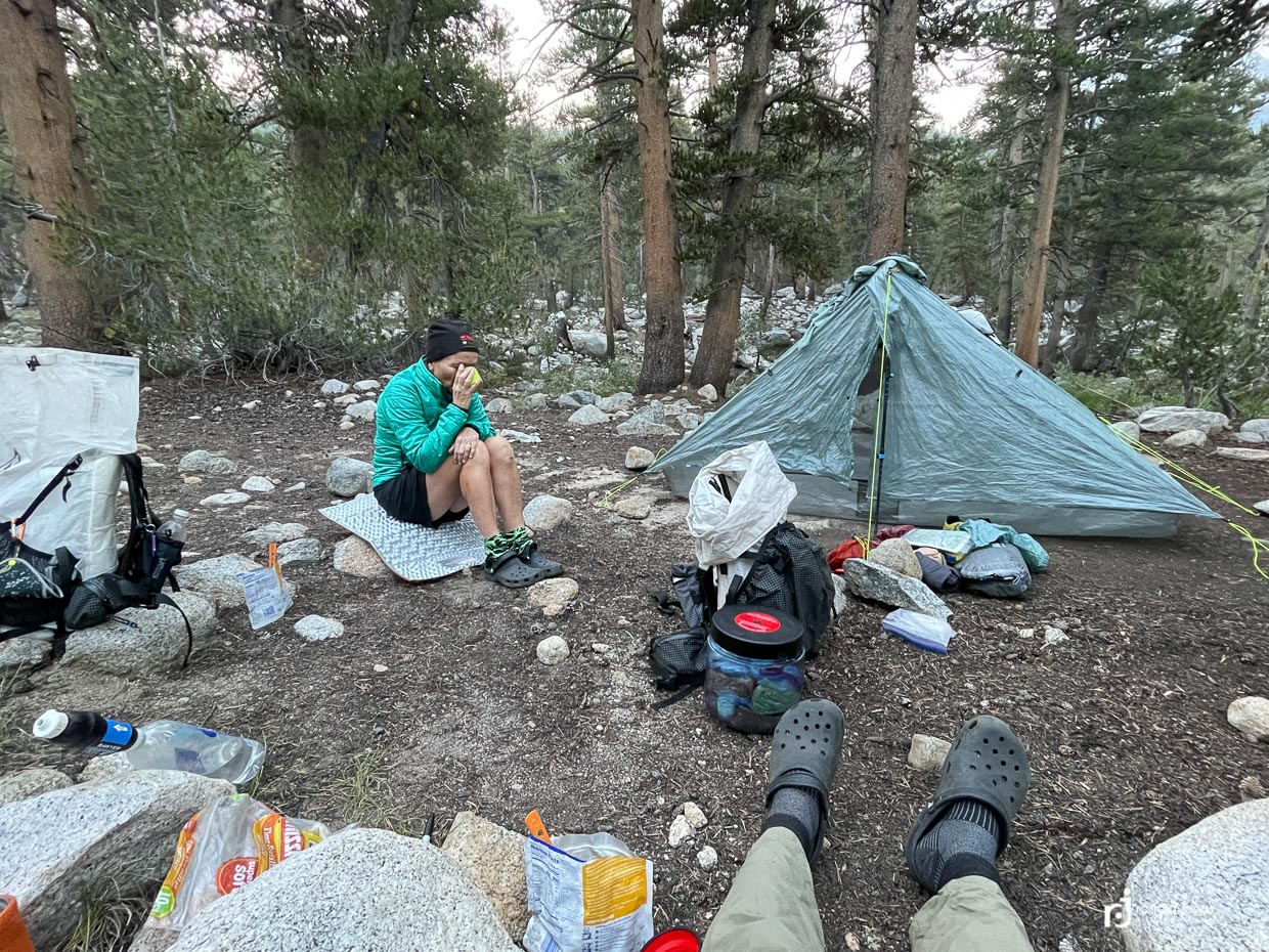
After Rae Lakes we just continued down, down, down, past some other lakes and streams. After getting into the trees it seemed we’d never arrive. The weather was mildly threatening but it never started to rain or lightening. We finally made to the Woods Creek Suspension bridge but it was not a very inviting place. It was late in the evening, not dark, but getting dim. No one was there, but there was a sign warning campers about bear stealing food. We picked a spot and began setting up camp. Then I saw another campsite down by the river, and shortly after, a group of three young men came in from roads end. It felt better to have some folks around. We later learned these signs warning about bears were in most of the frequented camping areas. Put there by rangers. I’m sure they’ve had issues, but who knows when it was, or how often. In other news, we’re consistently getting 30+ cups boiled with each 3.9 ounce canister.
Woods Creek over Pinchot Pass to South Fork Kings River – Day 7
Another day starting kind of late, after 7AM. Today is a long approach to Pinchot Pass, then down the other side to another low spot in the trees. I much prefer camping higher up with views, and it was a goal to be camped closer to the passes. We just aren’t making the miles necessary. But it’s not like we are wasting time.
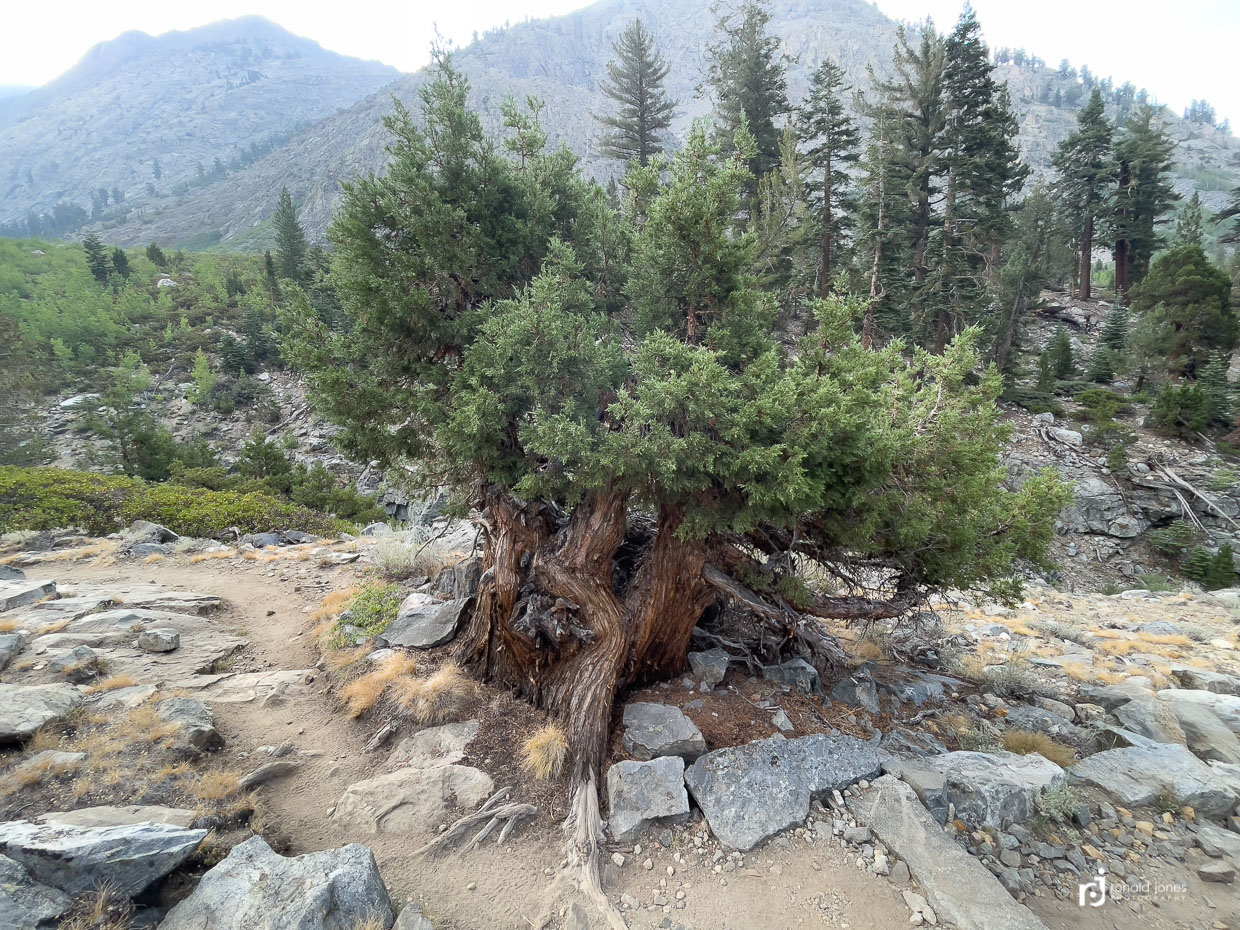
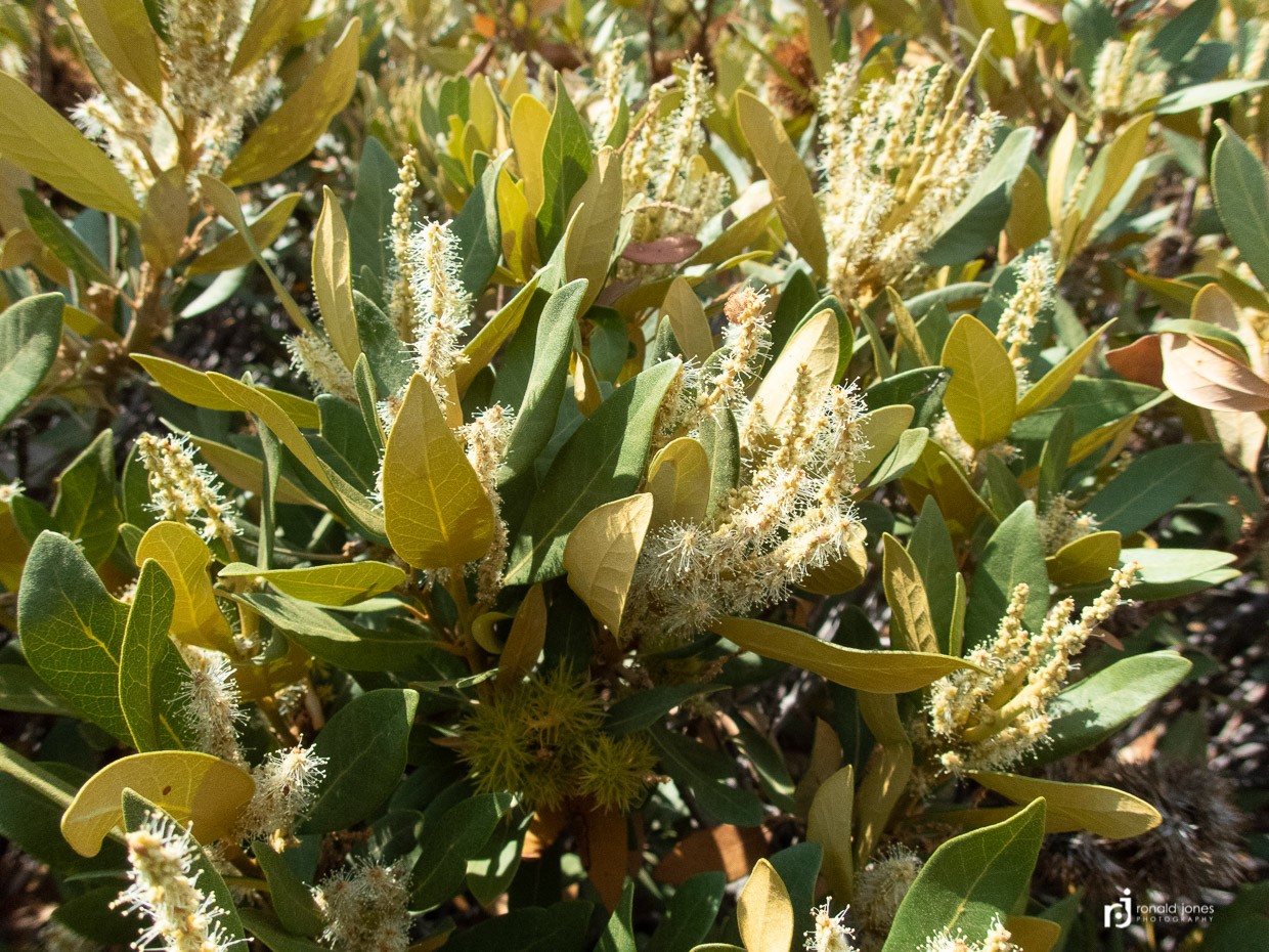
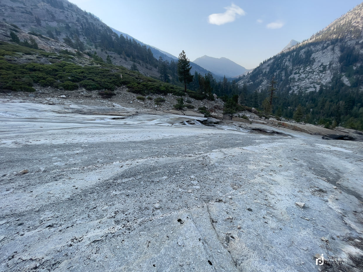
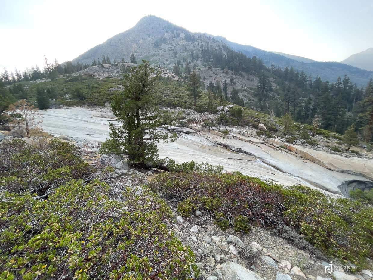
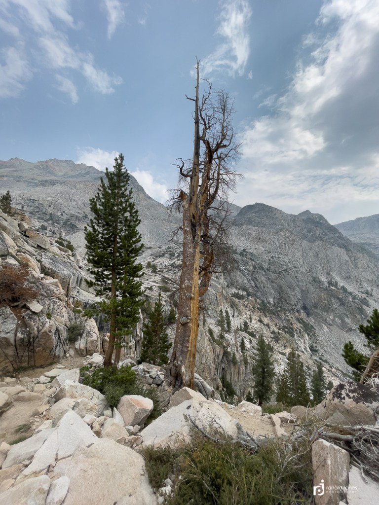
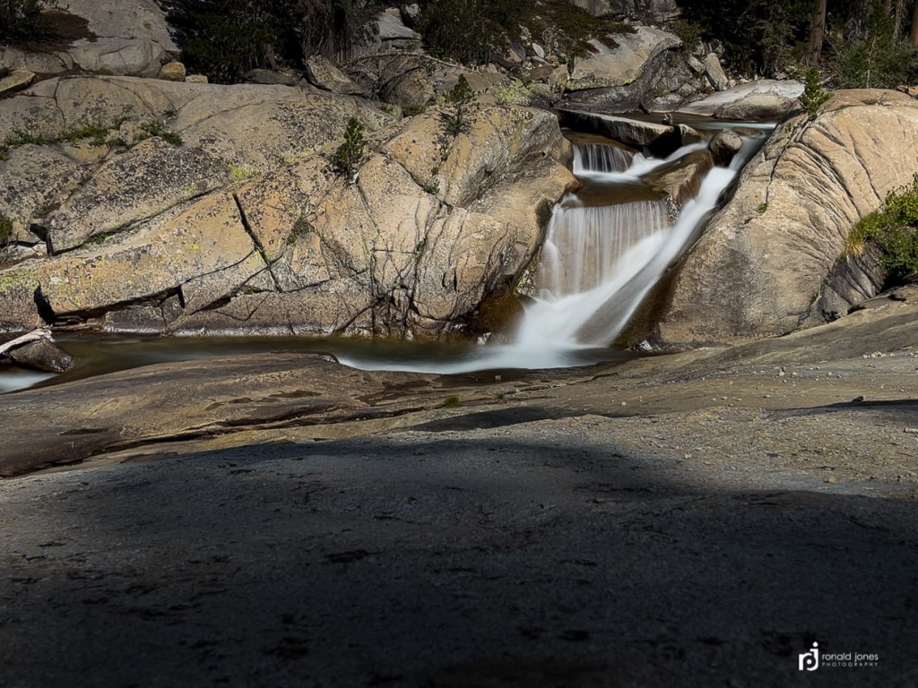
The approach to Pinchot from Woods Creek, and the same approach the next day up Mather were similar. We left the trees for more of scrub and shrub landscape, following Woods Creek, and alternating between climb and flat. We went through numerous of what I’d describe as a micro-climate or landscape. The plant-life changing and evolving from trees, to shrubs, sage, something that looked like a wild rhododendron, but may have been an azalea, thickets of ferns, juniper trees, manzanita, and then transitioning to grasses and finally mostly granite rocks. Of course we saw many other plants which we had no clue as to identity, sedums, lupine, fireweed and so no. Woods creek had what seemed like the never-ending granite water-slide – only sliding is really not advised if you want to remain a living creature, at least one without injuries.
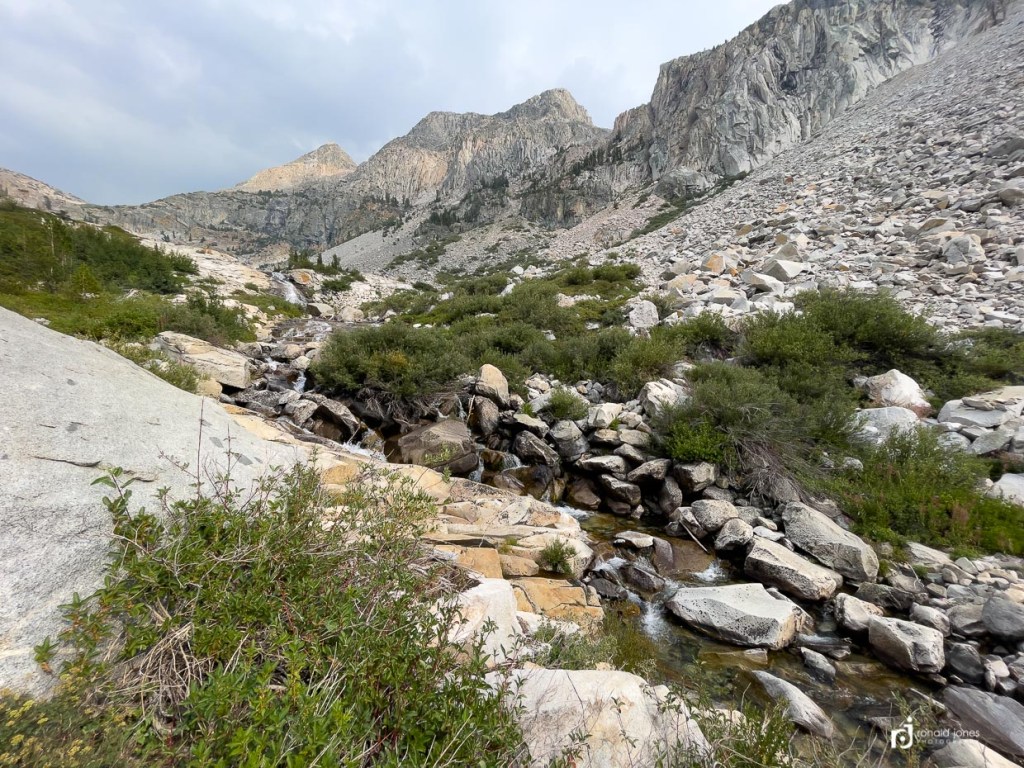
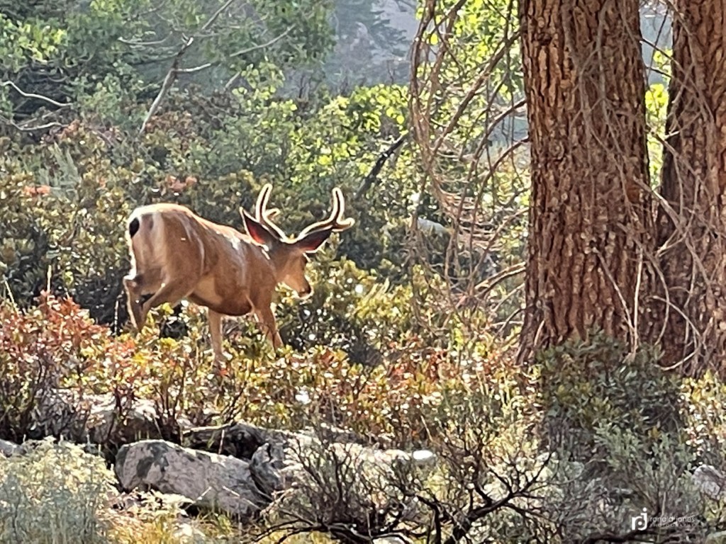
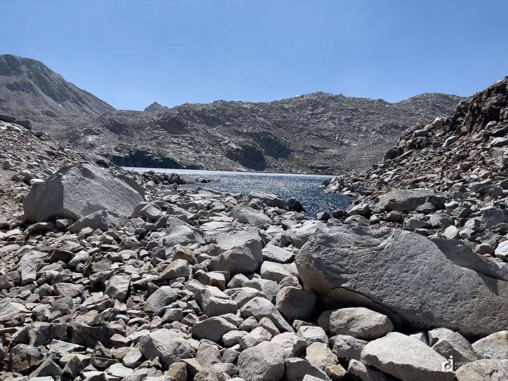
It was a really spectacular area and approach. At one point when we were climbing a steep section, but not the final pass, Jean sat on a rock to rest. I was a couple hundred yards ahead. She saw a bear far across the river (Woods Creek) walking along. It was quite a ways off. The only bear sighting of the trip. Jean turned out to be the wildlife spotter – being the first to identify quite a number of deer and marmots. We had been meeting hikers on the descent and getting mixed reviews on water availability up higher, but generally folks were saying not much opportunity within 4 miles of the summit. We were getting water at about that point when a guy descending was adamant (LAST WATER!), so I semi-reluctantly filled a couple extra liters. 2.2 pounds per liter. So again, maybe 6 pounds of water. We kept Jean at 1 liter plus her 20 ounce shoulder bottle. It was getting hot, and knew we not only needed to ascend, but also get down quite a ways on the other side. You can imagine my thoughts when we arrived at the approach to the final mile of steep climbing, and were parked next to a beautiful water source! It was this moment I stopped taking any advice seriously and spent more time researching maps, guthook, and my own thoughts.
Water at the southern base of Pinchot Pass, which is up to the right, out of the frame.
On the approach to the small pond, we met another guy descending. We saw him from quite a ways down and noticed he was moving slowly and carefully. Almost seemed to be badly injured. As we neared, we noticed he was shoeless. He wasn’t wearing a vintage baseball uniform so we know it wasn’t shoeless Joe Jackson 🙂 It was a real backpacker, not a mirage in the cornfield. He was hiking with a full, but not huge, backpack. Before we had a chance to say anything, he just commented; “there sure are a lot of rocks on this trail”, as he proceeded to walk past stepping ever so gingerly – his feet looking a little worse for wear, some red and purple bruising, as if someone had smacked them with a mallet. Okay, that’s an exaggeration, but certainly not fresh as a daisy. Later in the trip at VVR, Phil mentioned they saw him too, and said he had the same words to say to them. As luck would have it, I ran across this post on the JMT FB page. It’s the same guy. The Long Brown Path; 170 Miles Barefoot on the John Muir Trail.
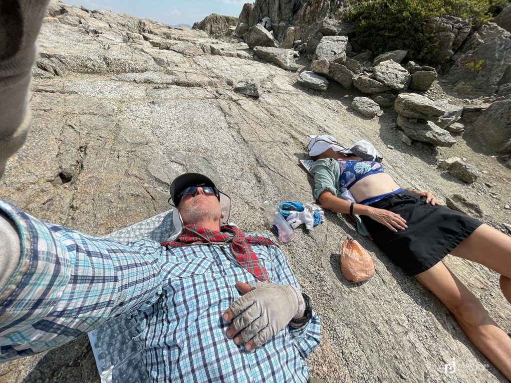
The main climb up Pincot was again, straight forward. Rather steep but trail was fine. We had the summit to ourselves, except the curious Chipmunk. We took a brief moment to close our eyes.
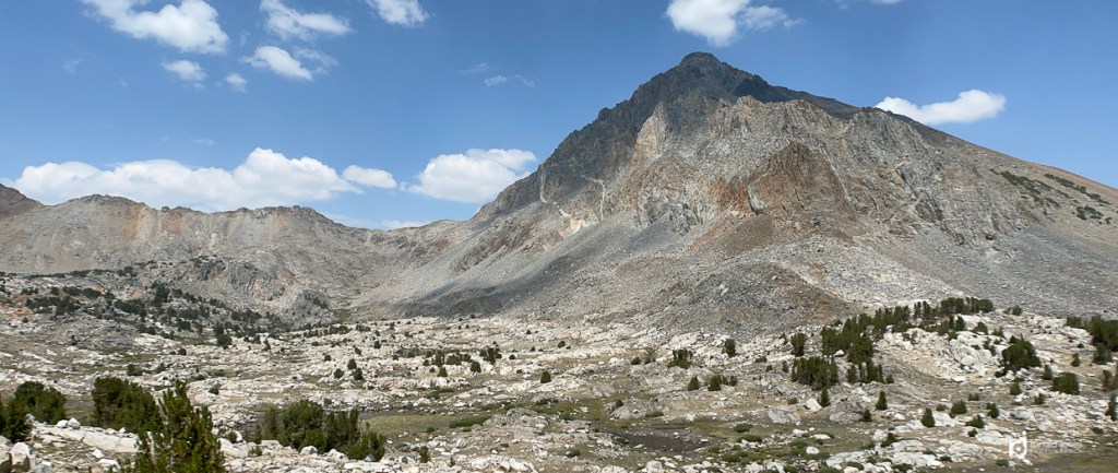
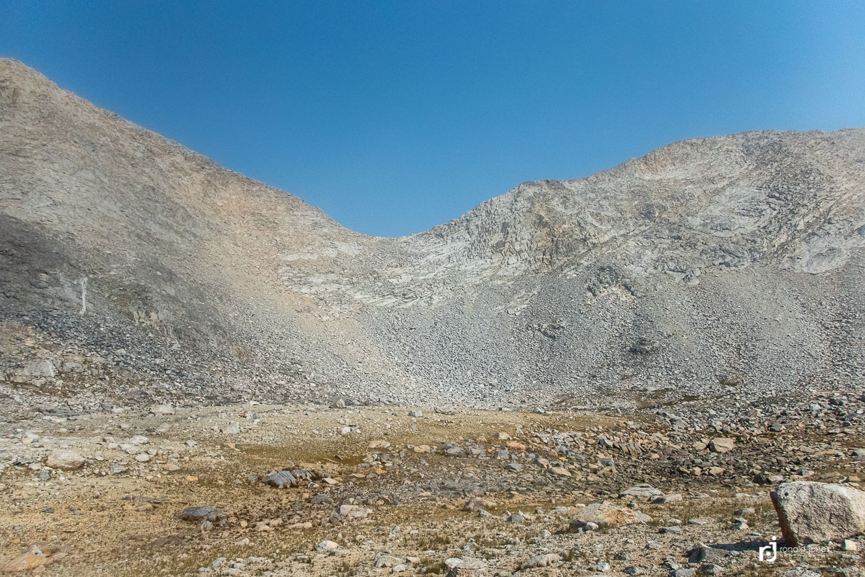
Pinchot Pass is on the left side of low saddle
After Pinchot we had another long descent. A bunch of switch backs. Frankly, I have little memory, and even fewer (no) photos, of the of section from Pinchot down to the South Fork of the Kings River, other than we spent time at the end of the day dropping down through a steep forested trail to where we camped. Again, it was along day, we passed a couple folks camped, crossed the river on rocks and started up toward Mather Pass. In about 1 mile we found quite a few folks camped. An older gent let us know there were sites a couple hundred yards into the trees near the river, which I was planning to explore. We dropped off the trail and found a pretty nice, more private location, whereby avoiding the social vortex.
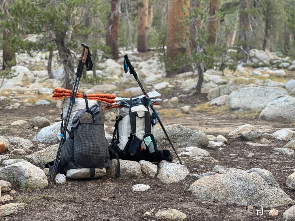
Packs, resting before the big lift
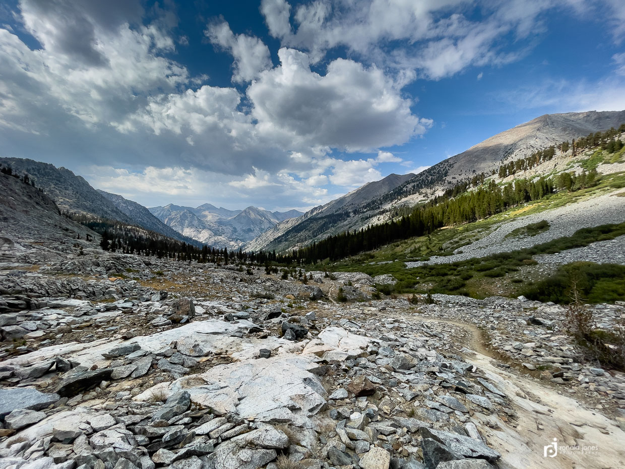
South Fork Kings River, Mather Pass, to Middle Fork Kings – Day 8
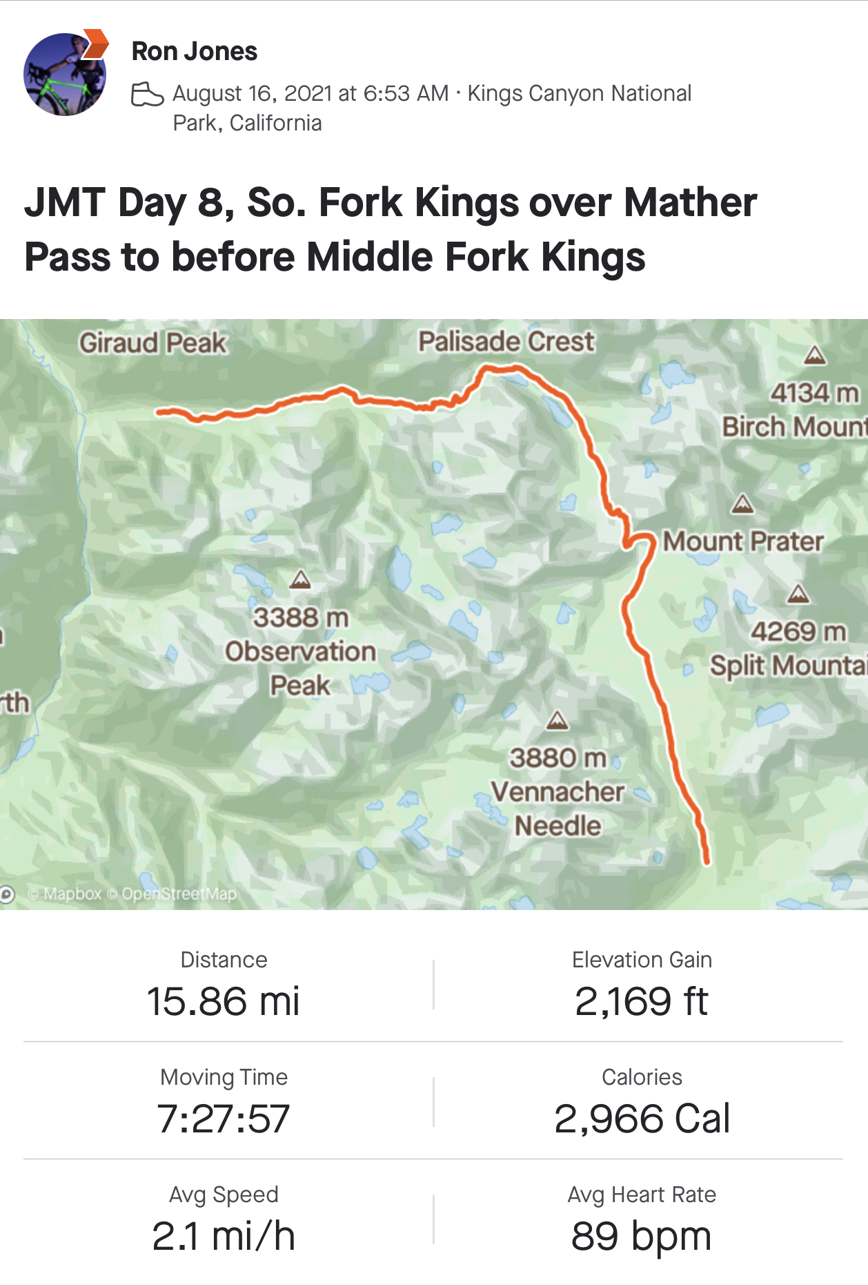
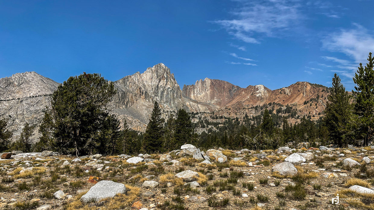
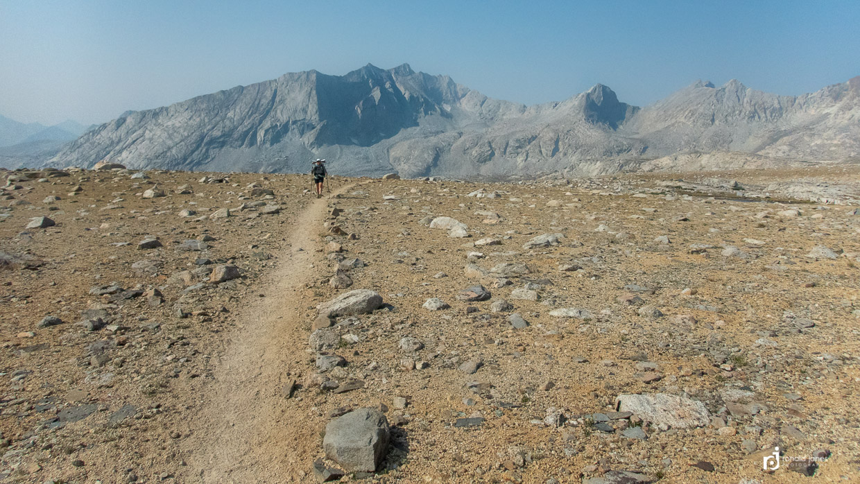
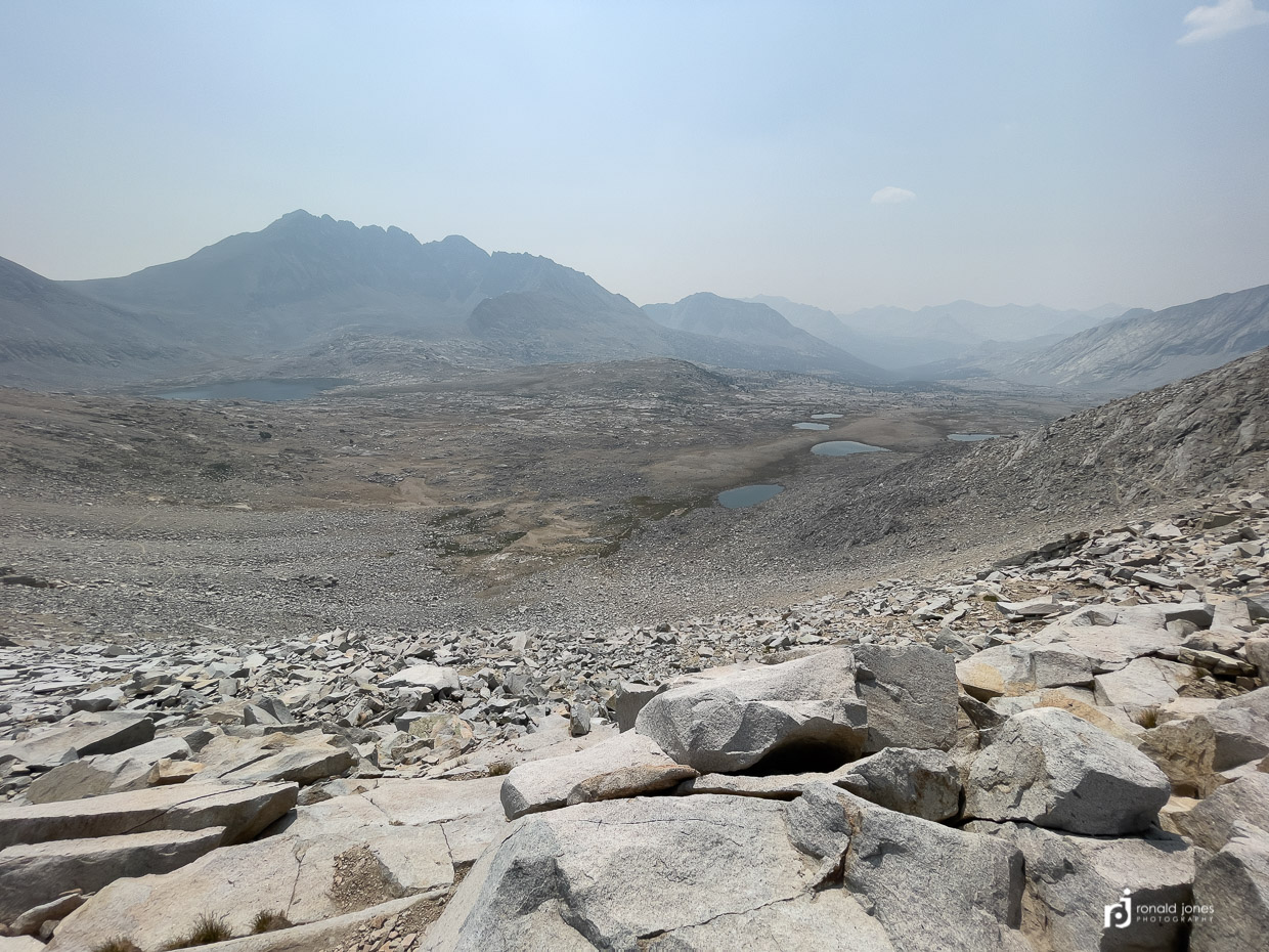
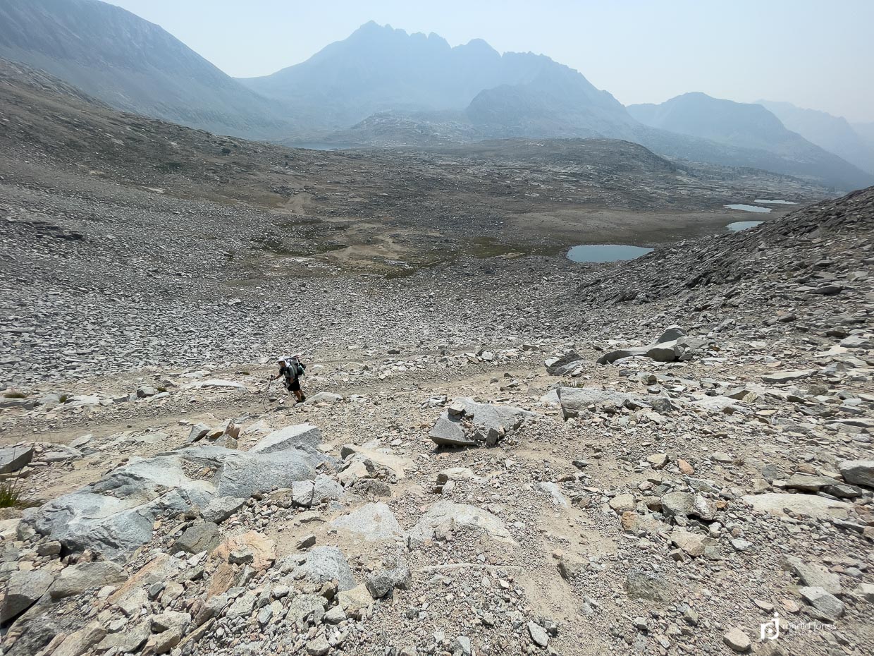
Day 8 started easy enough. A gentle cool climb up out of the trees to an expansive boulder plateau that undulated. Quite a bit of smoky haze today took away from the views. We are in a classic repeat. Start low, gentle climb, steeper sections and a general long haul to the main climb which was usually the last 1,000′ to 1,500′ or so over a mile or maybe more. We met a couple of truly energetic southbound hikers. They were younger, super stoked and some of their energy spilled over I think.

Upon summiting Mather Pass, we met a group of young folks from the U.K. Jean keyed in on the young man and his accent. He, another guy and two woman were going to Harvard or some other big east coast school. He was sort of stuck in the U.S. at the moment due to covid. They were headed southbound and once they departed, and another small group left, we had the summit to ourselves for a short time.

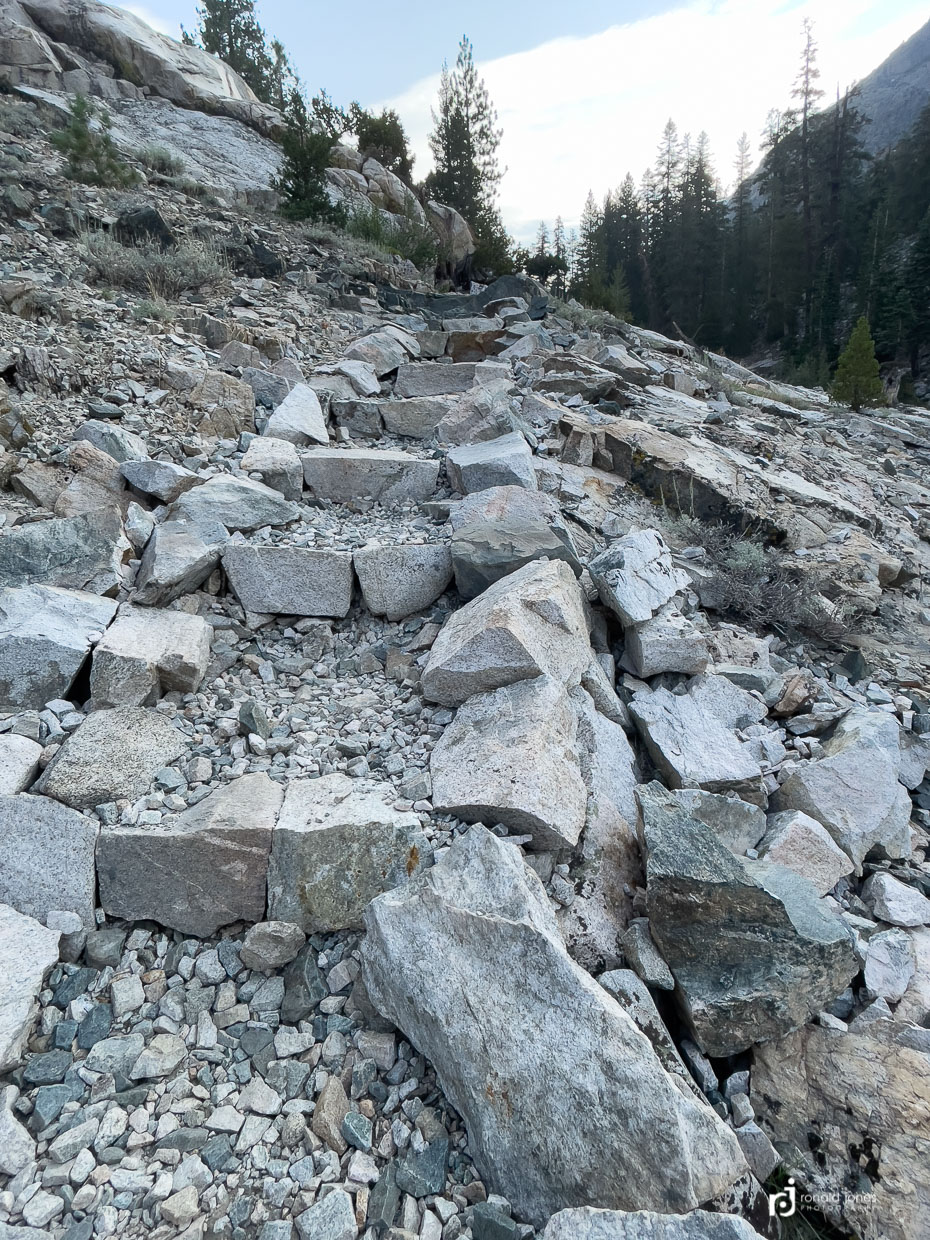
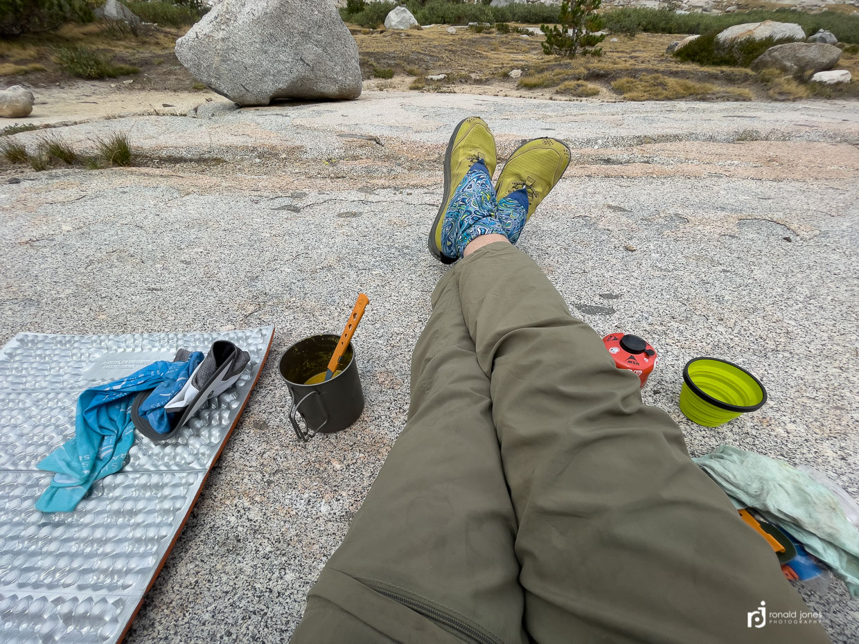
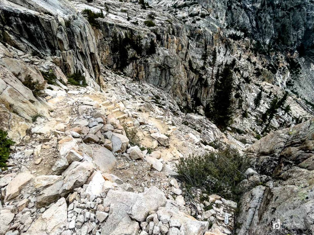
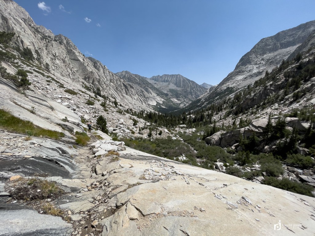
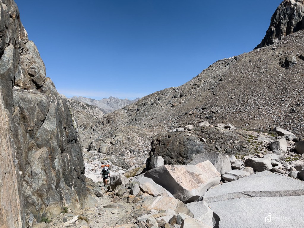
Descending Mather was one of the toughest sections. It was a packed talus (if there was such a thing), basically a rock pathway that descended the steep section. Smaller and medium sized rocks (grapefruit sized and some larger), placed in what was basically a narrow sidewalk width for a lot of the trail. Similar to what we’d call ‘shot rock’ here in the PNW, which is blasted chunks of rock used as a road base in sometimes mushy land. Used a lot around when developing large tracts of land. Anyway, it was difficult to walk on and we had to be careful with hiking poles as they liked to stick. It’s an easy way to snap one. This transitioned into the upper and lower Palisade Lake, which was inaccessible until the far end just before dropping onto the Golden Staircase. It seemed to take forever. As all these sections do. Once we got to the far end, we made use of the sandy beach. Unfortunately, all the hot sun we’d been suffering in, was now getting clouded over and it was breezy. So our planned bath was very short and cold. Just a bottom rinse. Then we huddled behind a rock out of the wind and cooked one of our dinners. We actually did this a few times on the trip. This time the first or second. It was a good way to eat our dinners. Have one meal for two late in the day, and another for dinner at camp. A few hikers were watering up, and others asked about camping further up. We were at least honest and said, we think, not sure, maybe… instead of giving them completely false information. It’s sometimes hard to remember just where there had been camping and good water access.
Below images: Top left, looking down canyon from atop the Golden Staircase, top right, down down canyon, middle right, my legs at our dinner stop which included hot cocoa, and bottom is looking up at Palisade Lake and where we came from.
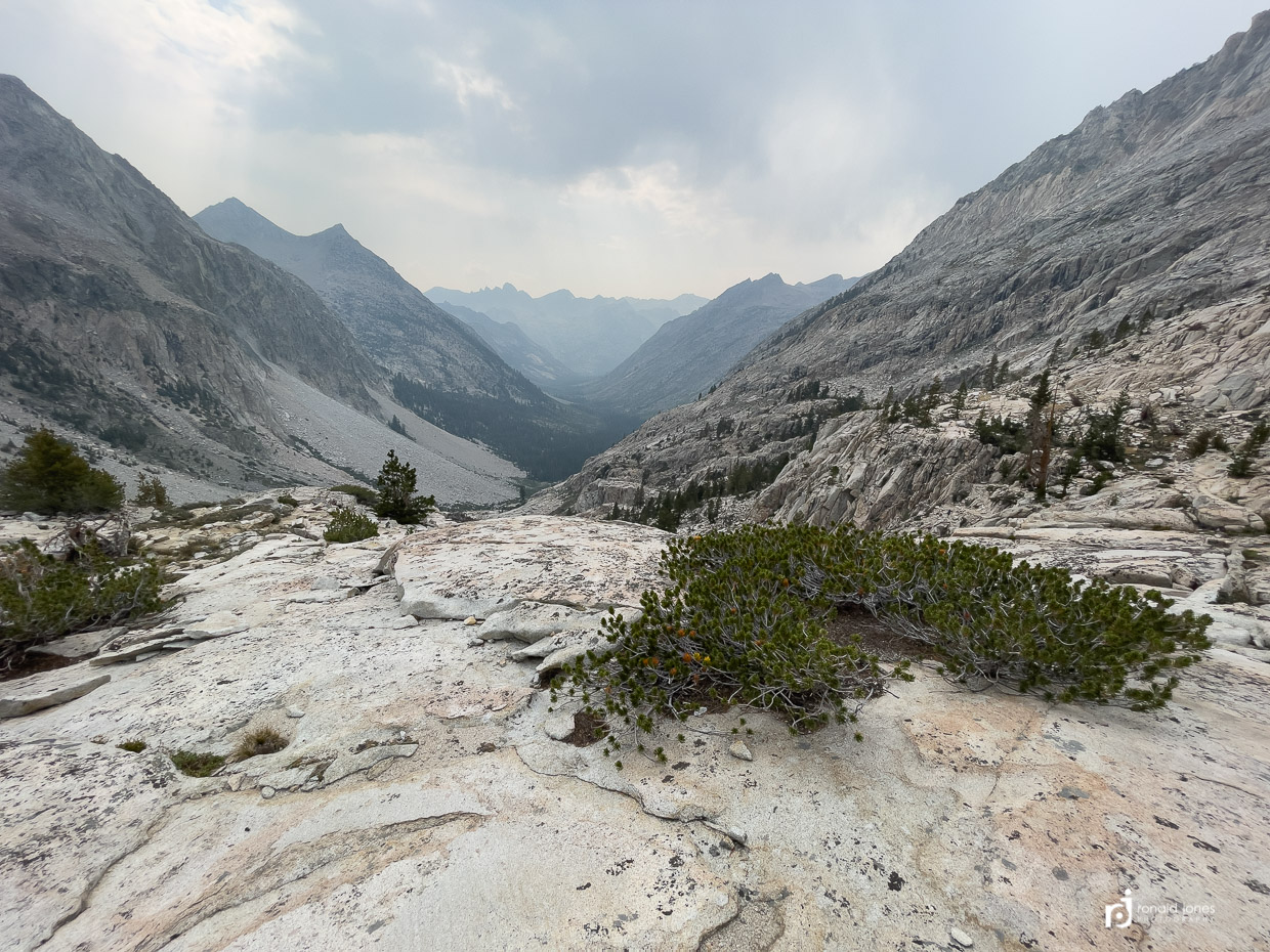
The Golden Staircase, as everyone mentions, is no joke. It’s long. It’s steep. It’s slow. Unless you’re fast of course 🙂 We were just darn glad we were going down, not up. For SOBO hikers, it’s the most feared I think because you climb up from 8,000′ at the Middle Fork Kings River, to the top of the golden staircase, only to be faced with another climb to summit Mather. Overall about 4,000′ gain, but much of it in two steep sections with longer sections of marginal gain, or undulating. Again, just glad we were going down, but that is hard too. Some of the steps are thigh-high.

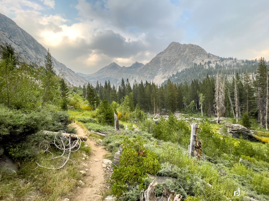
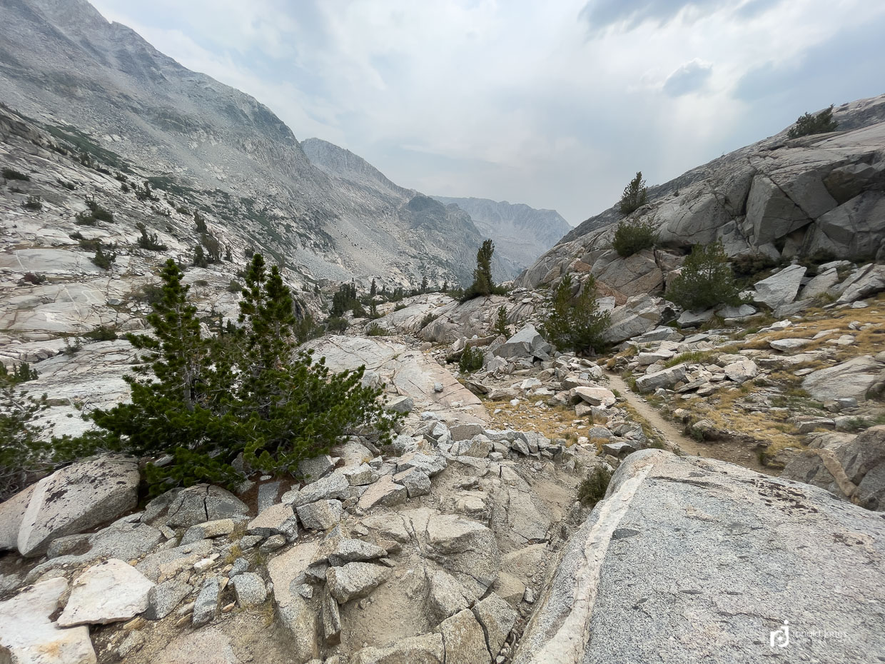
We finally made it to the forest in the drainage. Two men were headed up. They were discussing Alex Honnold’s movie – Solo. One guy thought it was lame. Just some of their conversation I overheard. Theyu were moving at a good clip and trying to beat the storm that seemed to be developing. They told us there was camping in the first set of trees, but folks were camped in some of the better spots, then there was a long burn area.
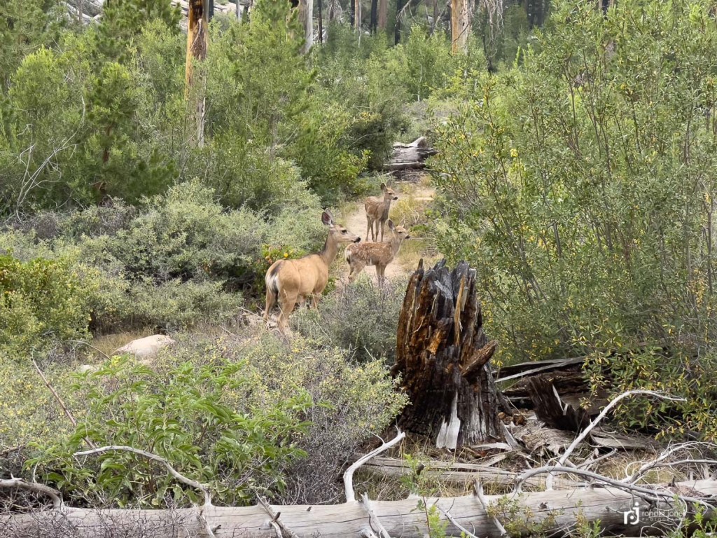
They were correct. We passed a few nicer spots, not great, but functional. Then we saw a few in the trees but they all had deadfall hanging, widow-makers, so kept walking. Then we hit the old burn area. It was probably 4 miles or more long. It was brushy, getting well into evening and felt like an area to meet a bear. No bear, but did sort of chase a doe and two fawns down the trail for a bit. We made the next stand of trees and finally found a campsite. A couple guys camped right close to the trail. They were nice. Well the one we spoke to. The other was in their ‘mid’, a type of pyramid tent. Didn’t focus on make, possibly a HMG ultamid 4. We asked if they minded if we camped in the nearby spot. They said it was fine. But then I noticed their bear cans were basically next to our site. So we hunted a bit and went 30 yards further past another group and found a more private site. It was just west of the downed tree and shrubs they were pooping near. Our camp was fine. It was kinda late. Maybe close to 6:45PM. It gets dark at 8PM.
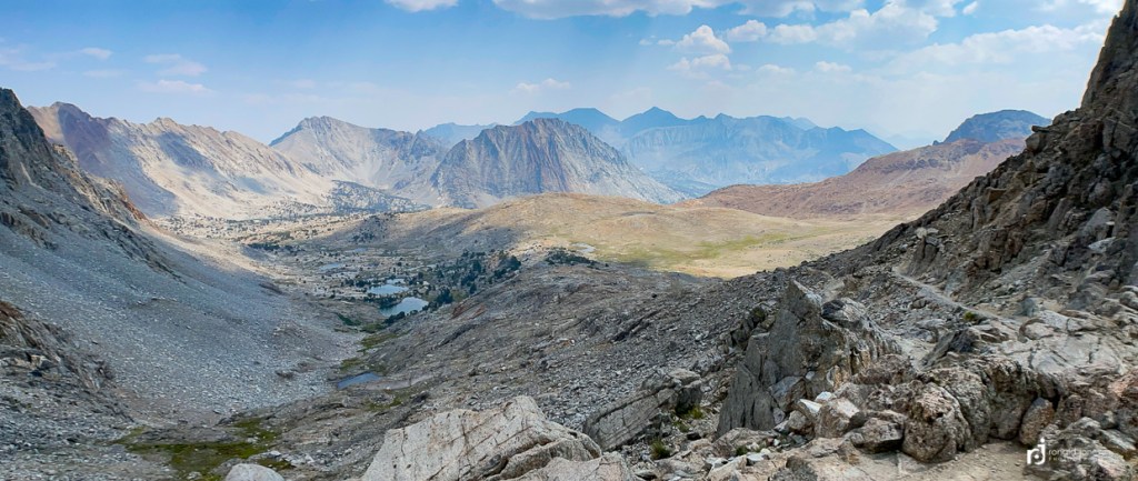
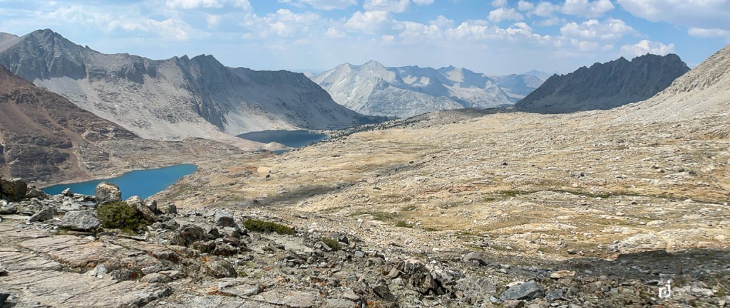
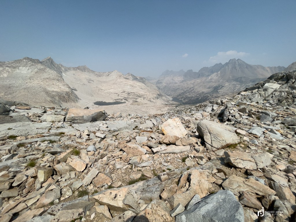
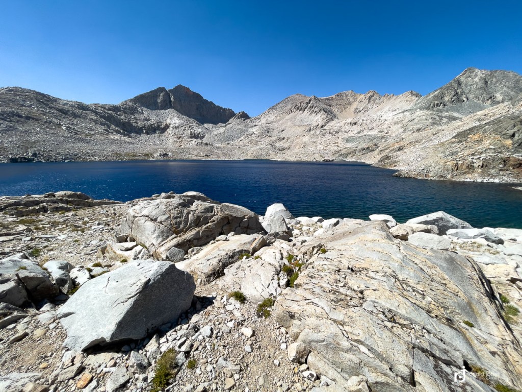
Middle Fork Kings over Muir to Wanda Lake, 14.35 miles and 4,500′ – Day 9
I think day was the grand daddy of them all. I had planned that we might pull a 19 mile day, from the south side of Mather to the Muir approach. Ha! For one, our pace and overall daily mileage was leaving us short and camping near the bottom of each valley, so we had quite a bit of climbing for at least half a day. The two exceptions were Glen and Foresters passes.
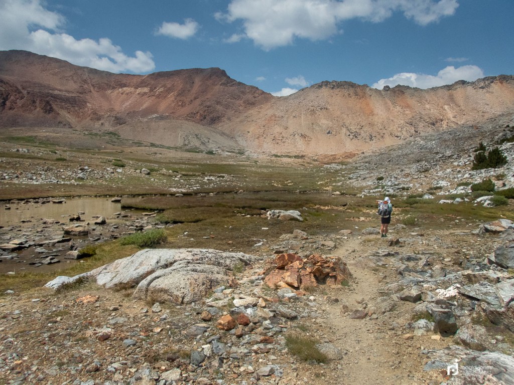
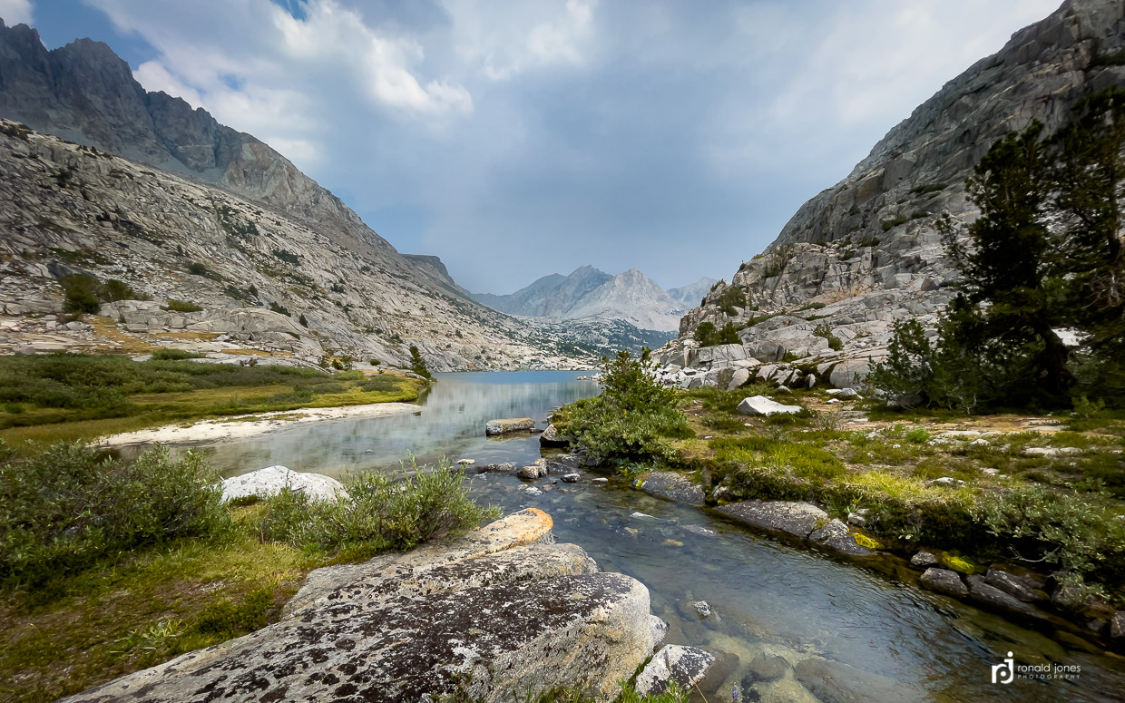
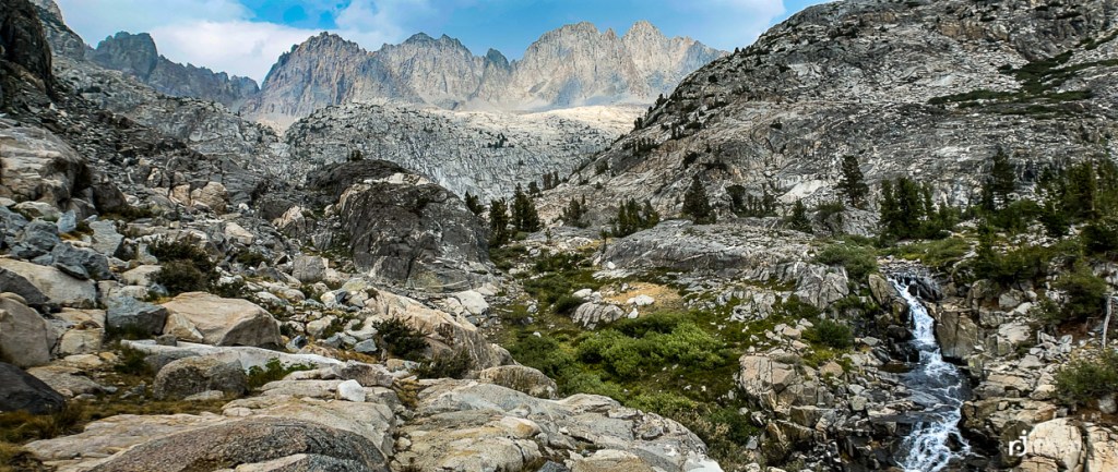
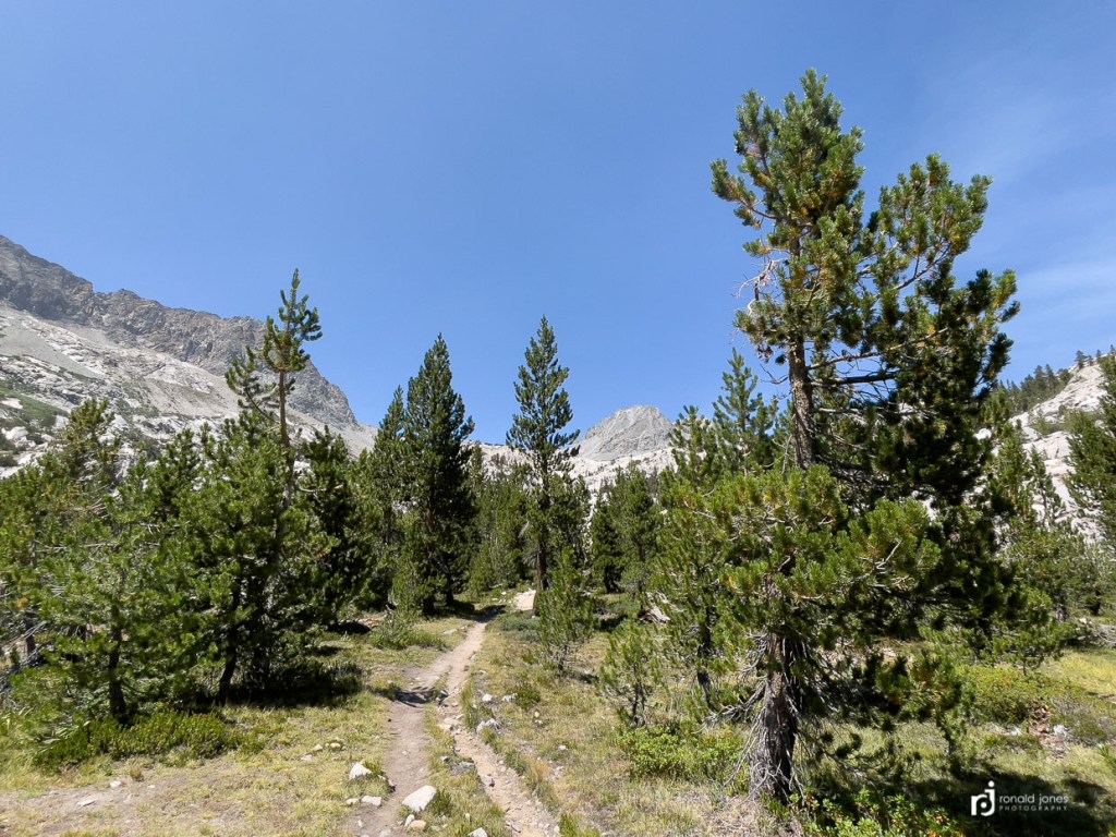
This was however, my favorite day and section of the entire John Muir Trail. The climb reminded me of the climb up from Woods creek two days earlier, passing through numerous micro-zones. We got moving pretty early, but not the day-break start I’d hoped for. It was just a mile or two to the junction and crossing over the middle fork Kings river. then we were following the river all the way up to the lakes and headwaters. We passed meadows, forested areas, and zones of varied plants and shrubs. The canyon would begin to open up and then we’d be back in trees.
It’s difficult to describe, but this section (all of it including Muir Hut), really struck a chord with me. Something said this is the reason Muir spent a lifetime advocating to preserve wild places. For me, it was the epitome of wilderness.
When we reached the Loconte Canyon / Bishop Pass junction, the two guys we camped near passed by us. They slowly became fairly annoying. Rushing ahead, stopping, we’d pass them, but just keep our pace, and one guy who was pretty fit would zoom by with his less fit friend in tow, then the slower guy would slow way up, stop, and we’d pass him. Then he’d zoom by. They kept asking how far we were headed. Seemed to really know our destination, which was just to get over Muir if possible, and decide how far we could get. My answer, which was fully honest, was “as far as we can get.” This seemed to annoy them to no end. At one point, the slower guy (black hyperlight pack) was stopped in a camp area, appeared to be looking at his phone. When we passed, Jean said he through on his pack very quickly, and jumped in behind. Then proceeded to follow Jean, clicking and clacking his trekking poles. Jean said he could pass, but he responded that he didn’t mind to be behind her. She just stopped and said, “I really don’t like people behind me”, so he passed her, then me as I waited and caught his friend. They took the last feasible camp spot about 3 miles before the summit. They’d also passed on information about water sources, or lack thereof, that were completely wrong. We would later name them click and clack. Jean named them, but I added they were like the real click and clack, New York automotive radio personalities. There will be more about click and clack later.

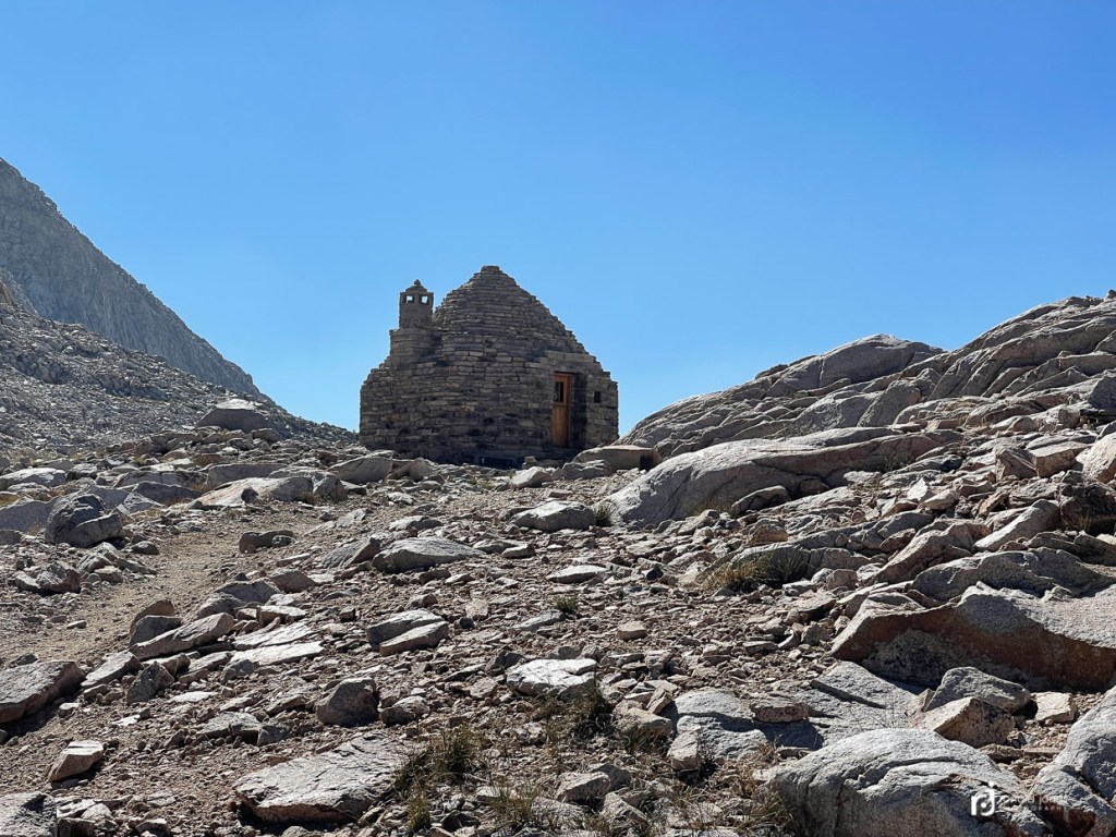
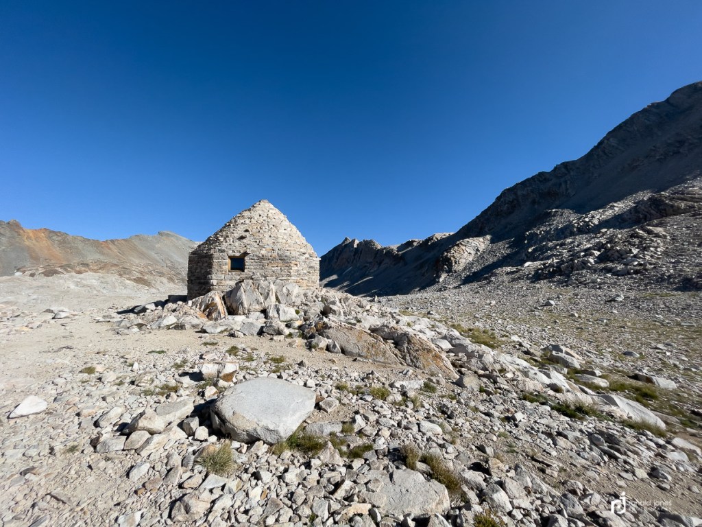
This is one summit, or rather one of three that had me muttering. It was littered with false summits. It was such a blessing to see the hut. Finally!
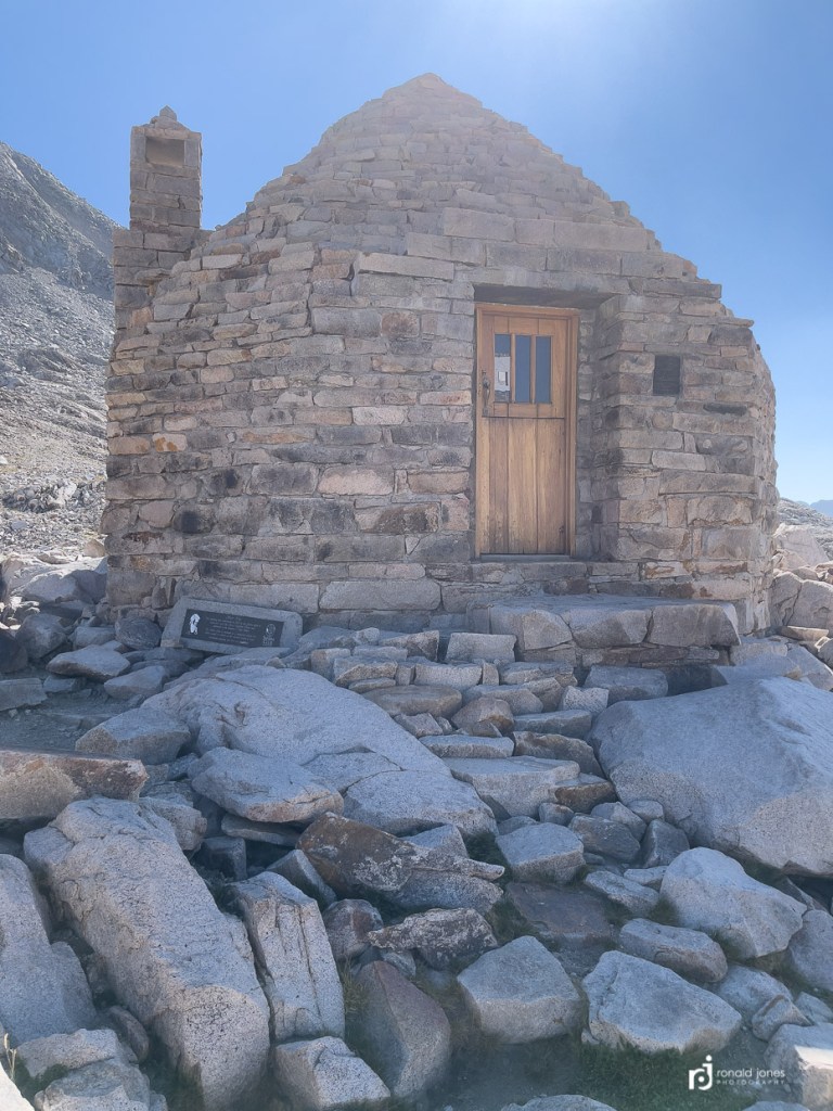
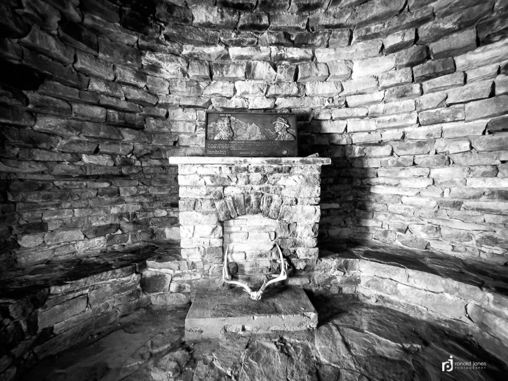
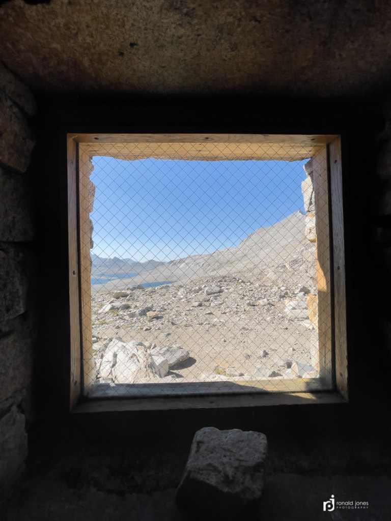
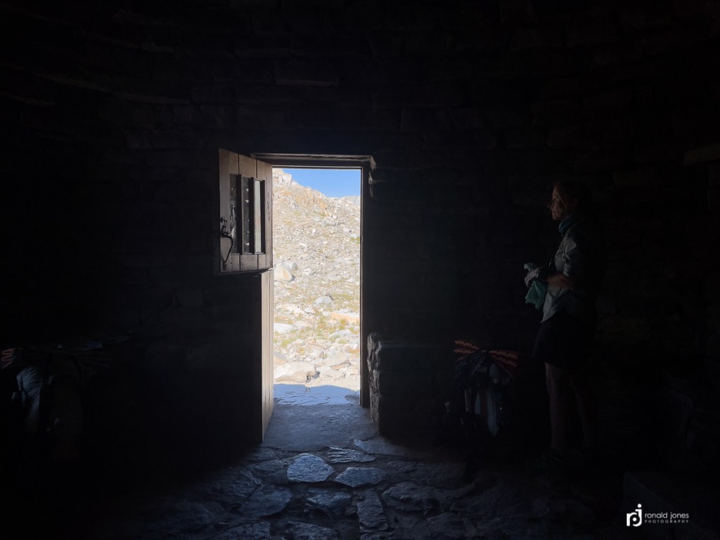
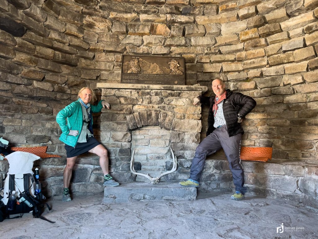
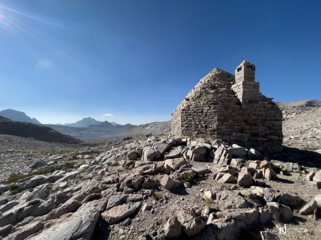
The Muir Hut is for emergency use only. We were lucky to gain this summit late in the day, around 4:20PM. It was howling outside. Warm when not in the wind, but chilly in the wind and since we were calorie starved, we got cold quick. We made one of our early dinners and hot cocoa in the hut. It was so good. We hung out for about an hour with the place to ourself on a blue-bird day, before descending the north side to find a campsite.
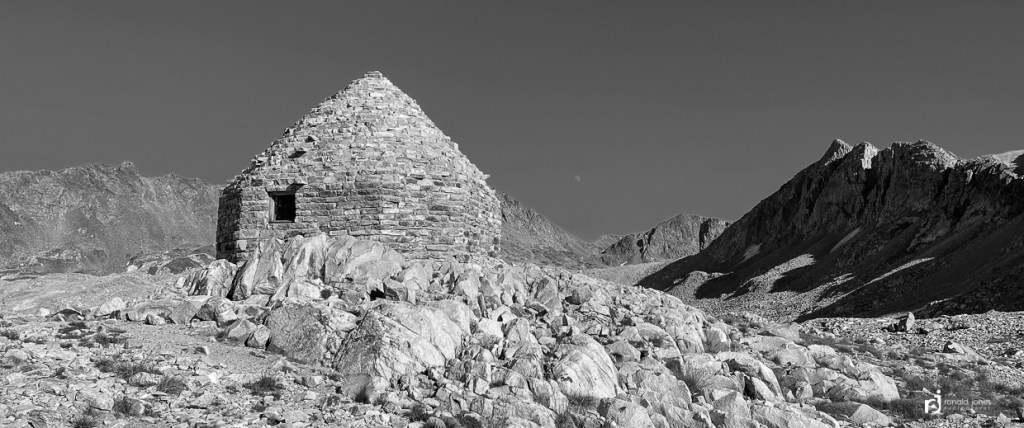
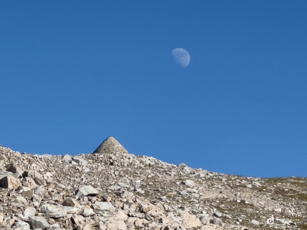
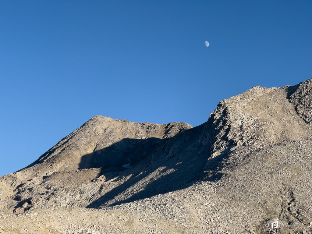
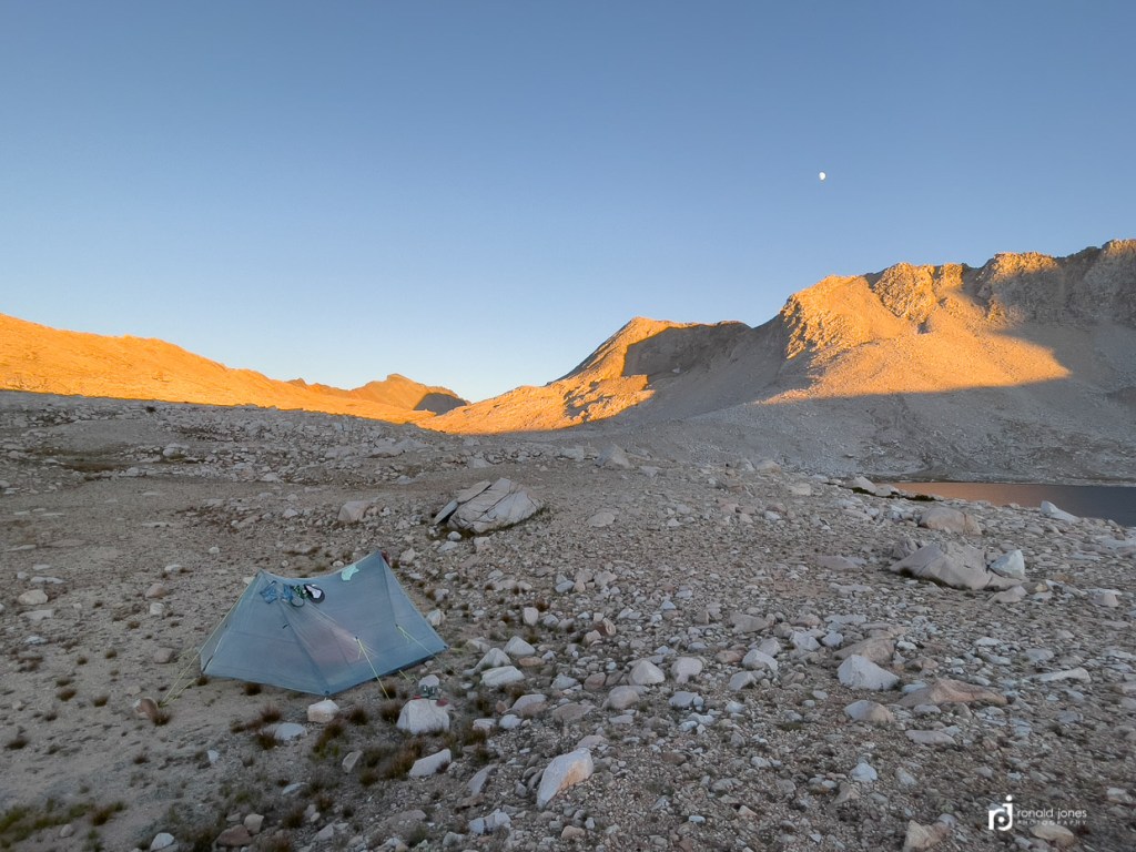
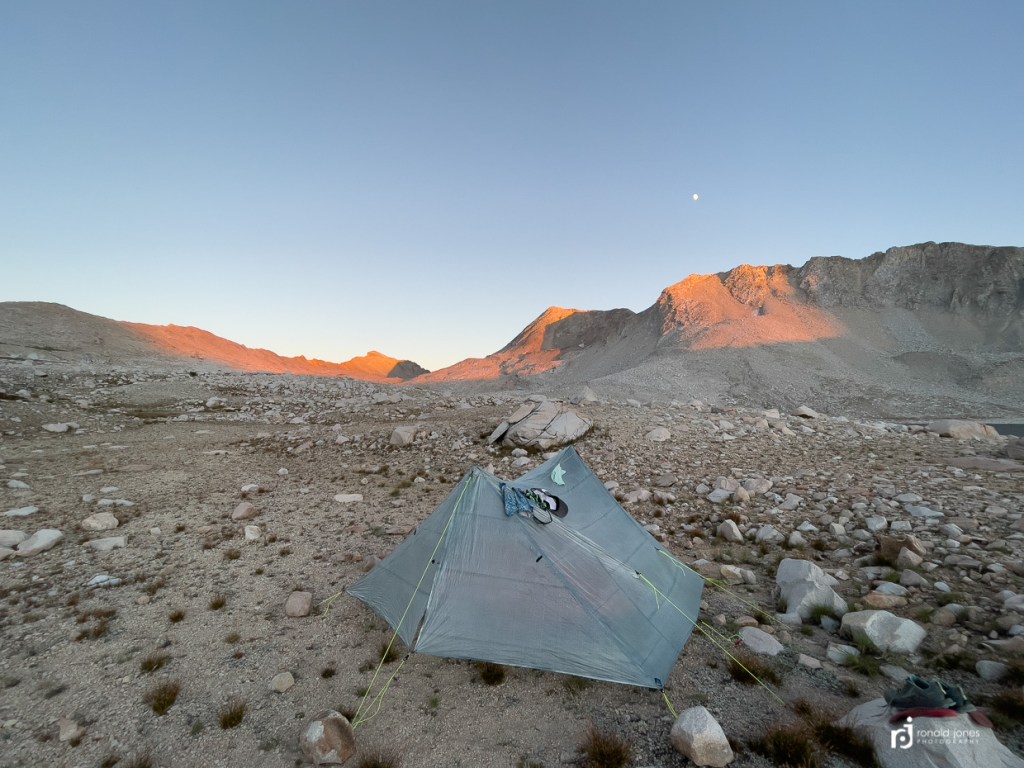
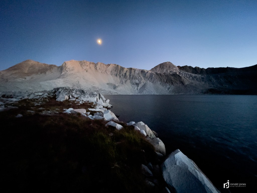
We ended up dropping just a mile and a half to Lake Wanda where we found a spot, semi-protected from wind. It was a long day. A great day. The moon was rising and provided a few photographic opportunities. Which by the way, were all captured either my my iPhone 12ProMax either with our without a Moment Anamorphic Lens, or my Olympia TG-5 point and shoot. I had decided to leave the Olympus OMD EM1M2 at home to save some weight and gear. I gave up, or had some lost opportunities by not having a real lens on a camera, but don’t think I gave up that much for a big hike like this. Certainly, night photography was not an option, and certain types of images, sun-bursts and dealing with dynamic range were and issue. But I shot most photos in iPhone raw, Moment tiff, or Olympus RAW so still had post processing latitude.
Oh. And lastly. Past the Laconte Junction on the approach to Muir is the Muir Monster. I was not paying close attention but knew it was coming up. It was a time that click and clack had me distracted with their game of leap frog. I ended up walking right past it. Jean saw it off to the side of the trail but didn’t really know about the significance. It’s just a large rock with a sort of mouth opening and little rocks made to look like teeth. People like to get their photo with it eating them. A sort distorted dream of being eaten by Jaws I suppose. Anyway. We missed it. And it’s not easy to go back. Here’s a link that included a a photo. https://highsierratrails.com/jmt/jmt_trail_map5.html

