
Sometimes a person just gets lucky. Call it serendipitous, magic, karma, whatever you like. Occasionally the cards fall in your favor, as they did on the third day of spring, 2023. Just a couple weeks earlier I had commented on a friend’s (Jeff Evans) FB post and mentioned we should hike/scramble sometime. He’d hiked the Big Creek loop after a huge dump of snow and made another cool short video clip.

We’d never hiked or scrambled together, but have done a lot of cycling with the local race team and some sea kayaking. After mentioning that Wednesdays are often days I can most easily schedule off, he through out March 22nd. We agreed on the day and because we both wanted to do Mount Ellinor, it was easy to pick what/where.

At the time the weather was still wet and cold and the avalanche danger was sitting in the considerable range. We both figured a couple weeks, or a week and half would be enough time to calm things down. Leading up to the day it was a little touch and go because winter is keeping a tight grip. As it turned out, the day we picked was THE day to go! It was the sunny weather day unlike the days leading up and after.


We knew the snow was still down low but that last reports we could find were from three weeks prior. Not interested in starting at Big Creek for a 5,000′ gain day, we decided to take a chance on the road. Maybe we’d get close to the lower trailhead. We met at Haggens in Olympia to car pool at 6:30AM. It takes about 1 hour 15 to get to the lower section of the road to Ellinor. We only drove up maybe a couple miles before hitting snow. We started into it but it was mushy and gave poor traction with my Honda Pilot AWD with all mountain snow tires. Not interested in pushing our luck, we backed up a couple hundred yards and parked in a wide spot. One other car was there also.
I was a little nervous about snow conditions. Over the weekend the Northwest Avalanche Center was showing moderate conditions at all levels and ranging from possible and size D1 and D2. But the trend was improving. Unfortunately NWAC only provides beta on the weekends for the Olympics. And the ranges is so diverse, any beta from the northern part may be dramatically different than the Hood Canal area. We both agreed to a pre-trip plan. I have been using my AIARE-1 Backcountry Decision Making Guide book since completing AIRRE-1 in January. I use it on every snow outing as recommended, whether I’m the leader or not.

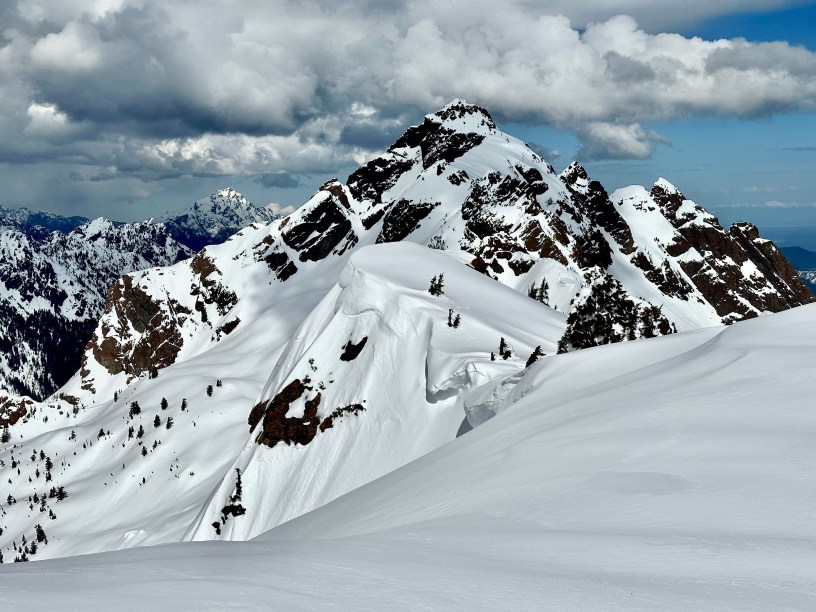
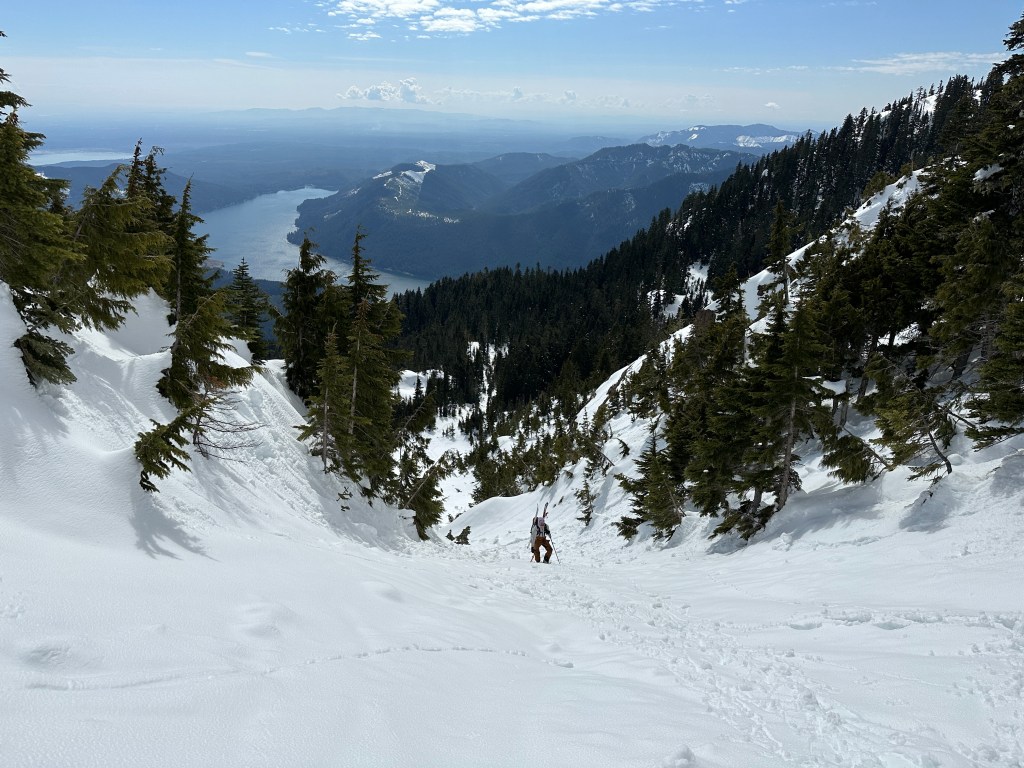
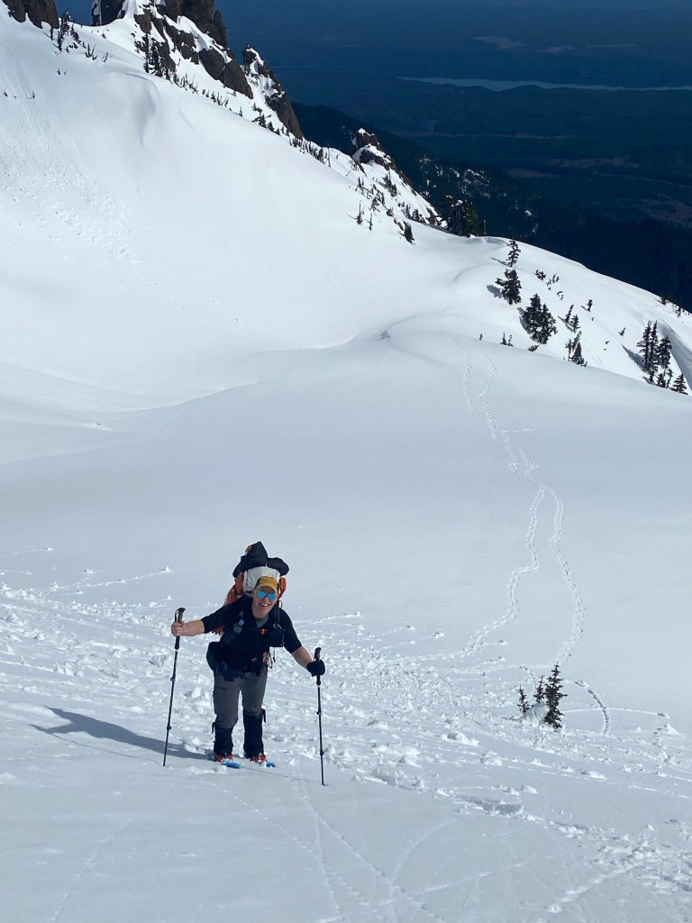
We agreed to both carry shovel, probe, and beacon. Frankly, it should be standard on any snow outing beyond basic terrain. The hike/snowshoe/scramble is tree protected until reaching the winter route chute, which is prime slope for avalanche, and exposed to the southern sun. We further agreed we’d assess conditions and each of us carried a veto card. Neither of us want to be a statistics. Our hike began at 8:00 am. After a close to a mile, we had to put on snowshoes. The snow deepened to over well over a foot and every step was dropping in 6″ to 12″.

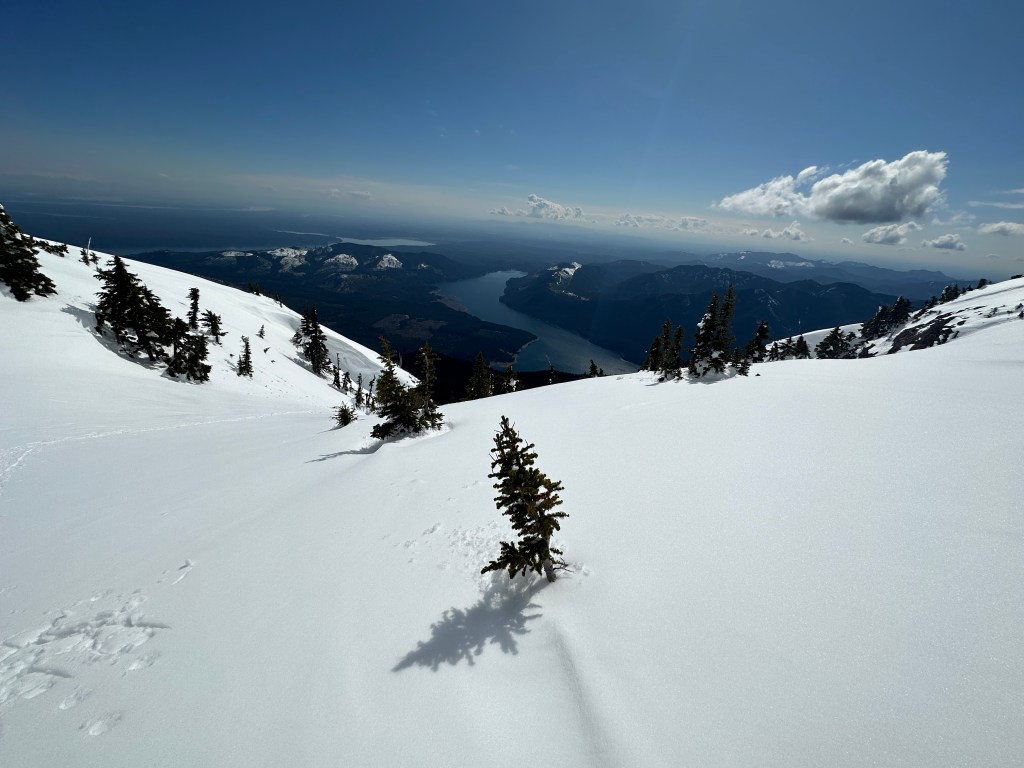
It took a little under 2 hours to travel the 3 miles to the lower trailhead. Just before getting there we stopped for a break and were passed by two younger guys on backcountry skis. We were so envious of their smooth travel. And figured they’d be skiing down about the time we were headed up the chute. More on that later. The road travel was mostly a gentle slope, but because it’s a road, not overly scenic. But not horrible either. Once in the big tree area it was prettier, but the travel was not easier. First we had to gain some steeper slopes, then get back to a gentle grade following very old and covered boot path, and ski tracks.
A mile in we passed the skiers as they were stopped to eat. We continued to where the the upper trailhead intersects with the lower trailhead. There are actually two of these intersections, and we stopped to eat at the lower one.

From our lunch spot in up it got steeper and slower. We ended up only a short distance behind the skiers. They ended up reaching the chute about 15 minutes before us. One other hiker with a dog came up behind be he turned back at the chute. He was not intending on going further.
We assessed conditions from afar. It looked stable. Old rollerballs but no real new signs of roller balls. I dug a quick hand-pit and found bonded snow down about 18”. As far as I dug. Trekking pole probes felt mostly consistent.


As we approached the chute one skier had gone up a ways. The other was putting his skis on his pack, getting ready to boot up. We ended up passing them and never saw them again. Hikers who summited just after us said they’d turned around. We expected as much since the second guy was really struggling in the deep snow. It was either snow shoes or post hole to your knees or thighs.


I think it may be a while before driving to the lower trailhead is possible. Warm rain and sunny days will help.
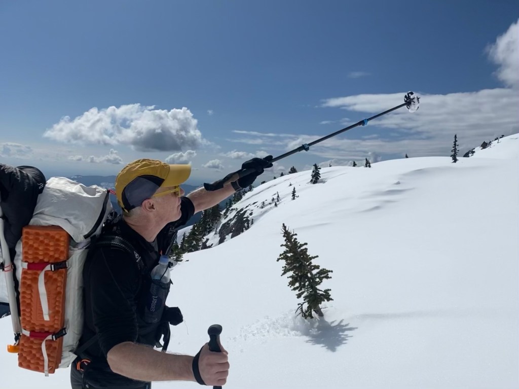
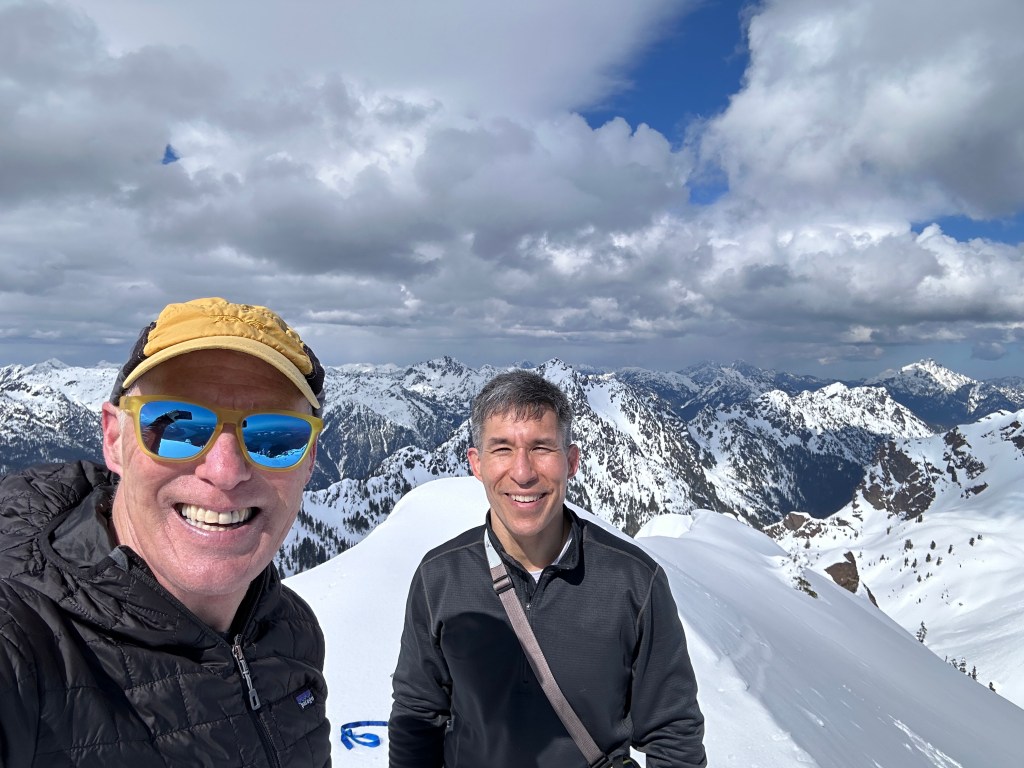
One of those days that’s feels like it may be hard to beat. Every trip is unique in its own right. When you’re left with such great memories, I find it difficult to want to repeat a trip for a while. I want to savor it. A magical day indeed.
So what’s your approach to repeating trips? Do you repeat no matter how it went or focus more on repeating when the trip didn’t go as planned? Feel free to leave a comment.

