

From Sunrise Lakes to Yosemite could have easily been one day, but why end a good thing too soon!
Sunrise Lakes to Little Yosemite Valley Campground via Clouds Rest – Day 19
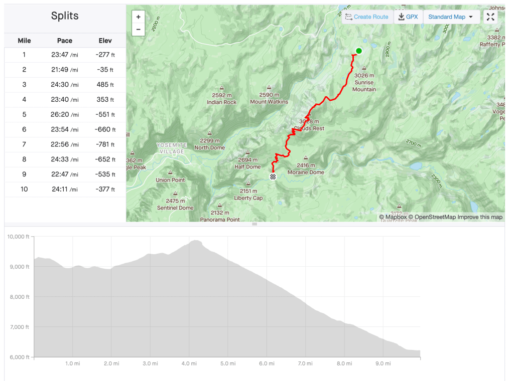
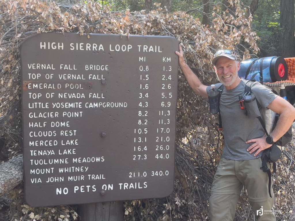
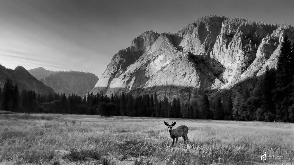
After getting so close to Clouds Rest, I decided it was worthy of a sunrise summit. I only had 4 miles according to my calculations. And a little more than 1,000 feet gain. I figured I should give myself two hours to hike up. The JMT miles have not always been easy, when they looked like they should be easy. I wanted to be at the top around 6AM so to be prepared for sunrise around 6:25AM.
Cowboy camping would help me pack up quick. I ended up sleeping a little longer than expected. I didn’t set an alarm. I was waking up fine when I needed to. I just go lazy about crawling out of my bag. I waited until about 3:45AM. I went ahead and boiled water for coffee while I packed up. I would have breakfast on Clouds Rest. As it turned out, I wasn’t hiking until 4:25AM. This meant I had to hustle, and actually figured I’d miss sunrise proper, or be there right went it pops up. I was hiking in the dark with my headlamp so foot placement was important. I had to pay attention. I’m also trying to hike in a somewhat noisy fashion in case I come across something like a bear.
I think I actually like hiking in the dark. A short time anyway.


I figured a sunrise was out of the question.


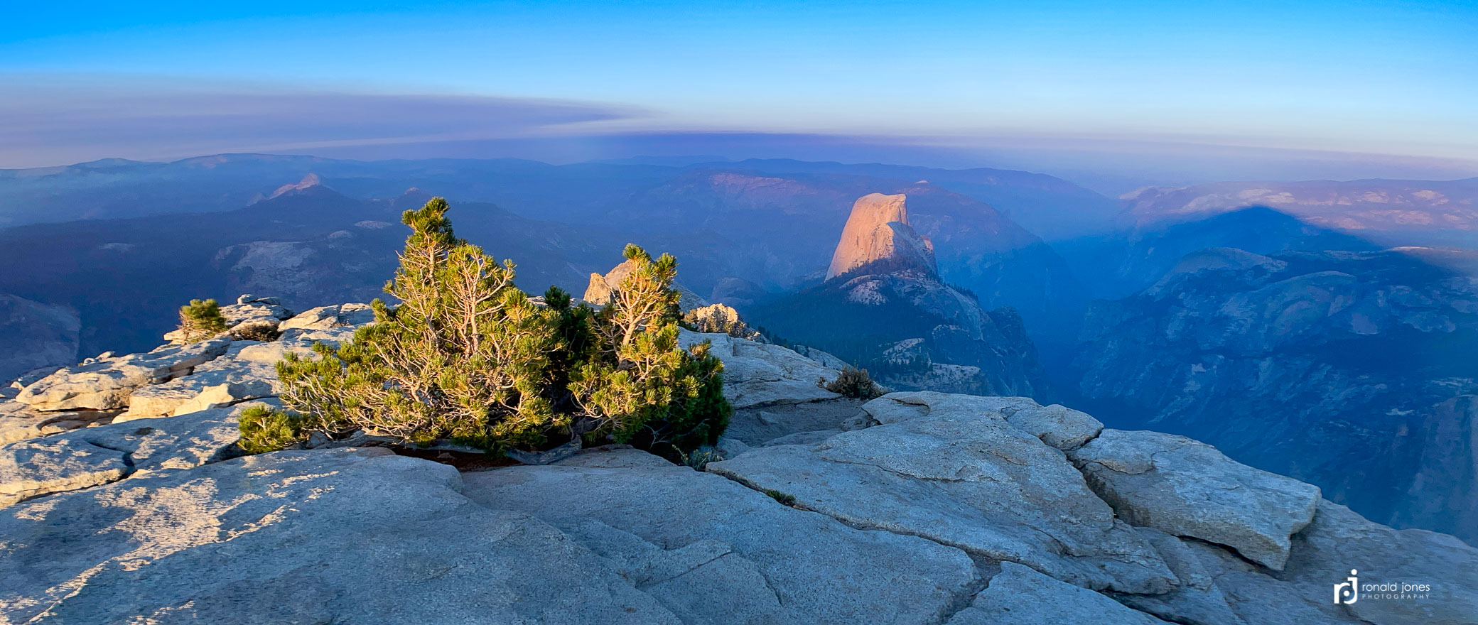
I made it to Clouds Rest summit in 1 hour 40 minutes. It was indeed only 4.1 miles. It was shortly after 6AM. I made more coffee and Mountain House Biscuits and Gravy. then watched the sun come up. The climb up the last little bit was not overly scary, but I think for some, it might be. There is a couple thousand feet of exposure (estimating) and at times, one is not walking that far from the edge. I decided to make a Facebook live video since I had cell service, and there was no one else around. I honestly thought the place would be busy. But I had it to myself for over an hour. Interestingly, after an hour, and the sun was fully up, and just before I began descending the south approach, I tried my phone again, and no cell service 🤔


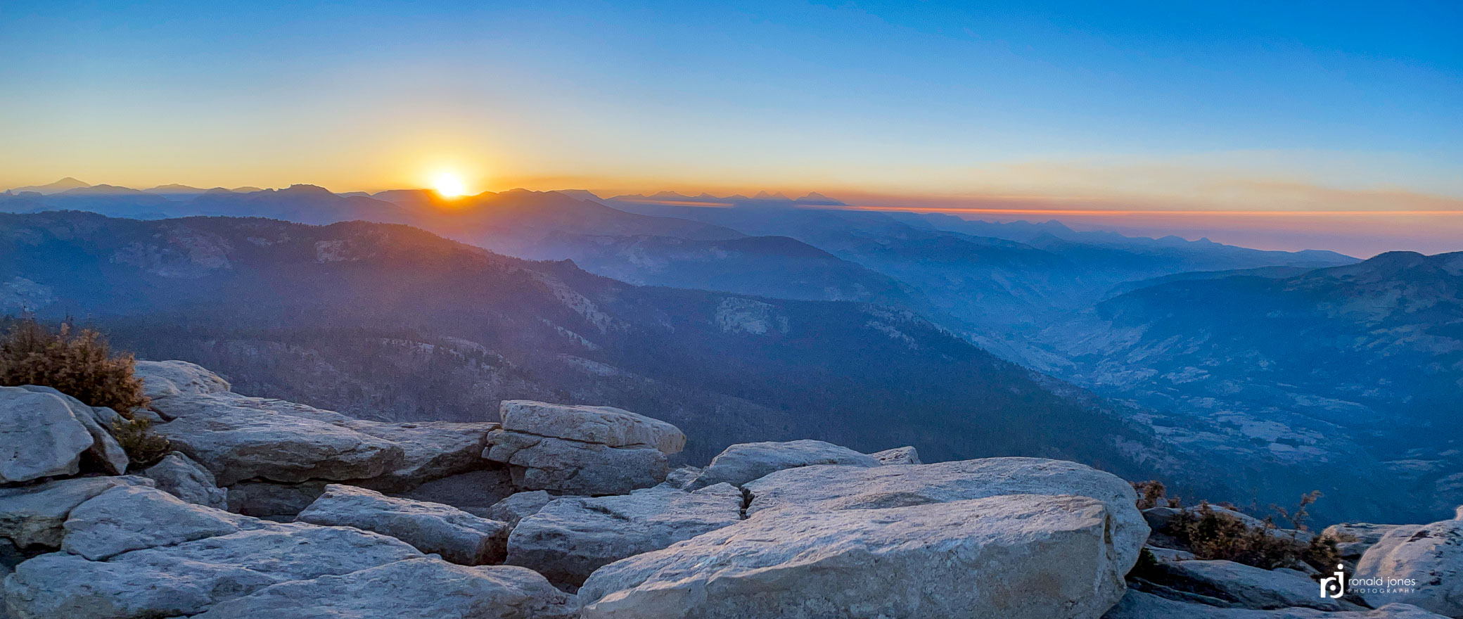
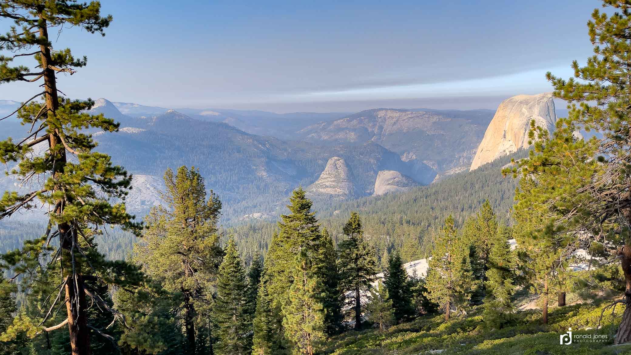
It was lucky to have clear skies above, but there was definitely smoke all the way around on the horizon. On one hand it was a bummer, on the other it made for some interesting atmospheric conditions. Below, top left – looking down on another old burn area, top right – some other granite face (not sure its name), the two in the middle showing half dome getting bathed in morning light, and then at the bottom – leaving Clouds Rest.


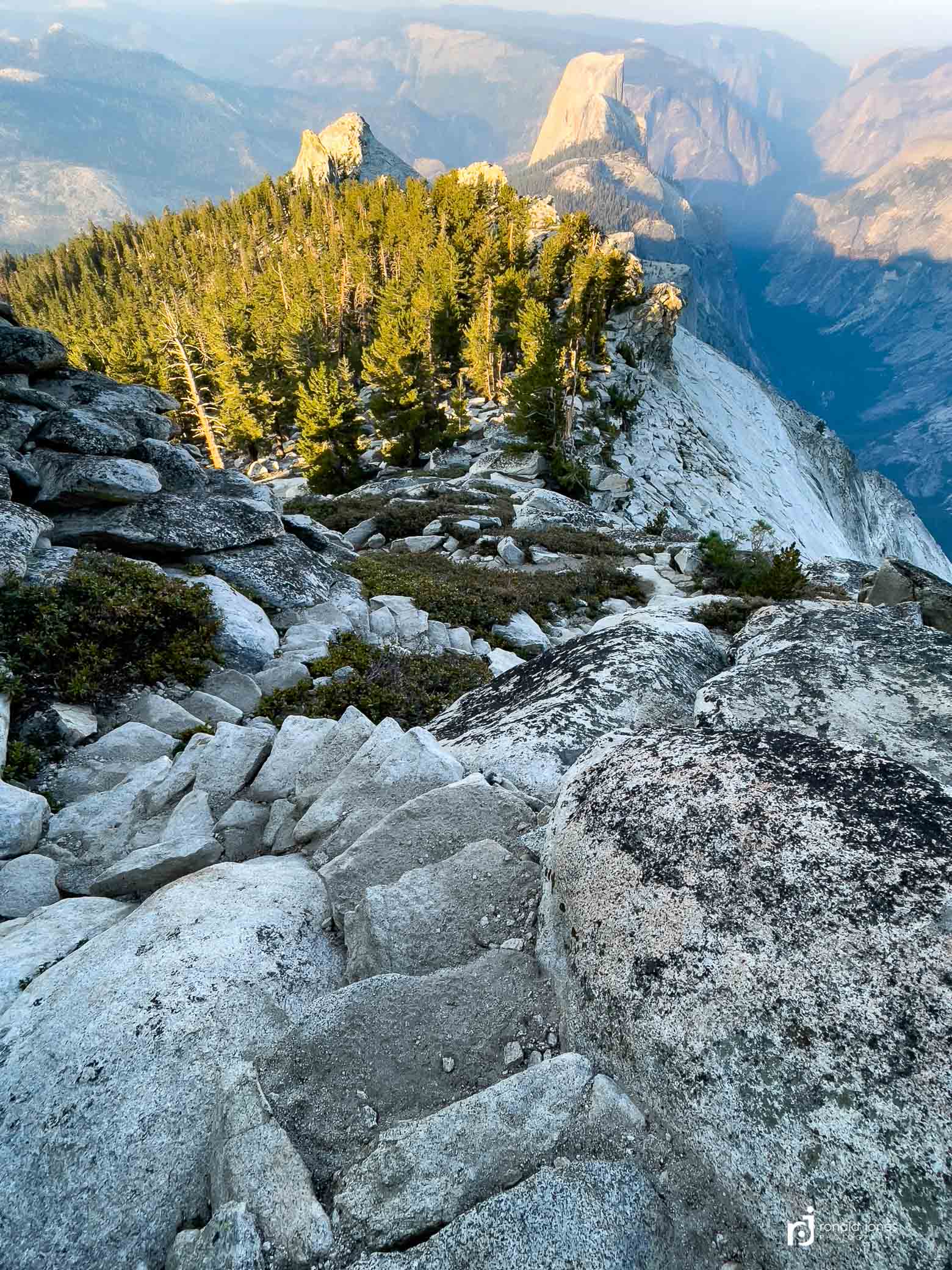
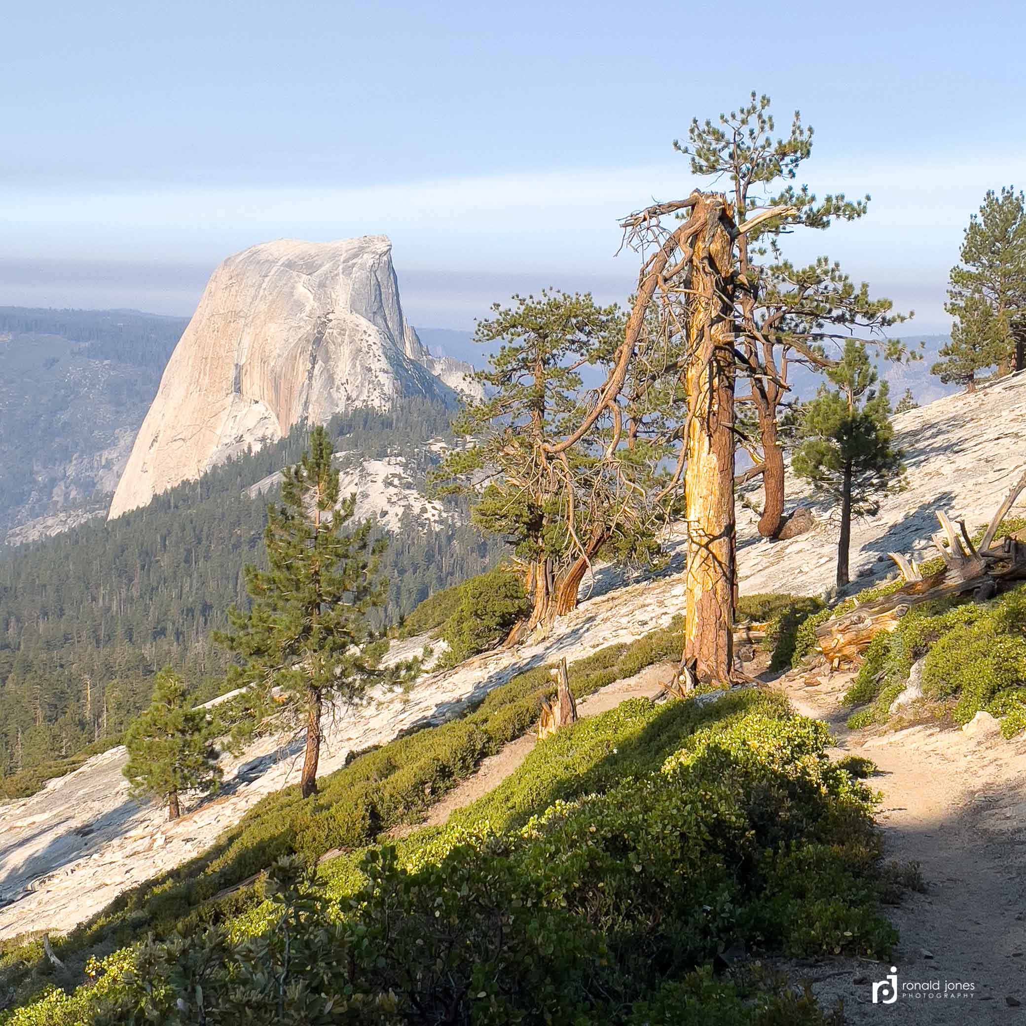
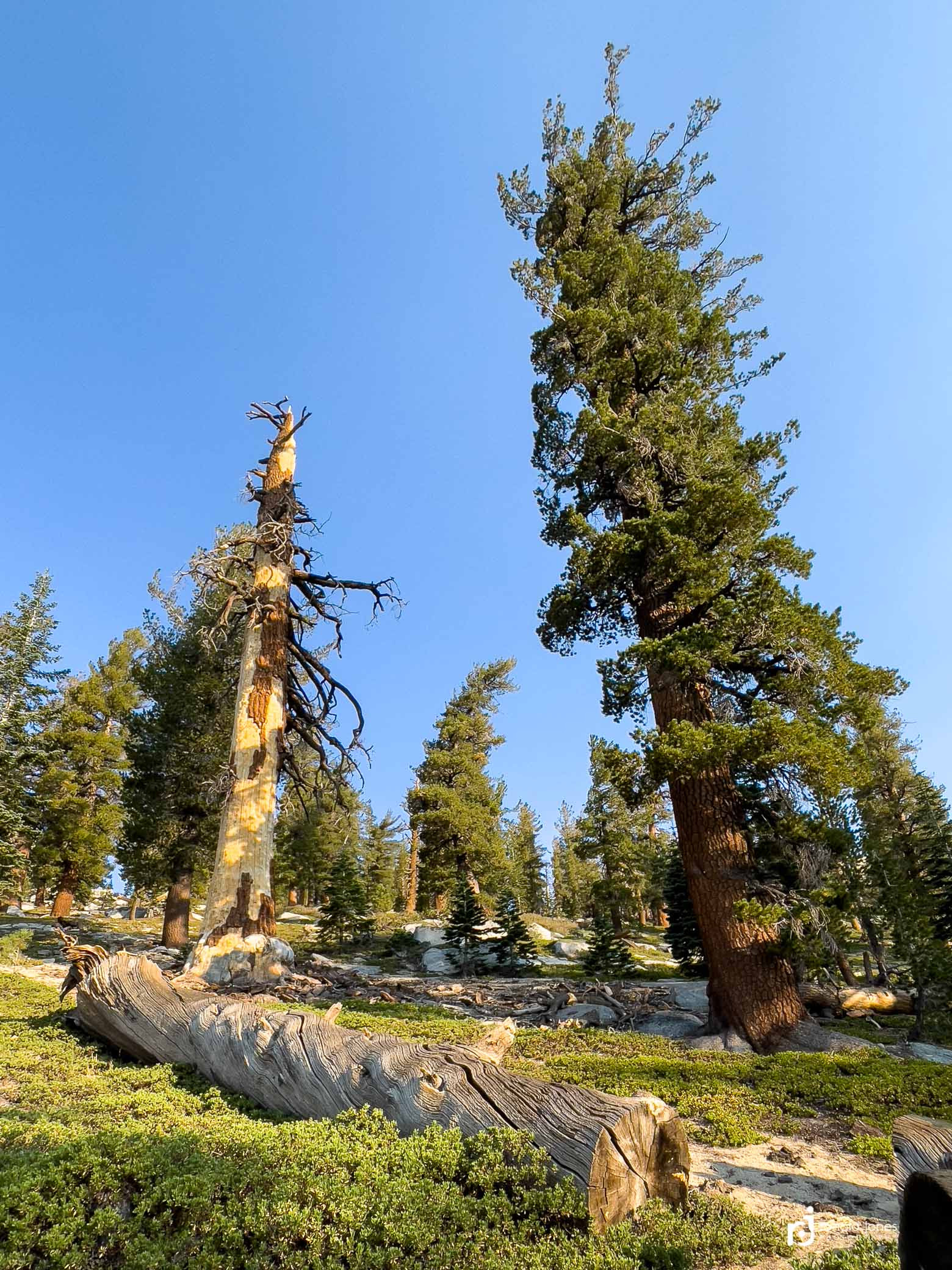
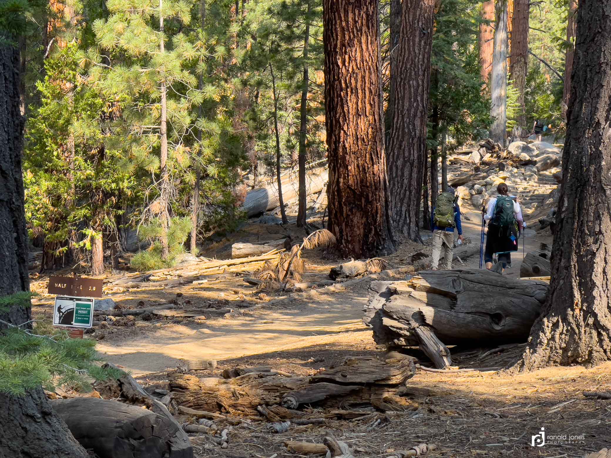
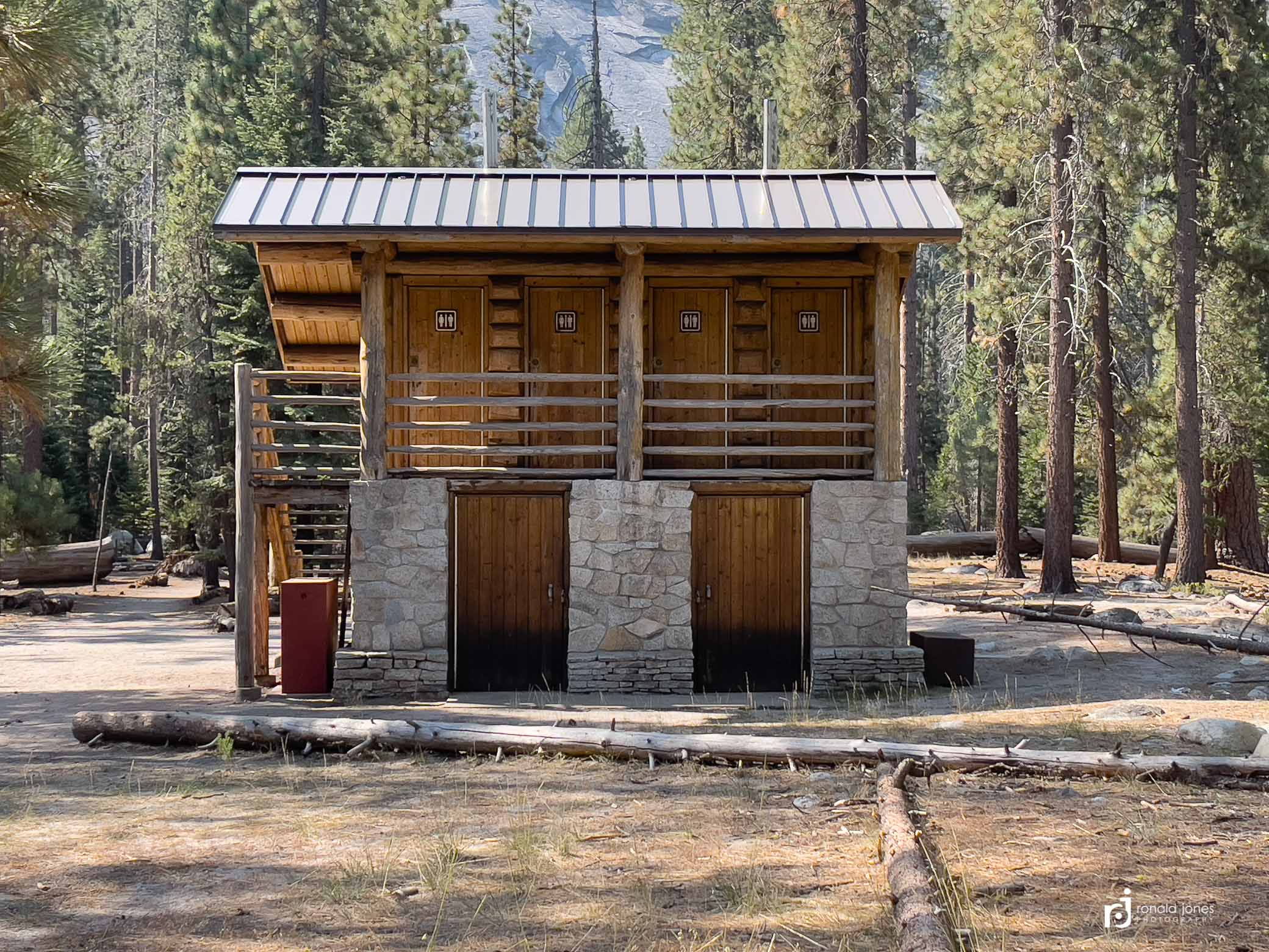
I enjoyed my time hiking down off Clouds Rest. Back into big trees and getting views of many assorted domes and rock faces in the greater landscape. I was looking for climbers but never saw any. I could fully understand the appeal of Yosemite to rock climbers now. There are many options, it seems. More than just Half Dome, the Dawn Wall and El Capitan. The photo below (top left) was a really fascinating piece of exposed granite. I actually passed by pretty close. I was tempted to go up onto the easier lower slopes but figured it’s smarter to be safe, and not do that. And that poor tree (3rd down left side), lost its top! At the bottom of the photo grid below – hikers headed up to Half Dome from the junction (bottom left), folks who camped next to me at Little Yosemite Valley (middle), the very nice toilet building at Little Yosemite Valley (bottom right).


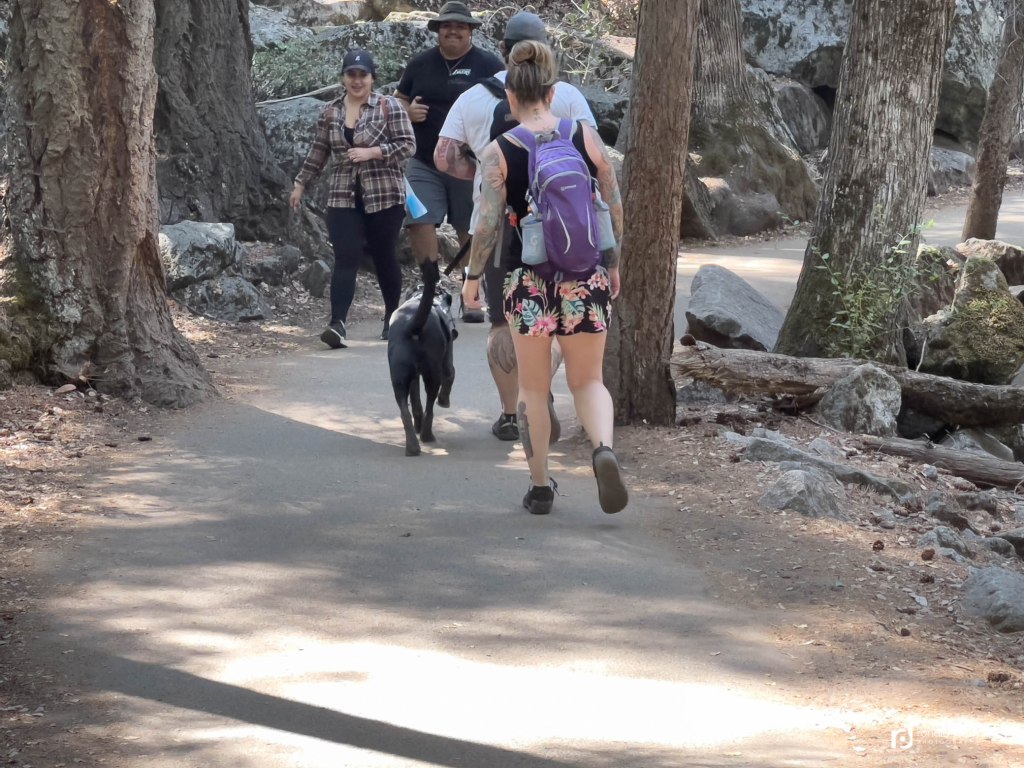
The feeling of the trip changed dramatically once I rejoined the official JMT below Clouds Rest. All of a sudden there were many more people, lots of day hikers, and a lot less trail etiquette. It was a real struggle to accept. I arrive at Little Yosemite Valley (LYV) around 11:30AM. It’s only 4-5 miles to Happy Isles. I wasn’t quite ready to end the hike so figured I’d stay the night and rinse up well in the creek, which is what I did. LYV campground is well used. It’s really a dustbowl and not my favorite style of camping for sure. The park service has fallen quite a few trees, and then camp areas are sort of delineated, but not always. There isn’t a lot of privacy. Let me rephrase that, there is no privacy! I hymed adn hawed and finally selected a site. I was pretty low on fuel and wasn’t sure I’d have enough for dinner, breakfast and possibly one more use or two in the main valley. I asked some guys who were packing up if they were headed to Yosemite Valley or just beginning their hike. They said they had been out a few days. I asked if they had a partial fuel canister I could buy. They ended up giving me a ½ full 16 ounce can! Way more than I needed. And they didn’t want money. They were happy to not carry it.
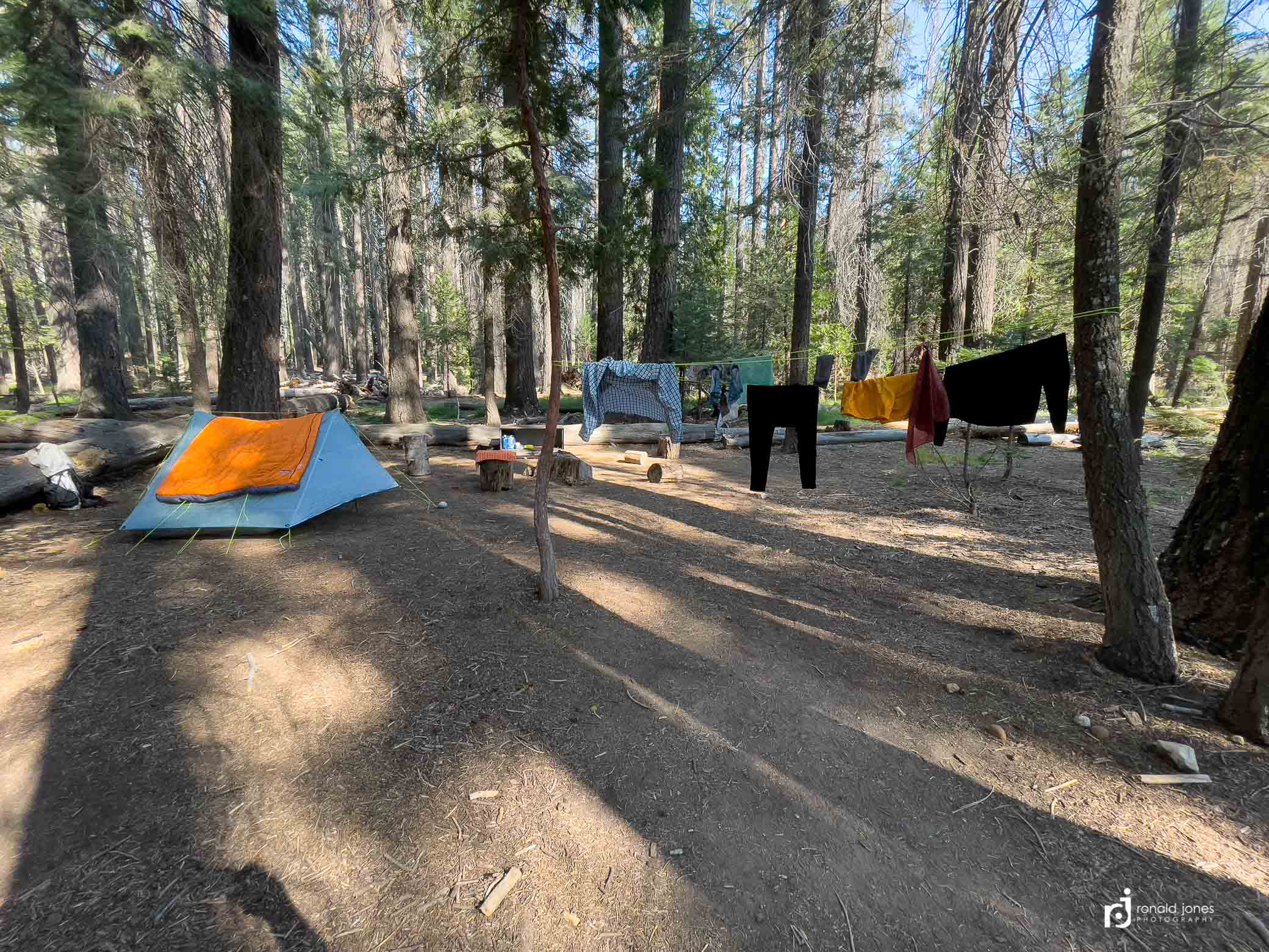
Below is my campsite. Dusty, yes! I did my washing in the river using my bear canister. I’d scoop water, use a small amount of soap, slosh and scrub, then ring back into the canister, walk it into the woods, pour it out, and repeat. It worked pretty well. The river wasn’t far from camp. As you can see, I wore out my socks and gloves. I choose to use Wright socks, because they are easy on my feet. I found that ‘darn tough’ socks are darn tough on my feet. They last forever, but my feet objected.
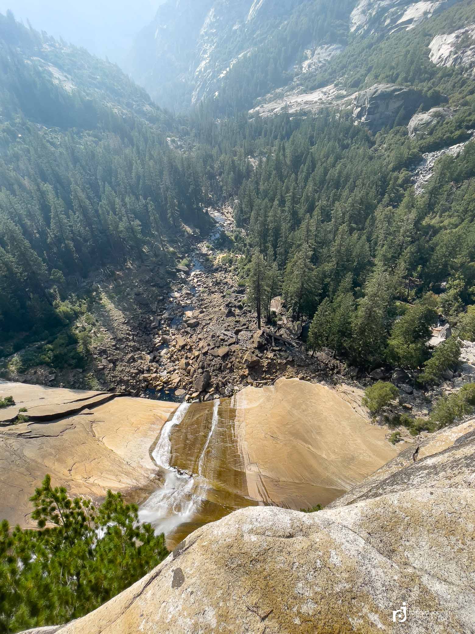
All the lower photos are of the river about mile down trail at Nevada Falls. This is a big deal for some day hikers. There is a person standing on rock next to the river (people also in the river), and he is right of the fence where the sign states to keep out of the river. During high flows, it’s easy to get washed over the falls and killed. It was a very low flow, but still, I question people’s judgement. People do get killed on hot days when the flow is strong and they jump in to cool off – wooosh!


Little Yosemite Valley to Yosemite Valley (Happy Isles) – Day 20
Saturday morning. The guys next door stayed up past dark and chatted but it was not bothersome. We had not talked at all Friday. I was a bit leisurely this A.M. I was boiling water and mostly packed by the time they emerged from their fabric dens, yawning, sleepy-eyed, and scattering into the woods to complete the morning ritual. We did end up conversing and they were starting a shorter backpack loop. I shared I’d hiked the JMT NOBO. One or two of the three had also done it, but many years ago.
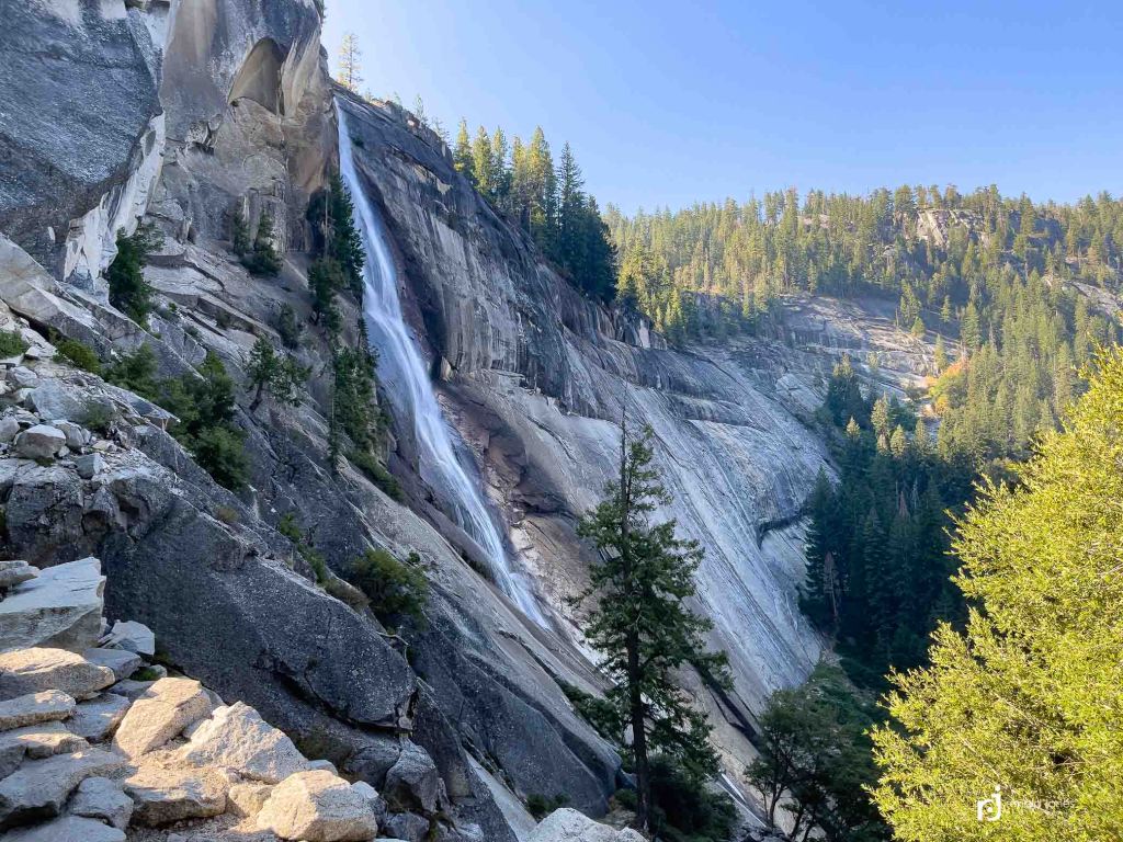
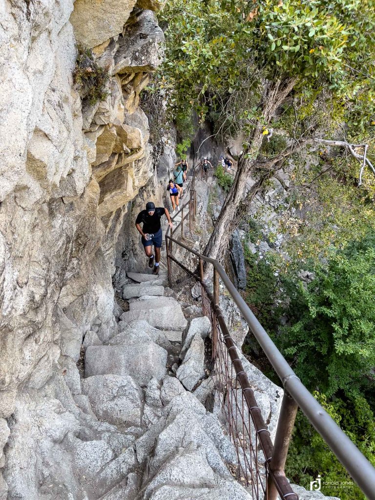
After breakfast and socializing, I used the fancy outhouse (talk about luxury!), and was on my way. When I got to Nevada Falls, I was already encountering numerous groups headed up to hike half dome. I had not paid attention to the JMT route, which technically goes over the bridge at the top of the falls and descends down to Happy Isles, eventually meeting up the the trail I would take (the Mist Trail), which more or less follows the river down. Well poop! It’s fine, I enjoyed the trail I took, it was steeper and shorter than the JMT, and according to some I spoke with, more scenic.
One section has some 680 granite steps built decades ago by the CCC.


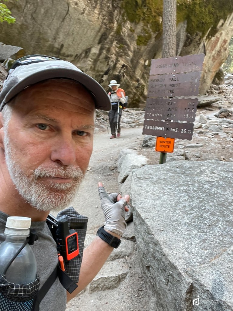
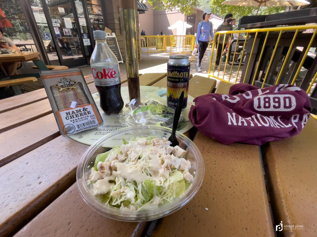
I had actually walked right past that iconic trailhead sign and had to backtrack 200 yards or more to get my photo. When I got to the end of the trail, it was a bit confusing as to where to go. I found the signage lacking. I followed what was the main road. As it turns out, Yosemite is really broken up – with two sort of main villages in the valley. Curry Village, which is where I was headed first. It was about one mile from the trailhead. It was quite warm. I was now down around 4,000′. I found a small store. The little take out restauraunt was not open for lunch or dinner. The pizza place opened at noon but there was a line. The outdoor store was open. I just went into the little convenience store and bought a plastic salad, plastic sandwich, diet coke and a beer. And got a couple t-shirts, as mine were not all the fresh smelling, even after the river wash.
I then set about to find the backpackers camp, but first, I checked on the option of a shower. I went into the Curry Village lodging office and asked a clerk if there were any rooms available. Curry village has about 1,000 canvas tent cabins (number is exaggerated but there are a lot!) with shared shower and restroom facilities, and then there is a hotel too. I had checked online the night before and I saw a few options for Sunday, but had not checked Saturday. The woman I was asking checked all lodging options in the valley and it was zero. I then mentioned I just completed the three week hike of the JMT, and wondered if it was possible to purchase a shower. All the showers in standard campgrounds were shut down due to covid I’d seen. She said that wasn’t an option. But she offered this; she said the guard is off duty at 11PM. More on that later.

Just before I got to the end of the trail, I ran into the Yosemite Search and Rescue, who were positioned just up from the trailhead. We talked for a while. I shared I really had no plans at this point, but would wing it getting home. One of them, not with search and rescue officially, came up to me as I was walking away and said that if I needed a ride, she and her friend were headed back to the bay area late Sunday, and I could ride with them. She also alerted me to the bike share pictured below. I ended up not using that option because plane tickets from Sacramento were far less expensive last minute.

After getting the shower information and some food, I made my way to the backpackers camp, which was out in the north forty across the Merced River. While it had nice toilets, there was no water spigot. I guess we were backpackers adn could filter water from the river, which was not all that close by. Or pack it ½ mile from the North Pines Campground which we walked through to get to the backpackers camp.
As a backpacking permit holder, you get one night in this campground. It does cost $6 however. And it fills up. And, a site is not necessarily yours. They are expected to be shared if necessary, up to 6 or 8 people. Or maybe 3 to 4 tents. Every site was taken by morning. Some came in very late. As you can see, I used that electric bike. I had it for the entire time starting around 4PM Saturday, until I left on Sunday at 2:30PM.

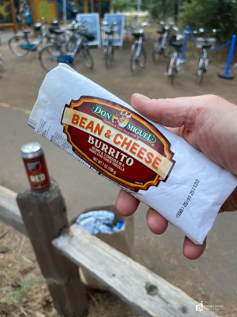
After setting up camp and talking with a few folks, including the really nice host, I went to the main village where the bikes were supposedly located. I got to the village, but no bikes. I didn’t know it at the time, but I was at the back door and rear parking lot. After getting some more food and drink I started to walk back and as I got to the intersection with bike/walking trail, I looked over to the right and saw the bike share kiosk. Score! I was able to get cell service, download the app and get a bike. I then ate my frozen burrito, which had been heated in a microwave, and drank a beer.

The sun was setting so I grabbed a few photos of half dome. Went back to camp. Dropped off my groceries and beer! Rode over to Curry Village (because I could) and saw a huge line of people waiting to order pizza. And the funny part was, most were making drink runs to the bar next door, and getting back in line.


I was surprised at how many hikers came in late. I was woken more than once by people walking with headlamps. A small number arrived after dark but before folks really hit the sack and the volunteer host was all over it. She was making sure folks had permits and that they registered. In the morning, she was up early and grabbing the late arrivals!
Instead of getting up at 11PM or midnight, I opted to get up a little before 5AM and try for the shower. I packed my little soap, clean clothes, a tiny towel (one of those light load versions, a partial!), and as quietly as I could, I mounted the bike and pedaled out of the camp, with my headlamp on dim. After getting out of the camp I was able to turn my light to bright and actually see ahead of me. I found the bathhouse, which was signed very clearly (Guests Only), up in more of a staff area that abutted the housing. It was not locked (people do have to use the restroom at night after all), and the lights on. I parked my bike, hoping to not be caught, and walked in. Wow! It was more than I imagined. Probably 20 shower stalls. I showered and washed my underwear and t-shirt I’d been wearing. Unfortunately, I hung my underwear over the partition and forgot them. I was half way back to camp when I realized it, so I returned. Now getting nervous because there was activity starting up. Some guy with a leaf blower in the parking lot. Other people walking. I retrieved them with no issues and got on my way. It felt so good to be clean and in fresh clothing. Well, underwear I’d washed two days before, a new t-shirt, pants that had been washed, and socks that were clean.


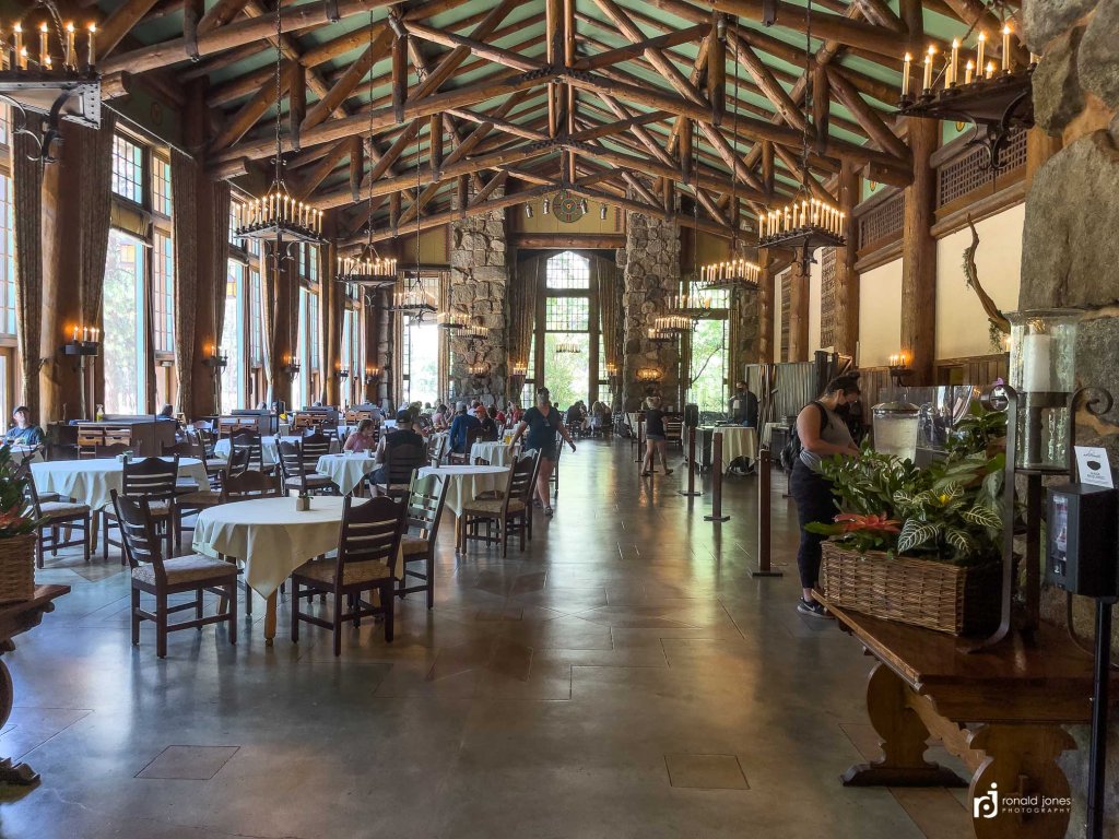
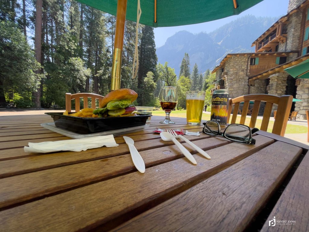
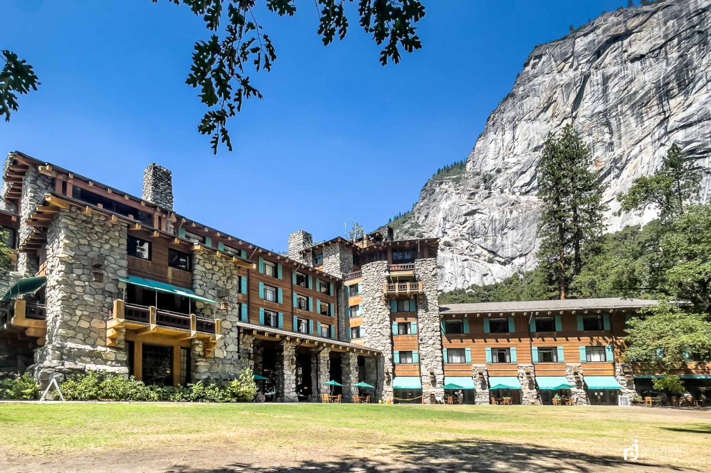
When I got to the Ahwhnee I couldn’t figure out how to get in, so I left and went to the main village where, I found the front of the store. And a lot more in the way of buildings. There was the Ansel Adams gallery, a ranger permit office, and small restaurant and some shops that were closed. I first got a coffee in the little restaurant and used the wall plugs to charge my phone and put some charge in a power bank. I then went to check out the Ansel Adams Gallery which was pretty cool. Then decided to go back to the Ahwanhee for lunch and drinks as was suggested the other day by the search and rescue person. I found the entrance and this place was nice indeed. It was one of the original structures and hotels in the park. I felt out of place with my backpack. But wow. And wow on the bike. It really made getting around possible. It would have been too far to walk back and return. There was inside dining and outside, but all food was take-out style.


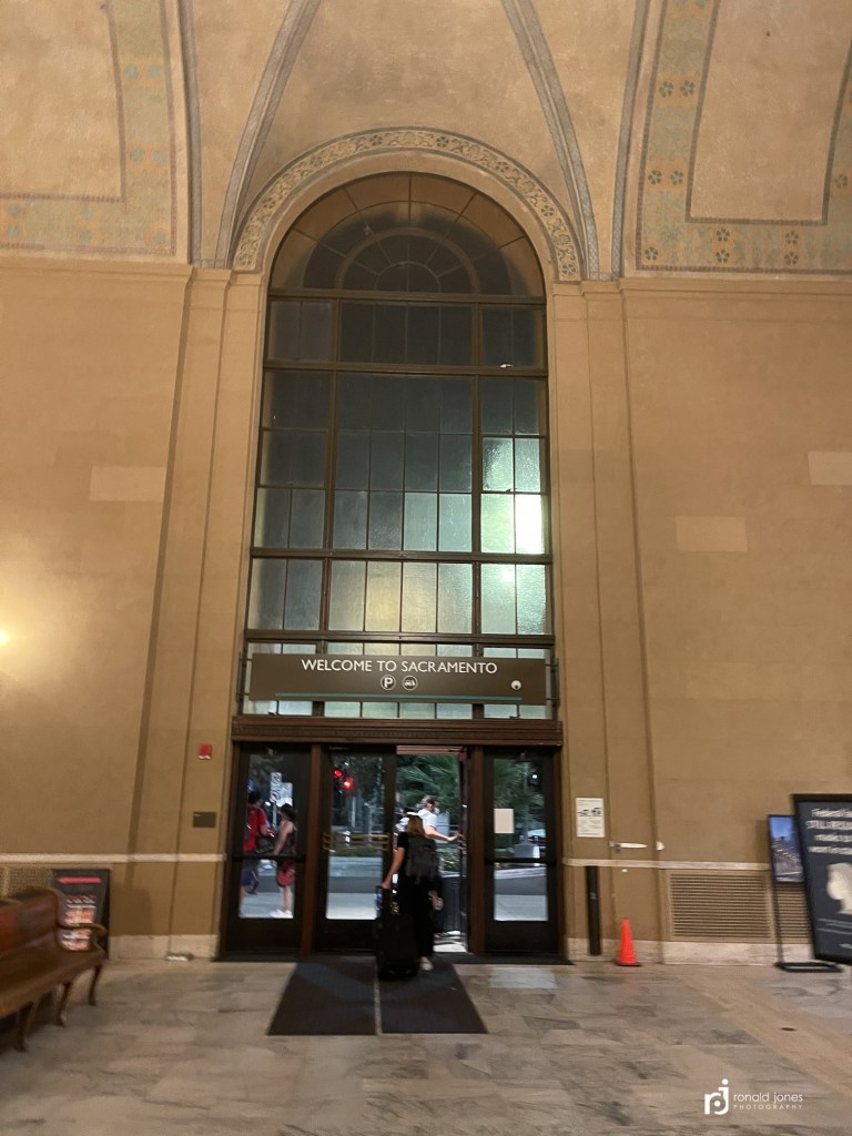
I almost hung out too long. I returned the bike to the kiosk which was a 5 minute walk to the village. I got a few things at the store in the village, and suddenly realized my bus time was approaching. I had bought tickets online earlier that morning. Funny how when you first find where you need to be earlier in the day, go to that spot, and then find out other folks are waiting for a different bus, but for the same time of day. Uh oh! For a moment I thought I had reserved the wrong bus. I’m frantically checking my online reservation and it looks right. 2:20 to Fresno, but these folks are waiting for the 2:20 to Lee Vining. As it turns out, there were two, 2:20 buses. Their bus arrived and departed, then ours showed up. There weren’t many on it. It was a trip to Sacramento, 2 hours by bus, transfer to Amtrak, 2 more hours, and then two additional hours by Amtrak bus. I arrived in Sacramento around 8:00PM. I had made a hotel reservation earlier in the day. The hotel was very near the train station where the bus stopped. Even though it was only a ½ mile away, it appeared I’d have to negotiate some dark underpasses in a big city. I decided an Uber was the smart way to go, so that’s what I did.


Sunday – A day in Sacramento and Flying home
My flight home was not until nearly 8PM so I had time to kill. I woke up and walked a few blocks to find food. Quite a few blocks. The place I had googled no longer existed. But I found the Fox and Goose pub nearby and they served breakfast. It was good, but not what I’d call great. I didn’t realize until I was sat down that the entire place had a British theme. And even more so when I went to leave and use the restroom. I had asked the waiter if there was an REI nearby. He was not sure. Maybe a few miles. I will just google it.


After breakfast, I googled REI. Only 4.5 miles. Then I found a Lime bike to rent and off I went, cell phone in hand (with lanyard of course!), google maps running. This is going to be easy. Well, first mistake was leaving google maps on car directions. I kept being put on these major 5+ lane boulevards. Luckily traffic was light, but every now and then I just pulled over. I just seemed to be going longer than I should and the roads were becoming increasingly less friendly to bicycles. Then I went up and over this overpass and, yikes, I’m on the freeway onramp. Oh shoot! I pulled over on the shoulder, did a U-turn and took the little side road that veered off. Google coughed and sputtered, yelled at me, recalculated, recalculated again, and then we were apparently on track again. I finally arrived at REI. I parked the bike and wen to lock it and got the “you’re out of the service area, leaving it here will result in a fine”. Oh great. I wasn’t sure if I locked it, and shut down, if it could reactivate it. But I wasn’t going to leave it ready to steal. As it turns out, it worked fine. I locked it and unlocked after I was done shopping. I bought some clothes to travel home in.

For the return trip, I put google maps on bike route, and so I was routed on bike paths and lesser traveled streets.


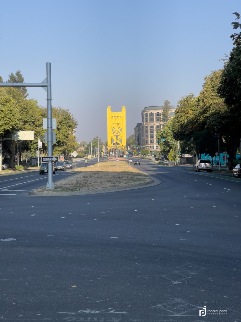
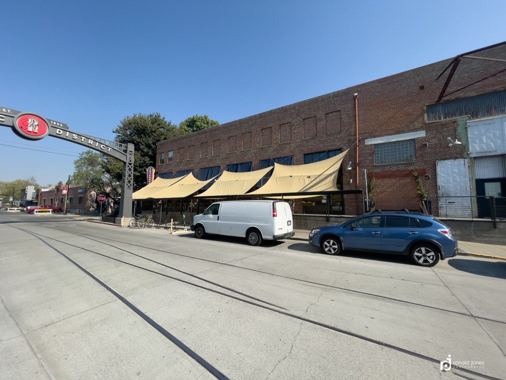
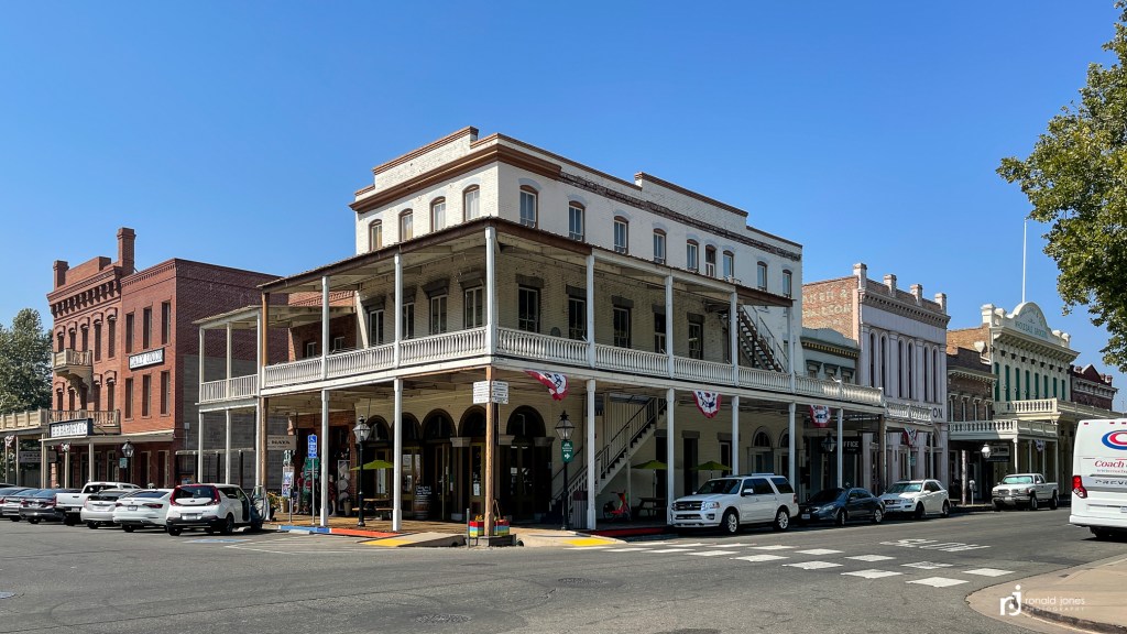
About 2 blocks from my hotel, the bike battery died. Those things are not easy to pedal when the battery is dead. I had asked for a late check out, but I was basically getting back at that time. In the end, I checked out at 1PM, an hour after my checkout time. They were nice enough to hold my backpack which was set to be a checked bag. I then walked around the old town, which is older than the historic town where I had breakfast! A young man had been pulled over the he and his friends were in cuffs on the curb while the car was searched. Eventually, the cuffs came off, the officer appeared to be lecturing, and folks went on their merry, or maybe not so merry way.

I got a Uber to the airport around 5:00PM. I figured I’d hang out in the first class lounge. Haha. The airport is too small for a first class lounge, so I had to use the bar. Oh well. It was a good flight home. Sat next to a guy who works in the airline industry. Inspecting planes if I recall. He has a private pilots license and was showing me his cool navigation app.
Jean drove to the airport and picked me up. It was probably 10:30 or 10:45 by the time she got to me from the cellphone lot. The place was crazy busy.
I ended up using a Zpacks made dyneema backpack sack. I carried it on the trail, but only used once. It packed small and weighed 3.5 ounces.

Final Thought about the JMT and Trip
Hiking the John Muir Trail had never been a big bucket list item. In fact, it only became a big interest after backpacking 10 days in the Wind River Range in 2020 with friend Bob.
I had considered the Sierra High Route, but didn’t see that as a trip I could pull off in three weeks. Certainly not as easily.
If I were asked, I’d suggest the northbound route we did. Staring in the Inyo National Forest makes it easier to get permits (no lottery). I felt we were traveling more against the majority of hikers. Against the grain. But that may only be perception. I’d suggest an extra acclimation day. possibly delay summiting Whitney by one day (hike slower) or staying two nights at Horseshoe Meadow. I had heard they only allow one night, but I think that’s the permit holder issue. A lot of folks were there more than one night, near as I could tell.
I would also recommend the mule packer resupply at Charlotte Lake. Frankly, the itinerary we did. It would be nice to add maybe 3 or 4 days so as to be able to explore off trail some, or spend time in certain spots. I didn’t feel we needed more rest days, just that a couple times we had to hike past a place we might have liked to stay. Lone Pine Kurt comes highly recommended as a shuttle option along Highway 395.
Don’t think I’d return to repeat the trip, but I could see doing a section again, or some section that connects. Maybe the Rae Lakes Loop. And I’d love to spend more time in Yosemite.
I got most of my beta from our friend google, but also the JMT Facebook page which provides a ton of resource pages and a wealth of information from the admins. I watched quite a few youtube videos. Almost too many.
My style, and Jean’s, more me than her though, is to hike alone, or not make a trail family. We did connect with some really nice folks early on. And following the trip, I’ve remained connected with Josh, but still need to connect with Phil and Trish. And amazingly, I met a guy, Henry Chen, in the backpackers Camp. He gave me a slice of extra pizza he couldn’t eat. He ordered a small and got a large. He had interviewed Josh, and it was only after getting home that I found out who he was. A truly nice and genuine person.
I found the hiker trail etiquette on the JMT to be the best I’ve experienced. I’d venture to guess that maybe 5, certainly less than 10 times, did we pass folks that either didn’t yield to the uphill hiker, or were in some other way, kind of oblivious to giving space to pass. There was one trail runner on our way to Forester Pass that was running the Rae Lakes Loop and he nearly ran me off the trail He was going SOBO (opposite direction) and on a flat spot just ran right past me, force me off trail. That was the worst experience overall. By and large, folks were super courteous. I will say the trails in Yosemite were a different story. There, you seem to pick up a different type of hiker, not familiar with certain trail etiquette.
Hiking the John Muir Trail is definitely a logistical challenge, depending on one’s itinerary and time. For us, it involved three different airports, a rental car, a private shuttle, mule resupply (Big shout out to Adam Klas) who organized the packer (I found him via the JMT FB Group mule supply shared resource document), time at VVR including hotel stay and shuttle to Fresno, and then my own time in Yosemite and getting home without it being pre-planned.
Resources
- Sequoia Kings Packer Station (Berner’s Packers) Dee Berner. Dee was awesome but an be difficult to make contact. They were awesome and on time, but again, making that connection can be a challenge. As I was looking for the websites, I wasn’t finding the one I had found prior to the trip. Their domain name, sequoiakingspacktrain.com, has lapsed –
- John Muir Trail Facebook Page
- Mt. Whitney FB page. Good for acclimation, plus by joining that page, you can connect with an altitude acclimation FB group too if you want.
- http://jmt.sierra-hikes.com/Resupply.html
- https://ingasadventures.com/resupply-on-the-john-muir-trail/
- John Muir Trail (book) by Elizabeth Wenk
- Tom Harrison Maps (I carried these but would have preferred the Nat Geo booklet listed below.
- National Geographic Topo Booklet – John Muir Trail
- Lone Pine Kurt (Private Shuttle along eastern Sierra). LonePineKurt@aol.com
- Vermillion Valley Resort (VVR)
- Inyo National Forest (Wilderness Permits) I won’t go into detail other than to say that we had to go online via their permit website and reserve 180 days in advance. The JMT FB groups will always have the latest information. Just know, hiking the JMT, requires a lot of advance planning. I had to be on the computer, 180 days before my start day, with a complete itinerary, ready to complete the online permit. The website went live every morning at 7AM for 15 available permits. That’s 15 people. So a group of 4 takes 4 of 15, etc. I heard horror stories of folks getting aced out. Just be on the website before 7AM ready to go. At the exact moment your computer hits 7AM, refresh the page and grab your permits. You have 15 minutes to complete the process but will be asked f you need more time. Take it. It’s free time! If you miss the 7AM, try again at 7:15 because someone may have failed. And then try the next day. Frankly, there are tons of access trails, and other options I am not versed at. The 7AM Inyo is what worked for me.
- Yosemite National Park (Wilderness Permits including access to the John Muir Trail). The Yosemite system is changing for 2022. It’s a lottery system.
- Whitney Portal is also a lottery system, accessed via the Inyo NF website.
Gear we used
- Hyperlight Mountain Gear Packs. (I find the HMG packs to be the sweet spot between something that carries a massive load and a pack only good for 25lbs.
- 3400 & 2400 Southwest
- Hyperlight pods and 1 dry bag
- Zpacks Triplex (We chose the triplex to have extra space in case of storms. It’s roomy, super light, and worked awesome even as I carried solo for one week!)
- Feathered Friends Flicker 20 degree bag/quilts
- Thermarest
- Bear Vault BV 500 and 450
- Toaks 750ml pot
- MSR Pocket Rocket
- Altra Lone Peak 5
- Photographic Equipment
- iPhone 12ProMax
- Moment Anamorphic Lens
- Manfrotto Pixie Mini Tripod. 8 ounces. Awesome for backpacking.
- Canon TG-5 Waterproof Point and Shoot.
- 8 ounces
- Captures in RAW format
- I opted to leave my Olympus micro 4/3 OMD EM1M2 at home. The complete kit with 24-80 FF equivalent lens in f2.8, an extra battery, and maybe the 15mm Laowa lens is 4 pounds. I didn’t want to carry that little bit extra weight on this trip. I gave up some resolution and ability to shoot night skies, but I’m very pleased with what I achieved with the new iPhone, moment lens and TG-5. I really only brought the TG-5 because I wasn’t sure about phone battery life.
- Power packs
- 2 skull candy 10k
- 1 skull candy 6k
- 1 Anker 10k

