After Jean departed in David’s truck with two other hikers for a shuttle trip to the Fresno airport, I spent another 2 hours working on my departure to the trail. We had a good hug, a few tears, and she was off. One of the staff took notice and was sad herself.
Phil and Tish had left earlier that morning, maybe around 9:00AM. Josh was staying another day. Later on as I was leaving, I got distracted and forgot to seek out Josh and say goodbye and wish him luck. One of the factors distracting me was that I left around noon, and noticed the brisket sandwiches were being served up. I must leave before I get sucked in by another big load of beef!
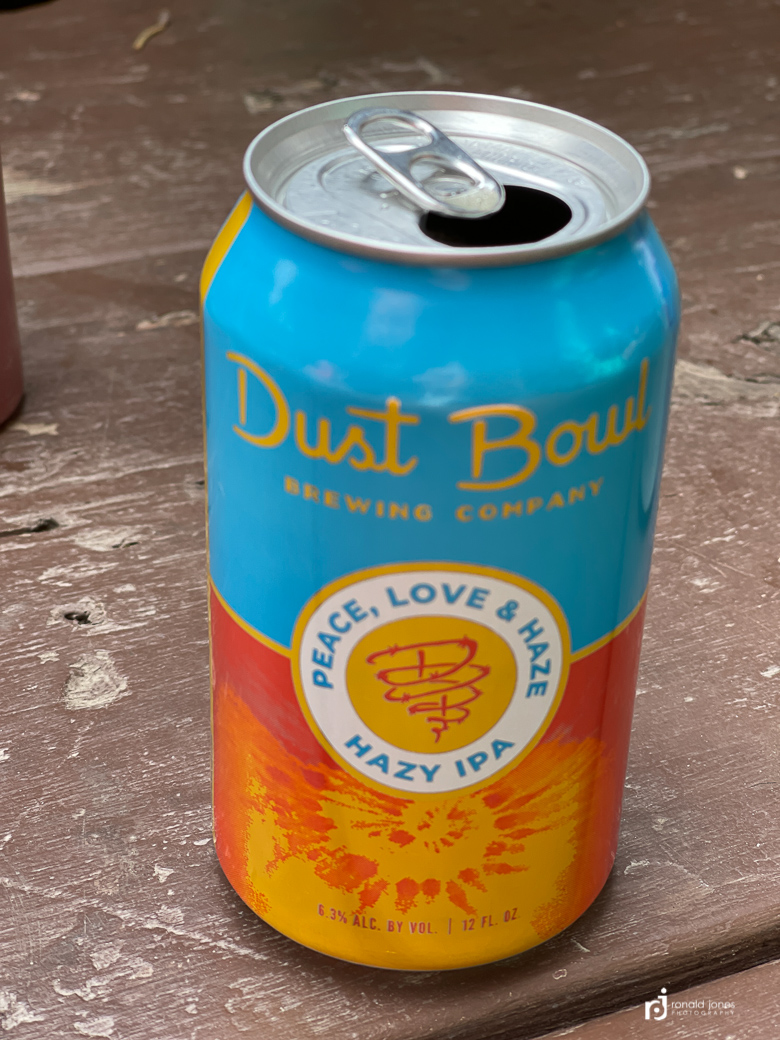
I took one last shower, tidied the room, finished packing and carried my pack to general store. I grabbed some potato chips of some sort, a Diet Coke and a beer. Then paid the bill$$
I think a lot of folks, based purely on comments in conversation and the JMT FB group, are very shocked at their final invoice, and a few believe it to be overpriced. I could understand that if you’re on a tight budget, it could be a surprise snd be painful. I felt the value was more than there.
I put the beer in my pack, figuring I’d drink it that night. Little did I know I’d carry it for three days before consuming it. For the record, a 12 ounce can of IPA weighs about 13.25 ounces.
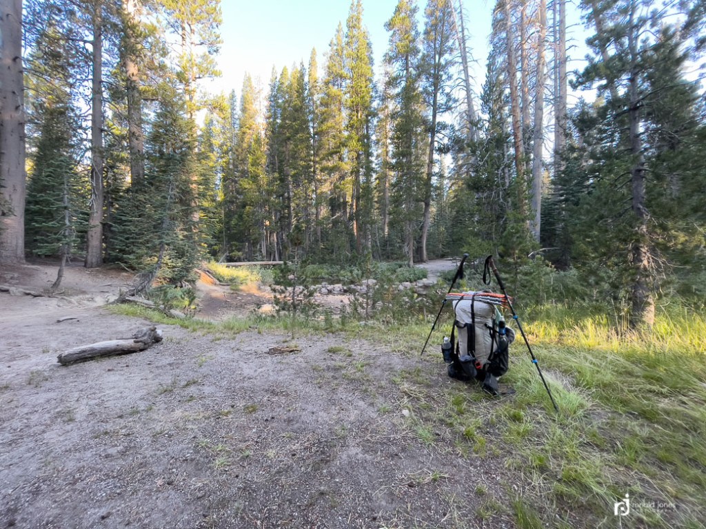
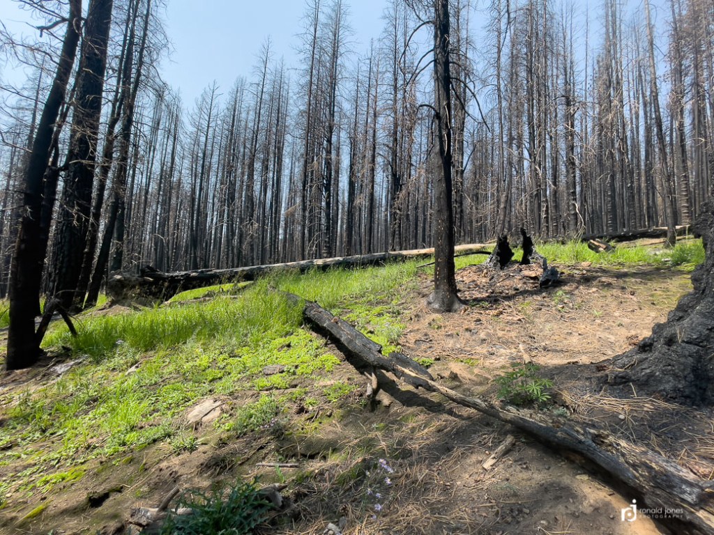
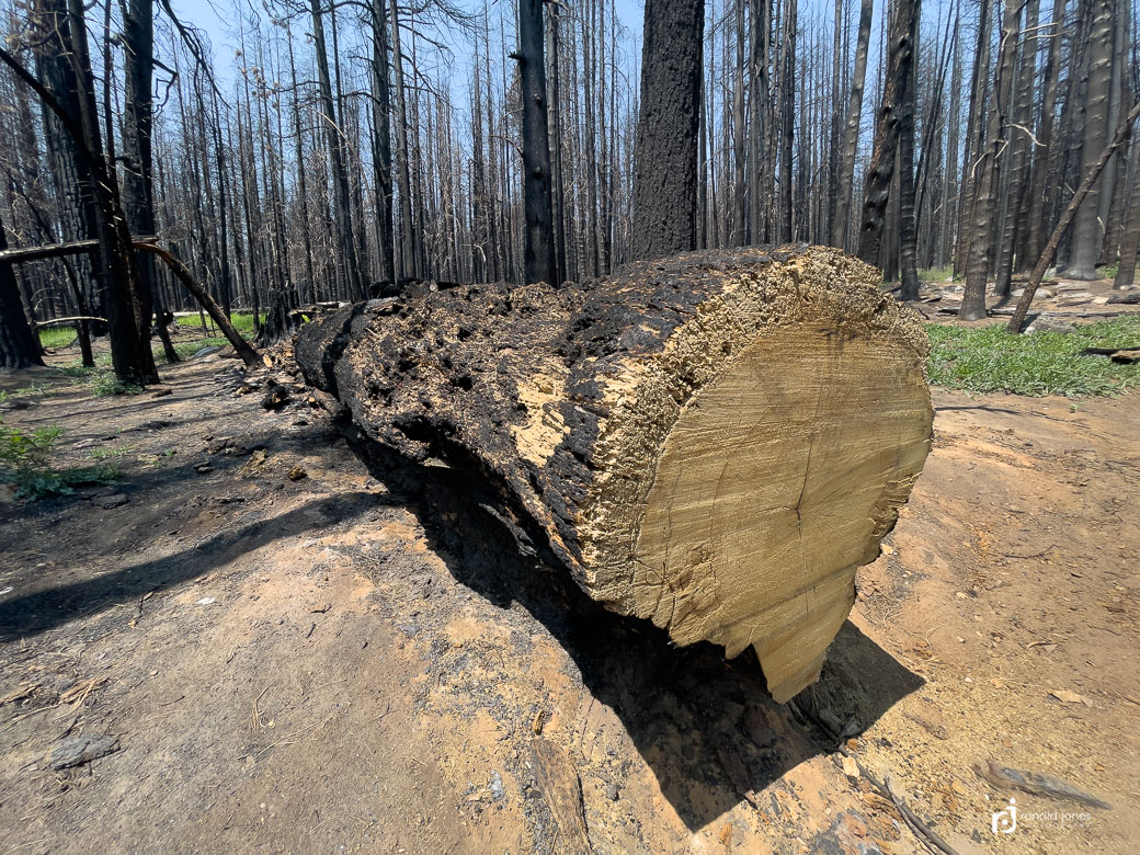
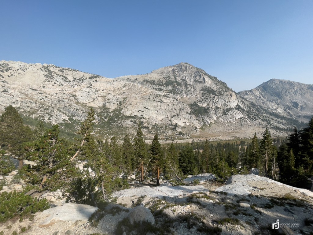
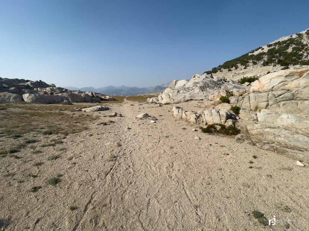
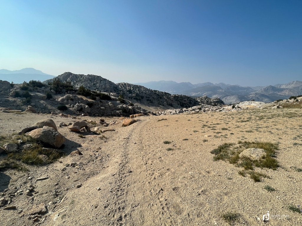
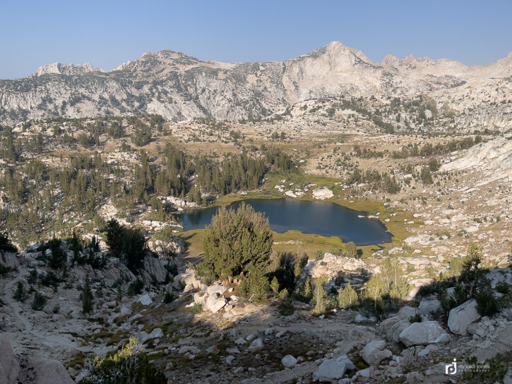
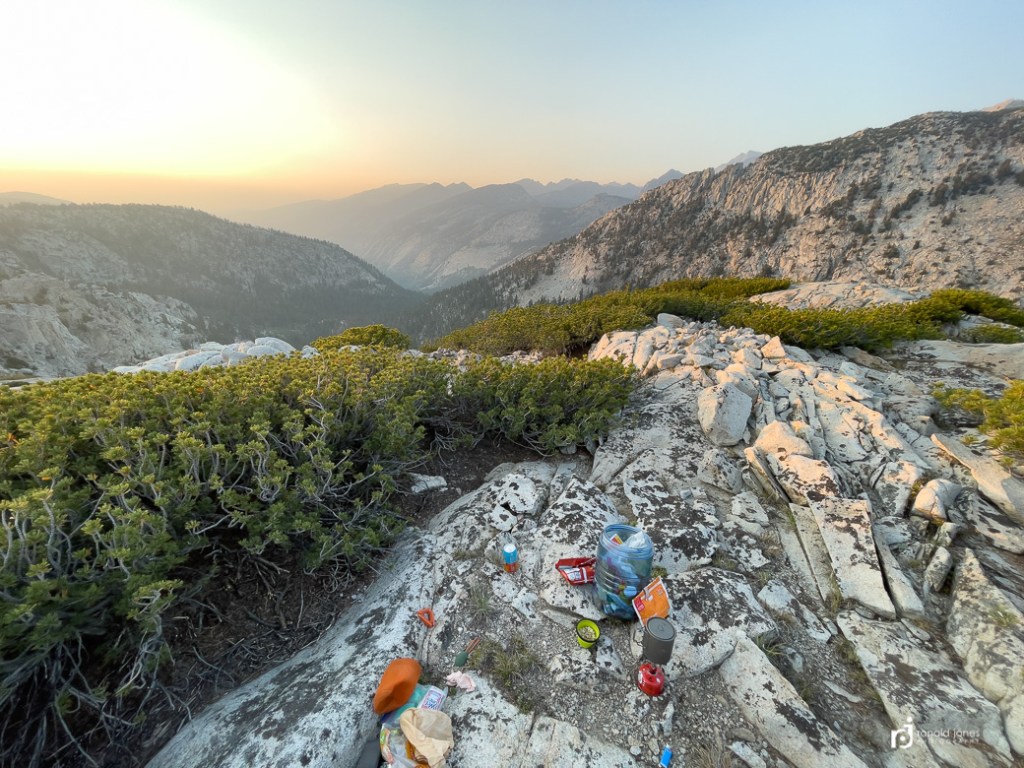
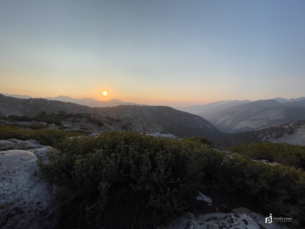
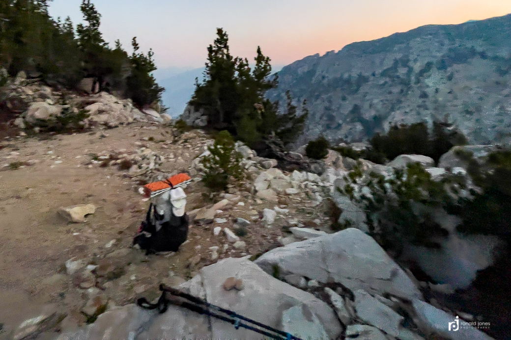
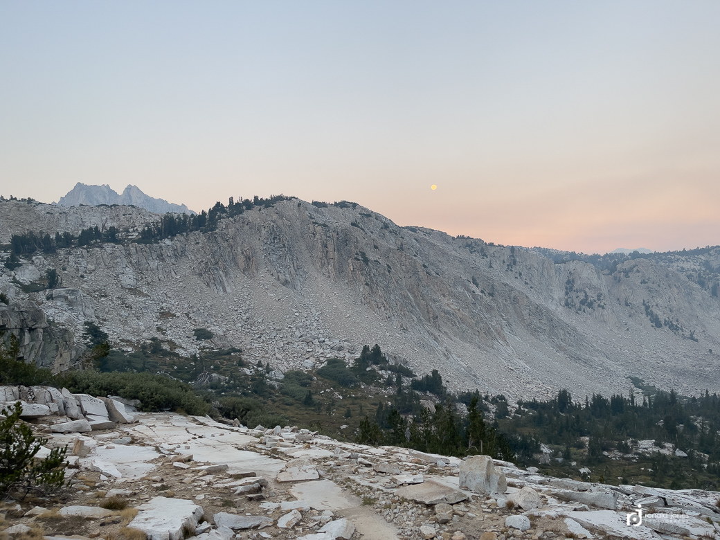
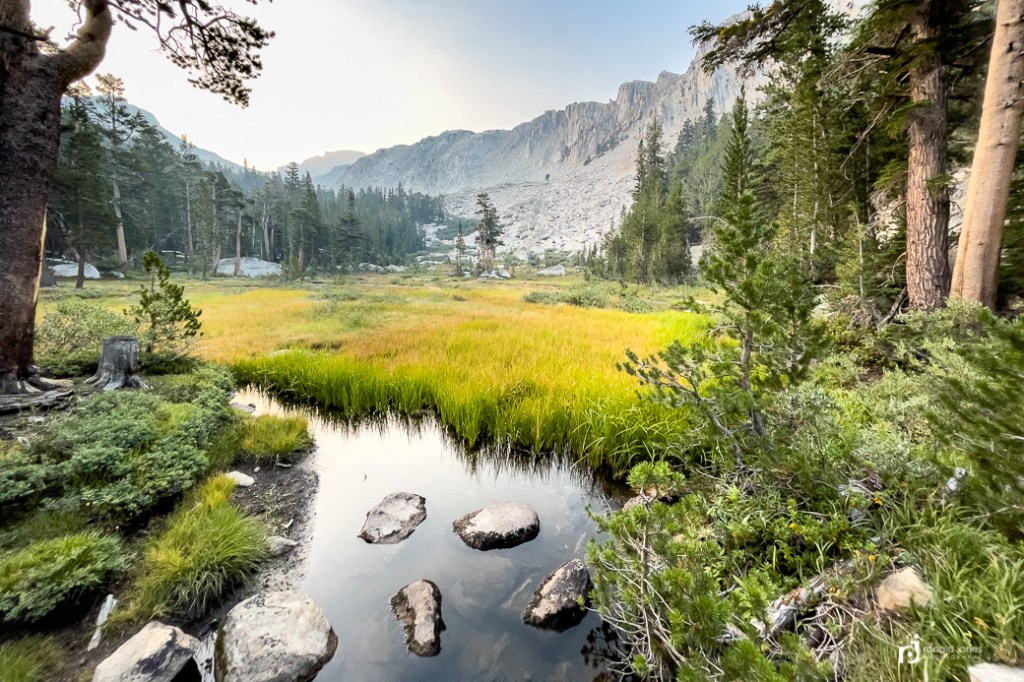
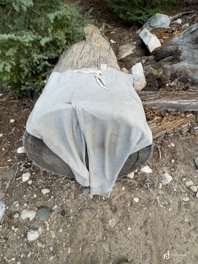
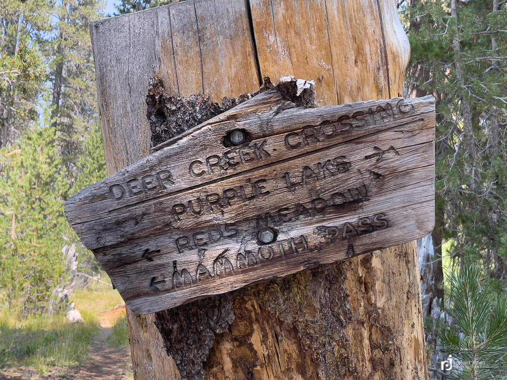
Seems I really missed documenting a few things, so I’m repeating a couple photos here.
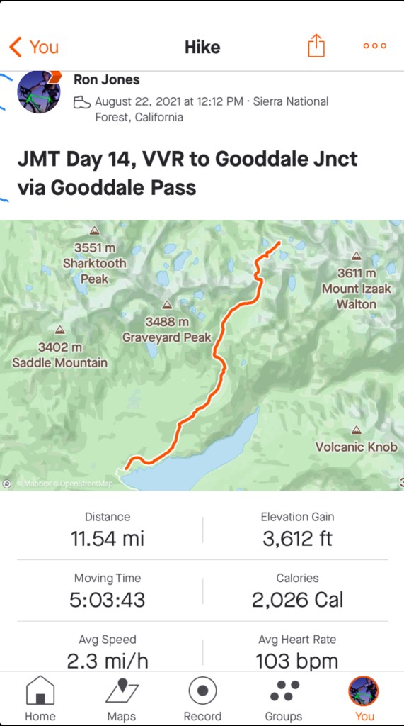
VVR to Goodale Junction – Day 14
As I said goodbye to Megret, she offered me a ride to the trailhead, about one mile up the road. It’s normally $5 or $10 per ride, but she said don’t worry. We had a nice chat and I was happy because the road was uphill and dusty. We arrived at the trailhead, and as I was departing, two hikers were arriving. Their lucky day. They would get a ride tonVVR!
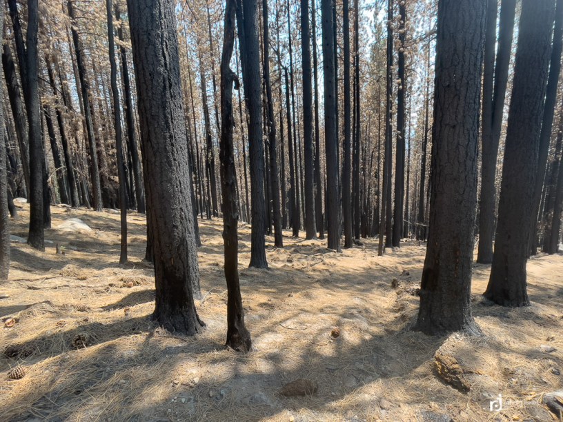
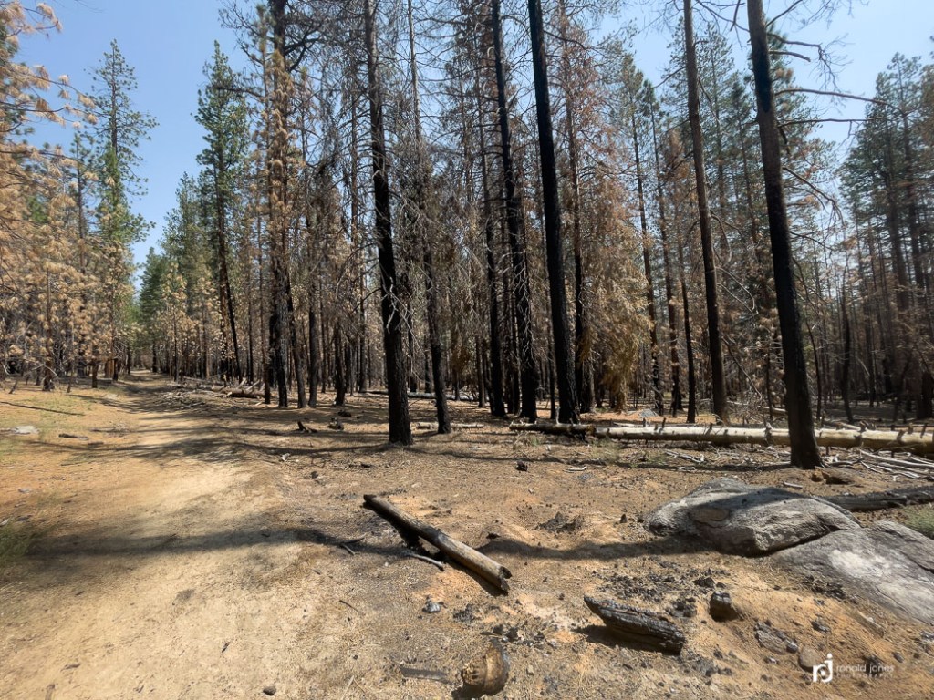
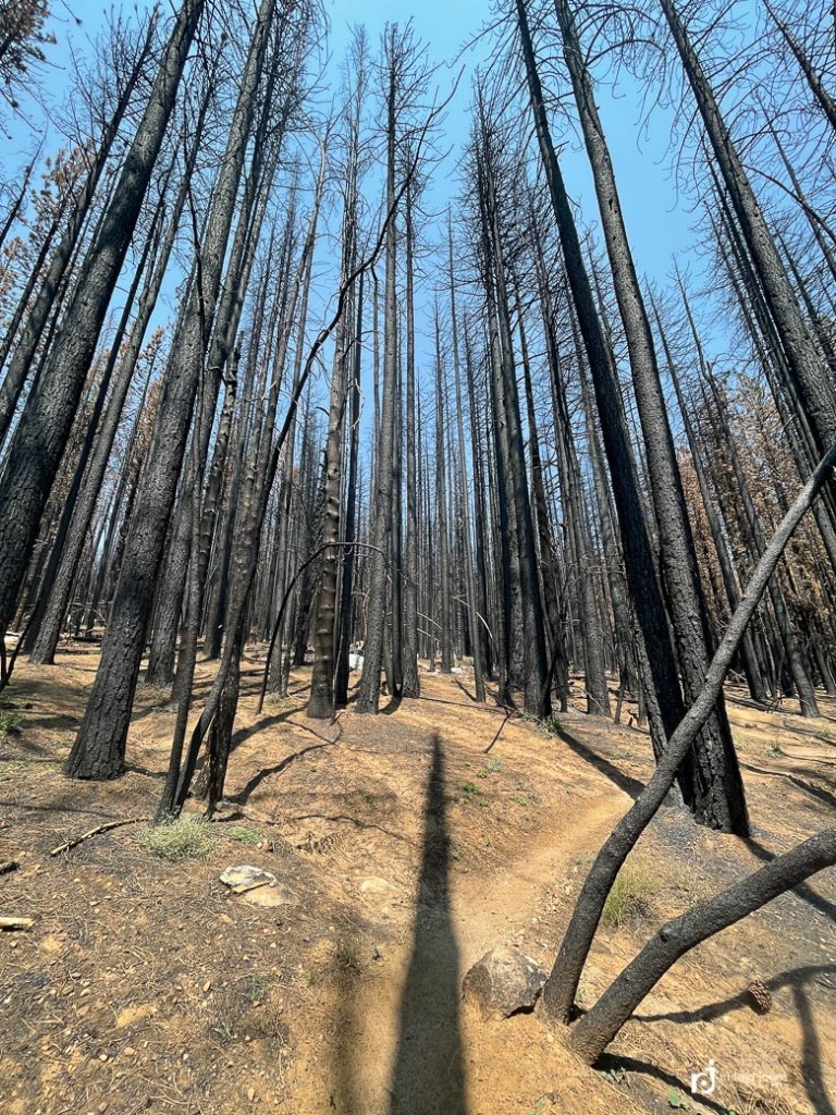
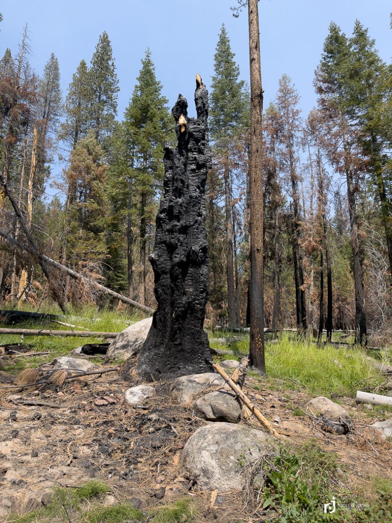
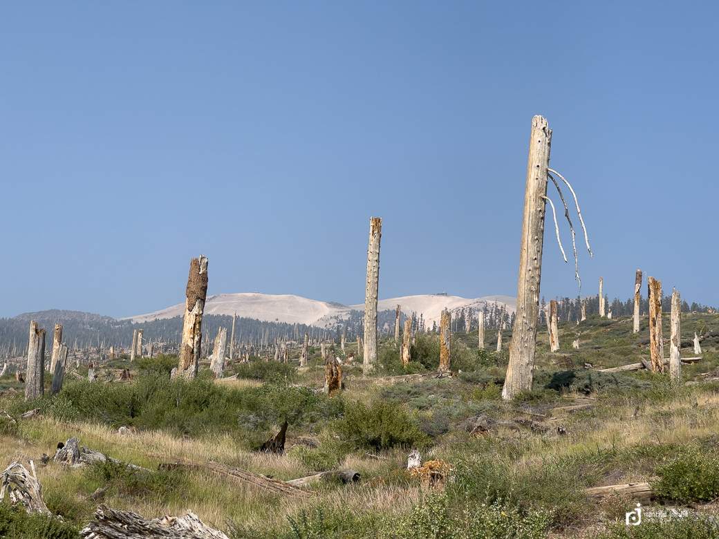
The hike began in the remnants of last years (2020), Credk Fire which threatened the existence of VVR, and resulted in emergency evacuations. The fire edge was only a mile or so from VVR. So lucky.
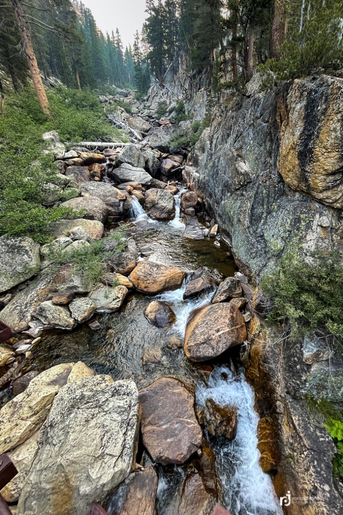
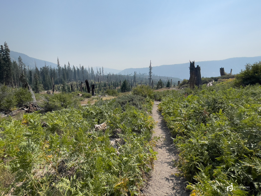
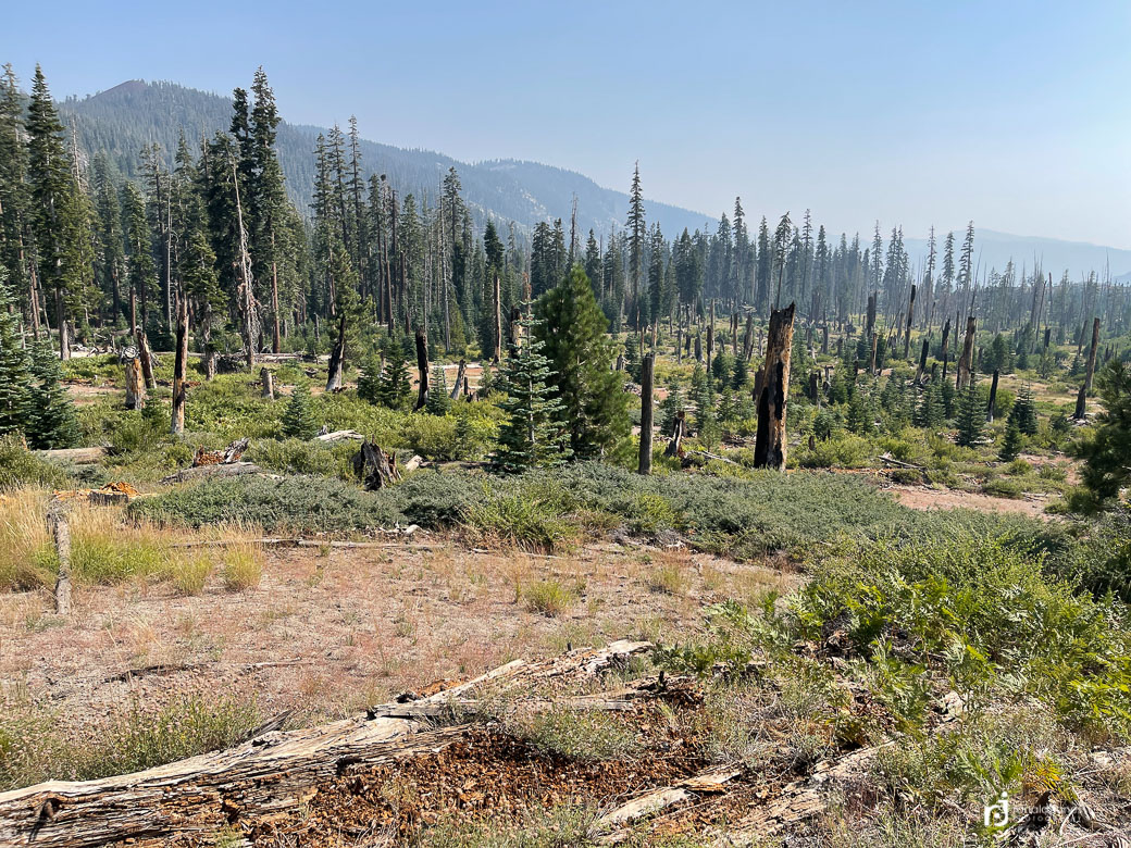
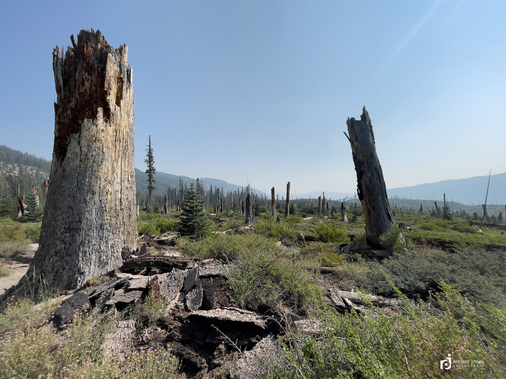
Walking the burn zone was both interesting and a little unpleasant. It was now midday and quite warm. There was a smoke haze, not bad, but definitely present. And the air smelled of charred wood and smokey embers. Almost heavy to the lungs. Most trees remained standing, blackened by fire. The earth scorched, where once the forest floor was a nice layer of duff and undergrowth. Now it was a mix of sand and fire ash, the color reminiscent of that grayish, colorless look when some one is very sick. I walk in on, the grade gently uphill, and with every step there is a little puff of fine dust.
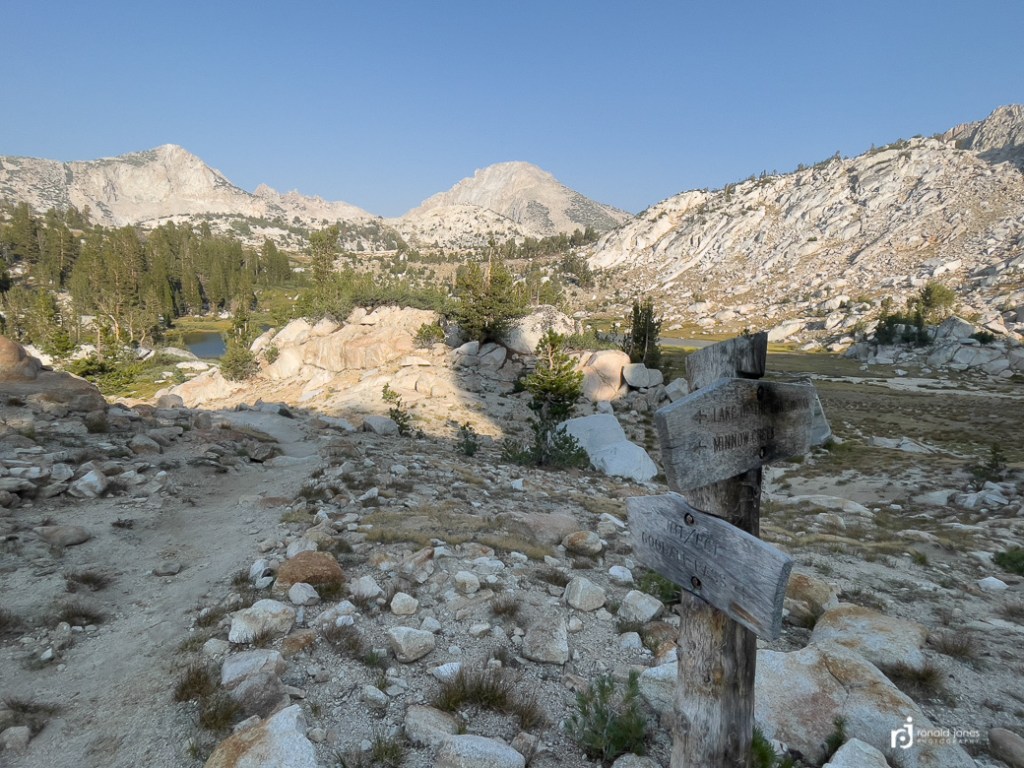
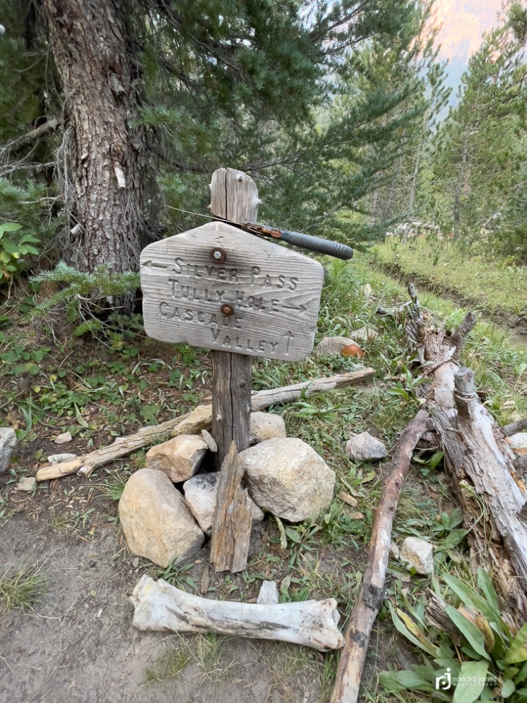
I found this link to a description of the hike from VVR up to and over Goodale Pass to the junction. It was about 10 miles to the pass, at just shy of 11,000′. VVR is around 7,700′.


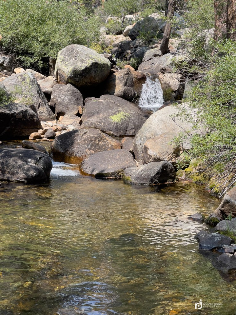
After the burn area I reached some forest that was not touched by fire. I crossed a small creek where a SOBO couple was getting water, and I’m not sure what else 🤔 We said our passing hello’s, they asked how far to VVR, and I let them know what I thought I knew. They asked how far I was going, and that there was no water before the pass. Here we go again 🤦♂️ I said thanks, but didn’t believe a word they said. I dropped down a bit off trail near the creek for a snack and water.
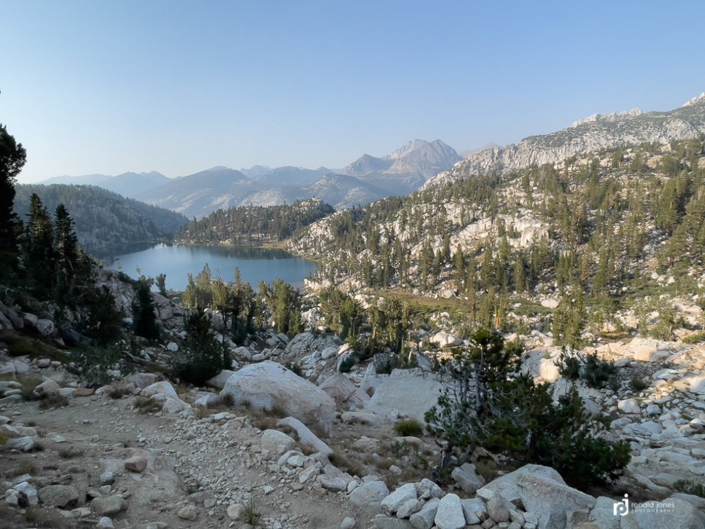
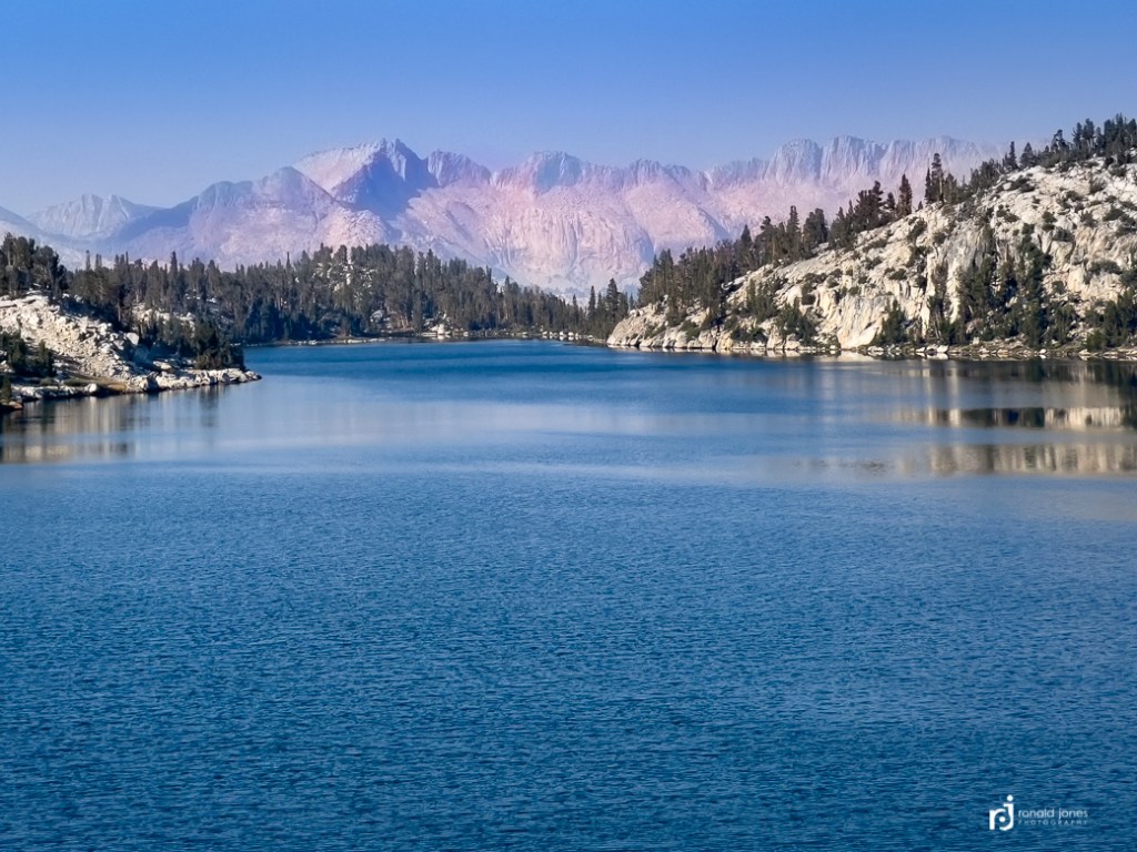
The hike to the summit was pretty straight forward. I passed a few people heading up. And met some coming down. At some point I had been asked again how far I was going. I had mentioned probably to the lake just this side of the pass. The person said there were no lakes on this side, they were on the other side. OK, thanks, again, not believing him. As it turns out, I had been looking at guthook on my phone and keyed in on Goodale Pass Junction. All the while, thinking it was the pass. When in fact, the pass itself was not marked. I had paper maps, but rarely looked at them. Had I been paying attention to contour lines and actually reading things, I would have noticed. I finally hit the last steep part and not long after, I was on the pass. But the pass itself was not marked. No summit sign. Then over and down I went. I then saw the lakes. There was smokey haze in the distance. I got water at one of the lakes and made the decision to camp high near the junction. The terrain was looking promising for camp. I grabbed 3-½ liters and packed it about ½ mile up, only to find a small pond. Ugh! Oh well. I went off trail a bit and found a nice secluded and protected spot above treeline. I set up camp and found a high spot for making dinner. It was after 7:00PM by the time I was making dinner. I finished up just before dark and got to the tent, and it was lights out.

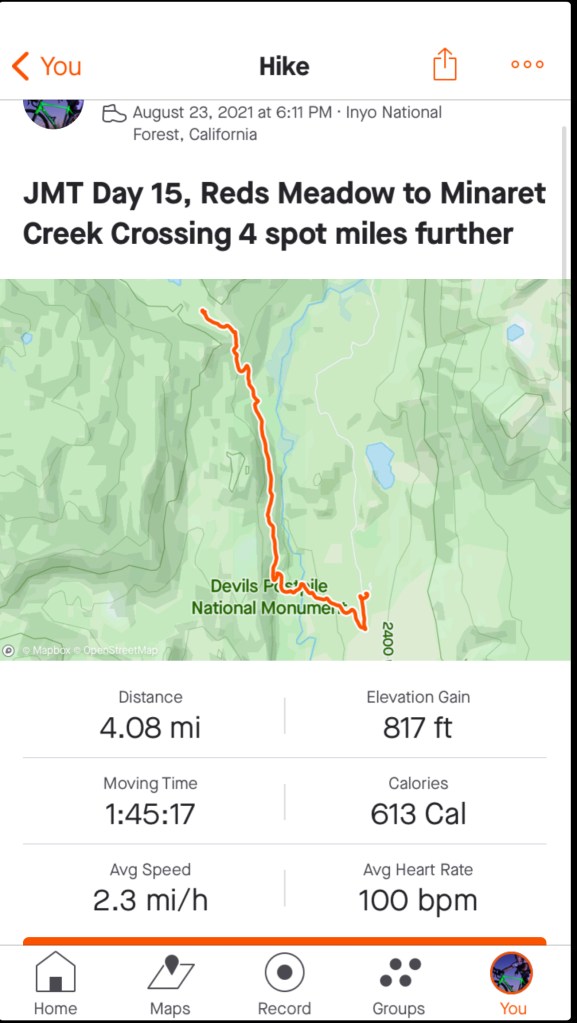
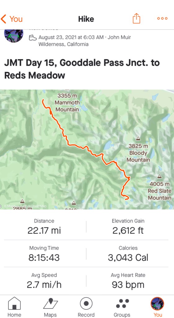
Marathon Day – Goodale Pass to Minaret Creek – Day 15
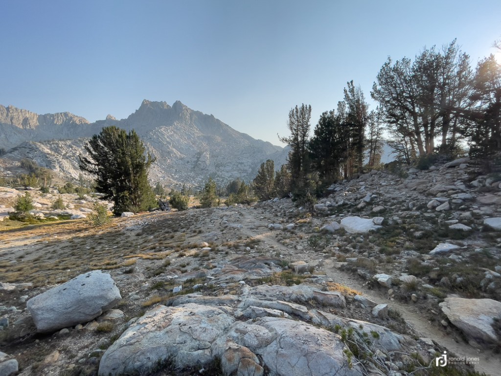
I didn’t start the day thinking I’d walk a marathon, but I definitely had plans to make it to Red’s Meadow. I was up, had coffee and breakfast, and walking by 6:03AM! Throughout the night I smelled smoke, and it was definitely present in the morning.
The day started with a lot of downhill. The further I descended, the worse the smoke seemed to get.


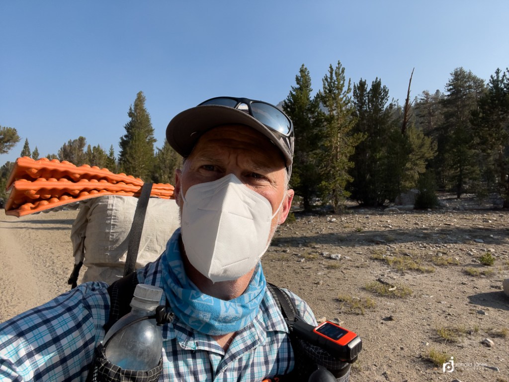
I had descended and then started climbing again. I was going up a hillside to around 10,000′ before a flat stretch and getting to Virginia Lake. The smoke had become bad. As in, very bad! I had my buff pulled up and was about to start digging in my pack to pull out my Outdoor Research face mask I carried for traveling in populated areas, airports, etc. It was deep in my pack. I had started to think that my hike might be done. It was not worth risking health. I might need to exit at Red’s. I was starting to get bummed out. Then, I met a group of 5 SOBO hikers. They were all wearing KN95 masks with exhaust ports. They offered by a standard KN95. I offered to pay but they said to just pay it forward somewhere. Since We had provided fuel and food to folks back at Charlotte, I felt okay for accepting it. The mask made all the difference. I had thought about putting one in both our packs for just this reason. I sure regretted it. On future backpack trips where wildfire smoke could be an issue, I’ll be carrying a N-95 mask.

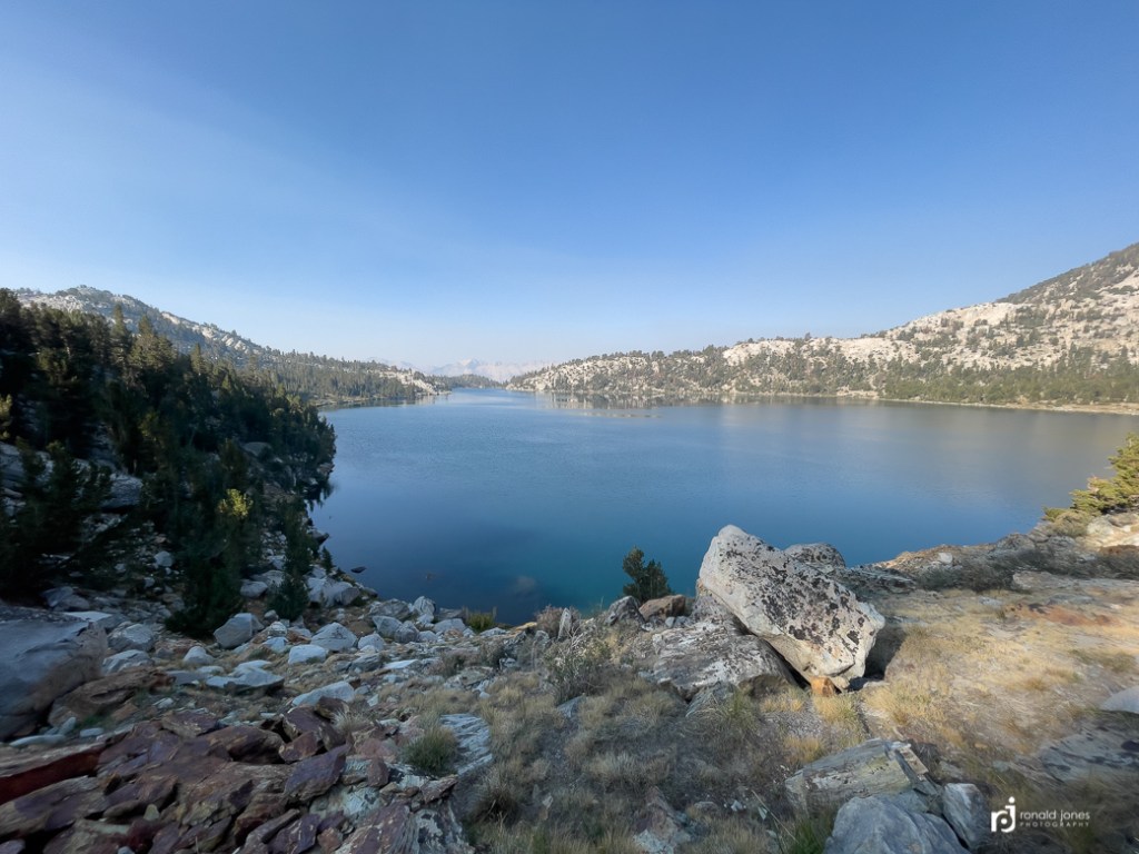
I stopped at Lake Virginia for an early lunch. I set up by the lake and ate quite a bit of food. Even cooked up some ramen. Watered up and off I went. I started seeing a few more people, but not too bad.
After Lake Virginia, the trail undulated above a canyon, more or less traversing a serious of ridges and ravines until finally hitting a longish downhill false flat to a very old burn area and Reds Meadow. At one point, I caught and passed a couple hikers. Prior to that, I had come across a small group stopped at the junction to Duck Lake. I looked at the sign, saw “Duck Lake this way”, and proceeded. About 50 yards later, I got to thinking, this doesn’t seem right. A quick check on Guthook and Gaia, yep, wrong way, I was supposed to turn left back there, so back I go. I made the comment, whoops!, as I passed the group again. They chuckled.
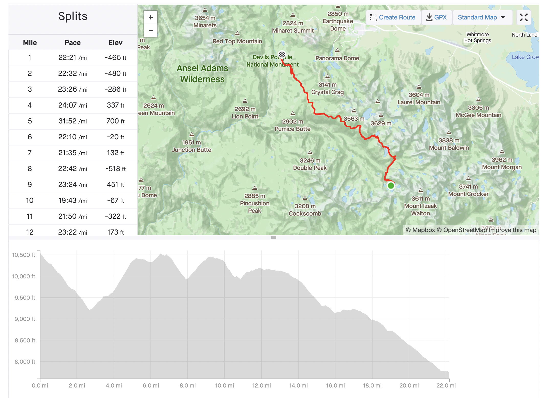
Some log bridges in great shape, others, have seen better days. Back to those two hikers I passed. Being mildly competitive (understatement), I didn’t want them to pass me. So I kicked it into high gear and tried not to stop much. I really felt I left these two in the dust. But that social vortex, two or three times, allowed them to close in. Oh, I should mention, that after Duck Lake, even before, the breeze had picked up, the smoke was not as bad, and I was able to hike naked – my face that is 🙂 It was really breezy along the ridge.
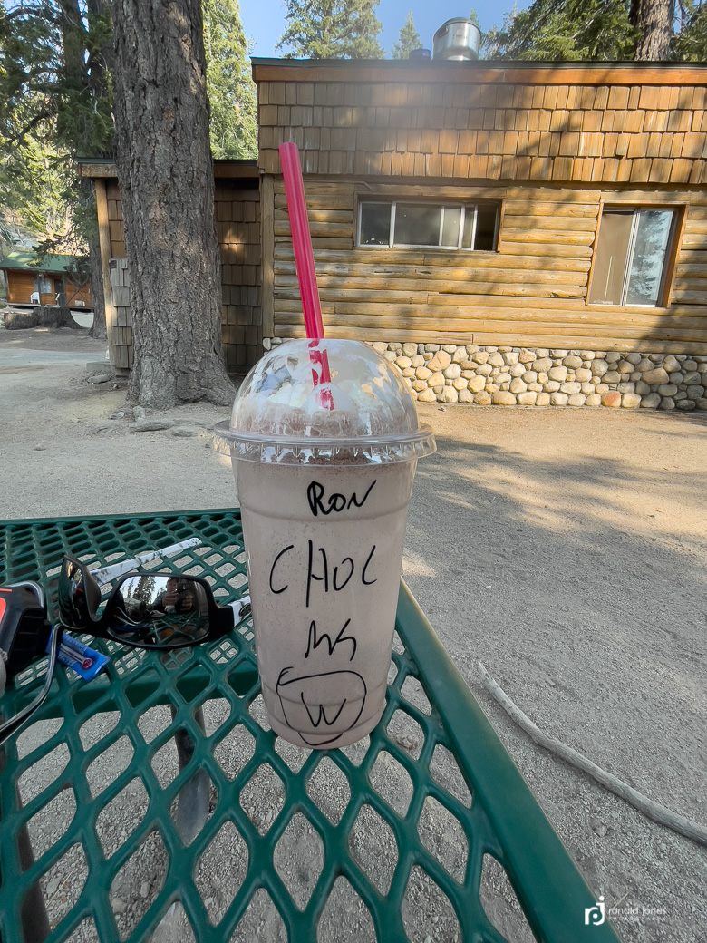
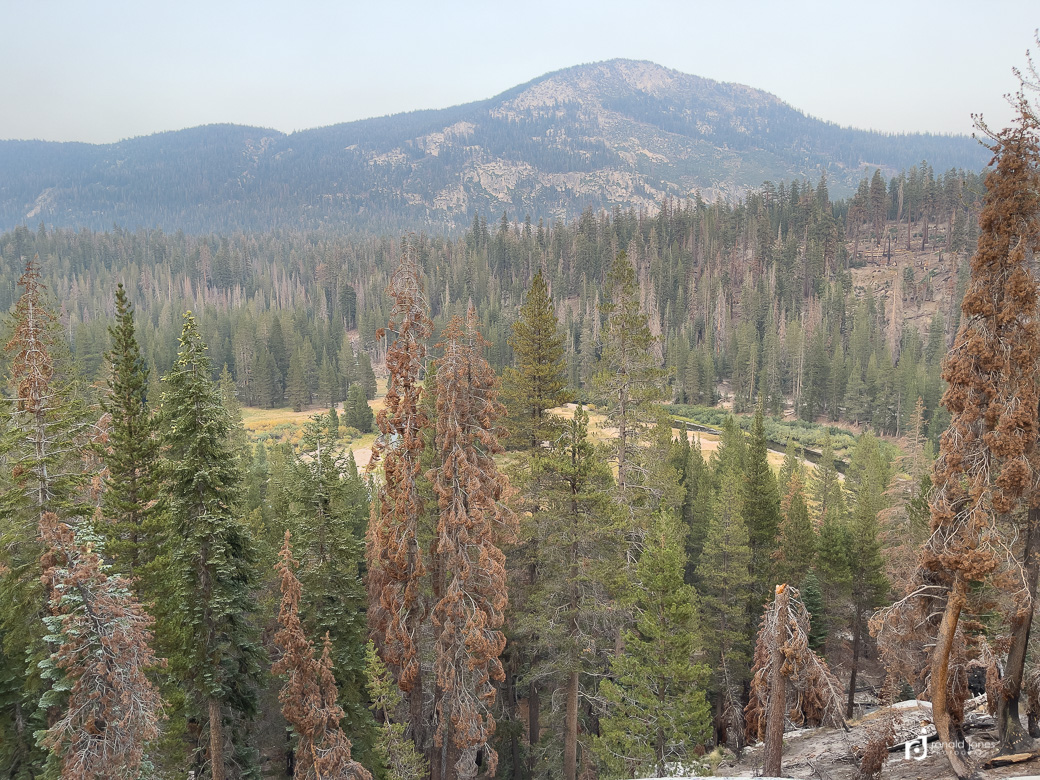
So, back again to these two hikers. About the time I started dropping into the old burn area with significant blowdown, I see them behind me. Once again, I pick up the pace, this time, they do not catch me. The old burn area was fascinating. It also had me questioning the route. I was headed to Red’s Meadow, but I was not seeing any sign of meadow, only forest and I was dropping into what appeared to be a river canyon. I checked Guthook and Gaia a few times, just to make sure. The sign for Red’s just appeared. It was actually forested. I have no clue where the meadow was at. I got a cheeseburger and chocolate shake because that’s what folks do at Red’s. Quite a few hikers were there. At least the tables were mostly full. Once again, I failed at capturing the correct set of photos at Red’s.
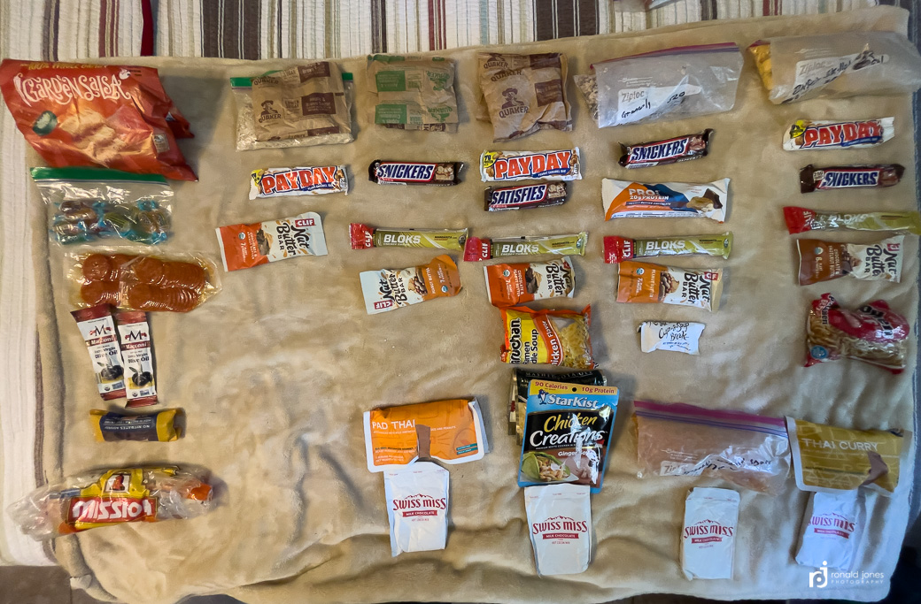
A younger female sat at a table alone and offered for me to join. She was hiking with a boyfriend (?), and some others in a group, not sure, the details were a bit unclear. She had developed knee pain and was icing her knee. Her ‘boyfriend’ (?), had continued on without her. She had a map, notebook and pen, and her calculator on her phone out, and was recalculating her mileage and trip strategy. I Ordered by burger and shake. I ate the burger pretty quick because as soon as I opened the to-go container, the burger and me were swarmed by yellow jackets. Another solo hiker walked up and took advantage of the less crowded table. She was hiking the PCT SOBO, doing some various flip-flops. She carried a HMG 2400 (40 liter) pack that was not jammed full. A BV 450 on top. Clearly traveling pretty light. I went ahead and did some shopping after looking at the dismal hiker bucket. I bought a couple more dehydrated meals, some salt and black pepper chips, a bag of jerky, and a few other things. My total came to nearly $70. The prices at Red’s were definitely marked up, which is odd, because grocery type items here were easily 40-60% more than standard retail, whereas it was either standard retail or slightly more expensive at VVR. Interesting because Red’s has easy access. They run busses into Red’s. Before leaving Red’s I made a phone call home to Jean, since I had cell service 🙂


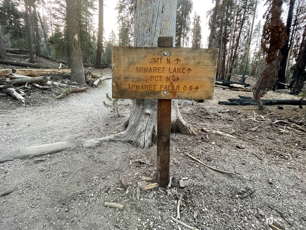
Red’s had a backpacker’s campground somewhere, but I was not feeling the vibe, so I decided to continue hiking. I think it was already after 5PM. I also didn’t want to camp near people. The young lady icing her knee had been gifted one of the cabins by someone who had to leave early. She offered up the use of the shower to me and the PCT’r, but I didn’t feel I needed it, and really wanted to get moving. So off I went. The signage wasn’t that great, so I just ended up backtracking a short bit, not more than a mile, to where I know I saw a trail intersection and JMT north.
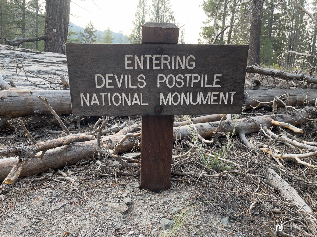
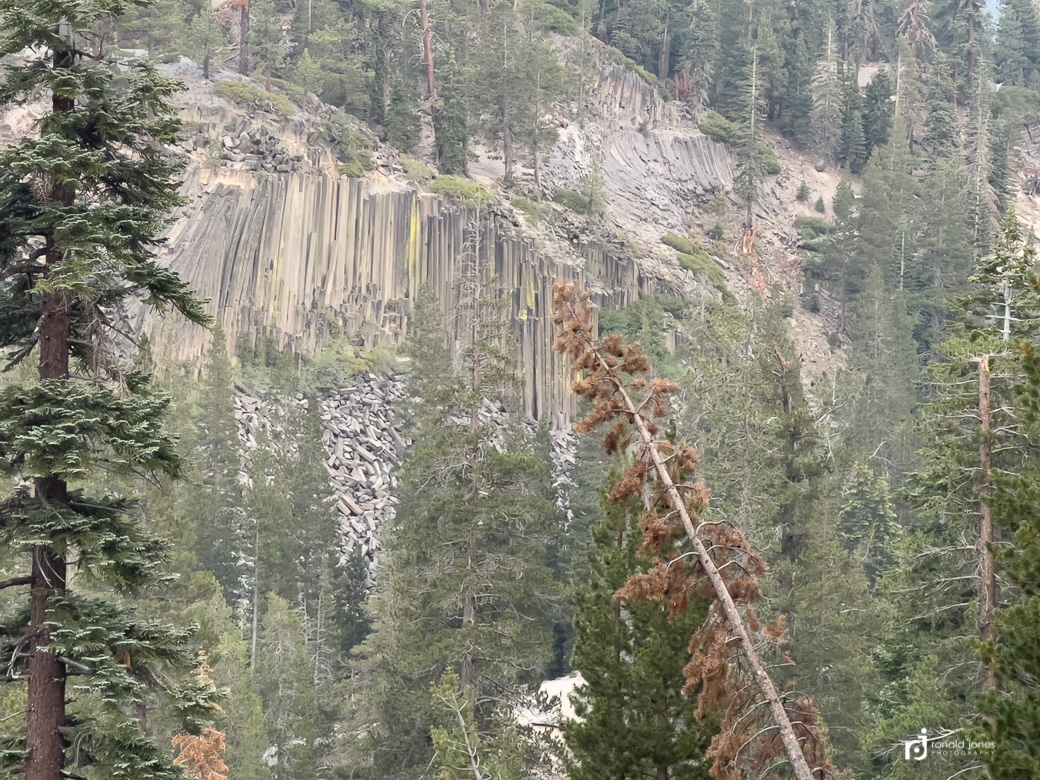
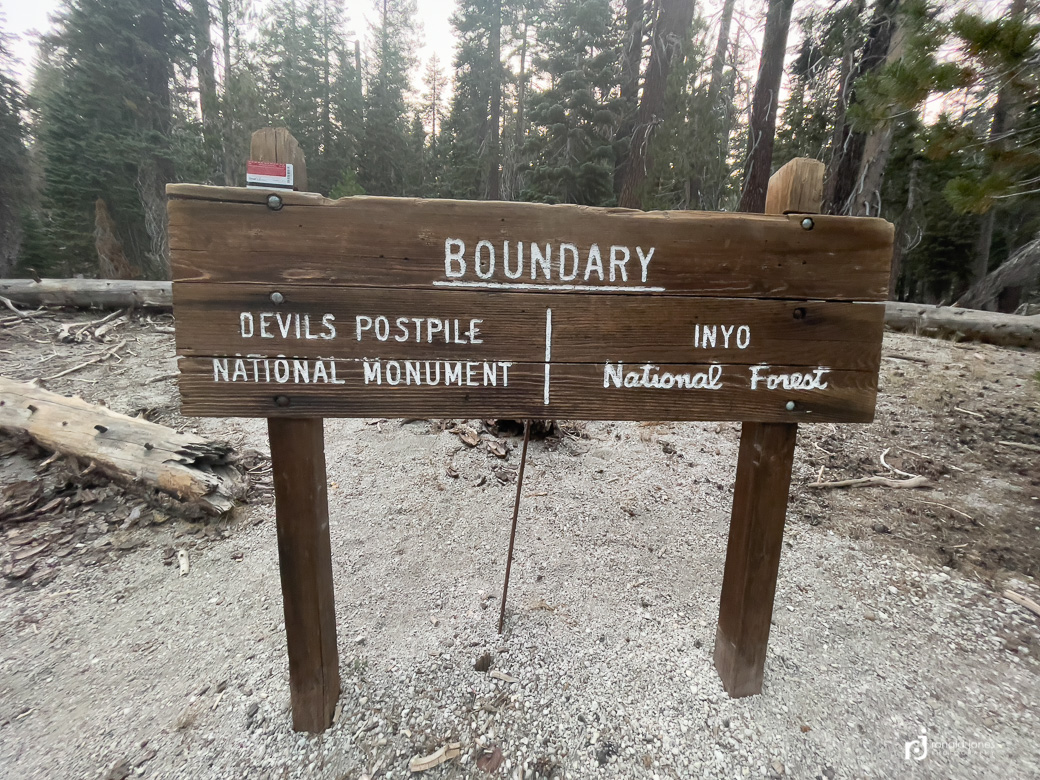
I opted to not go to see the Devil’s Postpile up close. You can read about it here. It was a mile up and mile back and I knew I had another 3-4 miles and not a lot of daylight. I did see it from afar, which was fine. I did actually walk through the national monument however. Even though no one was around, I made sure to show my annual pass – you can see it on the sign. After dropping to the river and crossing it, I had a pretty long climb up. I think I climbed for 2.5 miles. My goal was to get to a water source, because I chose to not carry much water. I finally made Minaret Creek at 8PM, and it was dark. It does get a little worrisome when you’re solo, and walking late into the evening in a forested area. It sure felt like a place one could see a bear or cougar.
In all, I hiked 26.26 miles according to my Garmin. From 6AM to 8PM, with some time spent at Red’s and various breaks of course.
I set up the tent, washed my legs in the river (they get dirty, I mean dirty, so an evening wash keeps the bag and sleeping clothes cleaner), and went to bed without making dinner. I had already had a cheeseburger!
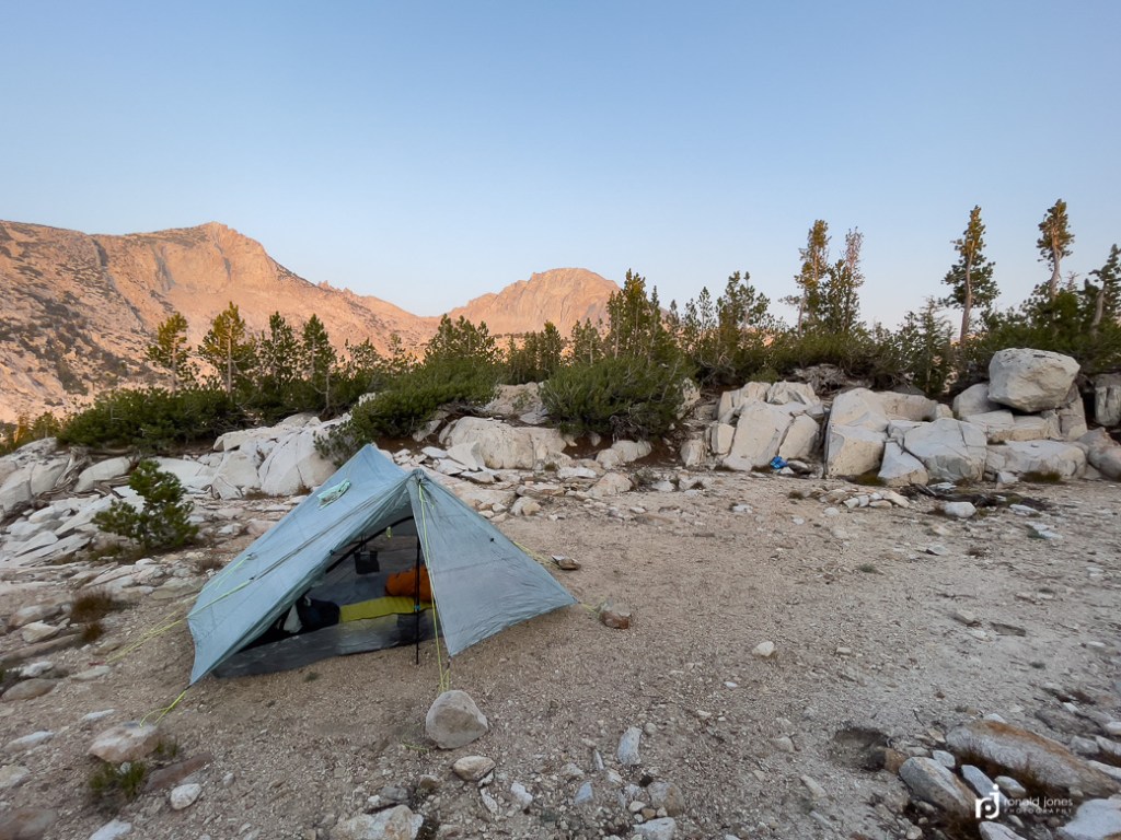
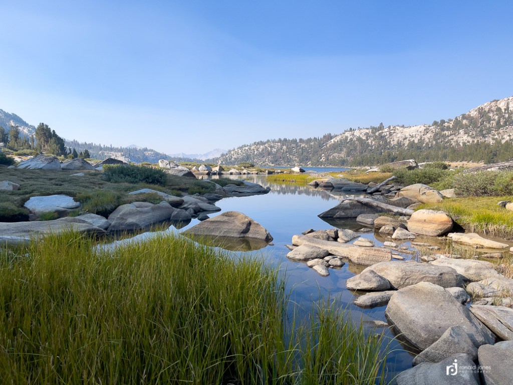
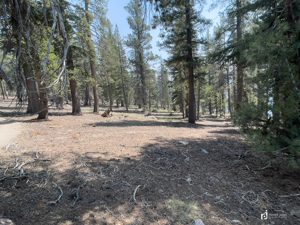
I had intended to include my hike to Thousand Island Lake in this post, but think it’s better to combine it with other segments. I am including two photos below of the campsite, but these are the from the next morning.