

Hiking Day #3, Below Copper Mine Pass to near Colby Pass jct
As noted in the previous post. We slept in a little and I choked down some cold spaghetti along with hot coffee. I honestly felt a lot better than I thought I would. I should mention that I had never developed any sort of headache from altitude or dehydration, which is a little surprising.
The night had been clear and gorgeous. I recall waking up and looking up, but unfortunately, I just didn’t feel like staring at the sky. I did see one amazing shooting star. It was a nice sunrise too. My phone was at my feet and turned off and I lacked the energy to retrieve it for a photo during the night or the best light of the morning. I did get this shot below.

Looking back up from where we came over and down the night before. The path is drawn in rough proximnity. I walked all of it alone, and 90% by headlamp, with only the headlamps of our team in the distance to guide me. I had a track/coordinate to help if needed.
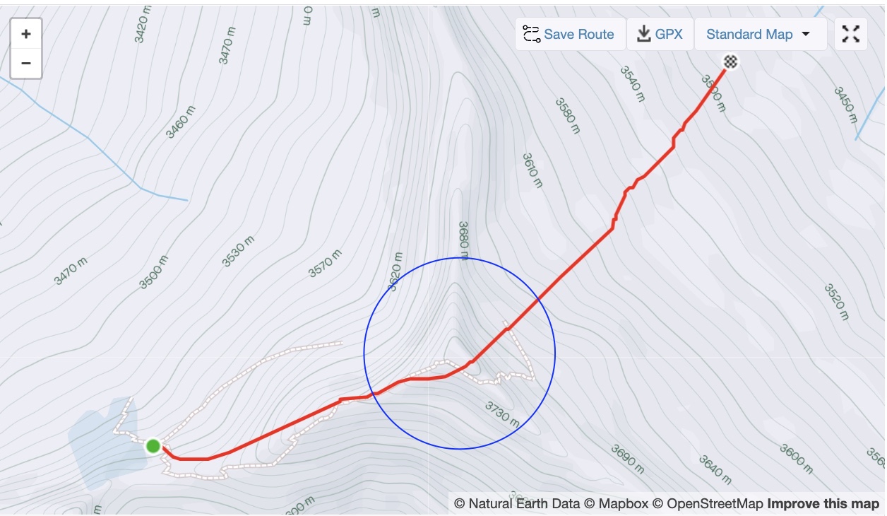
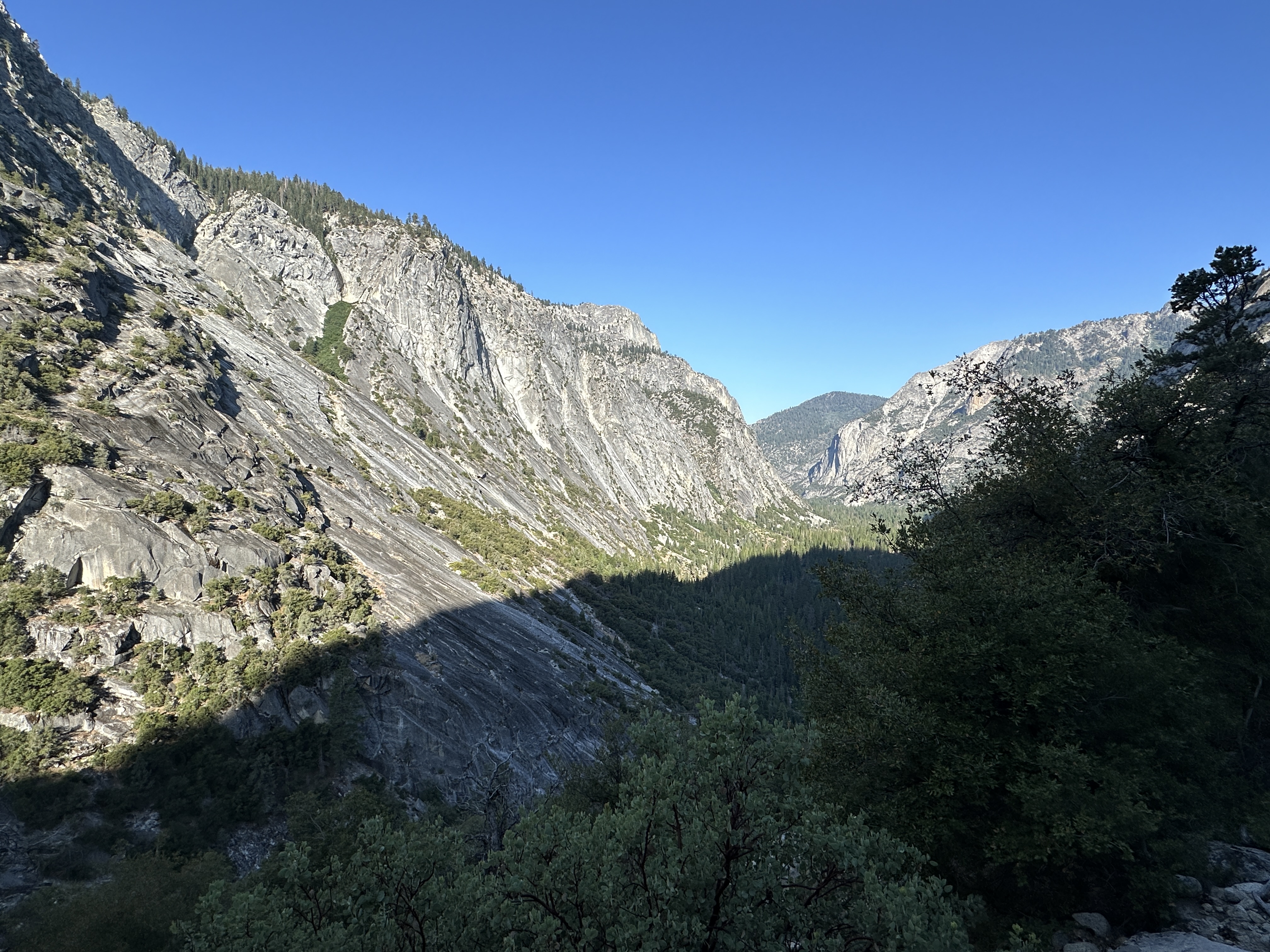
The ridge is a bit of an interesting feature. It’s actually a peak and ridge series that separate three valleys. We climbed a northwest facing ridge to see a valley to the south, then traversed a ways, to drop of the north side again, except it put us in a different valley than we had been in. I’ve marked the feature in the image below.
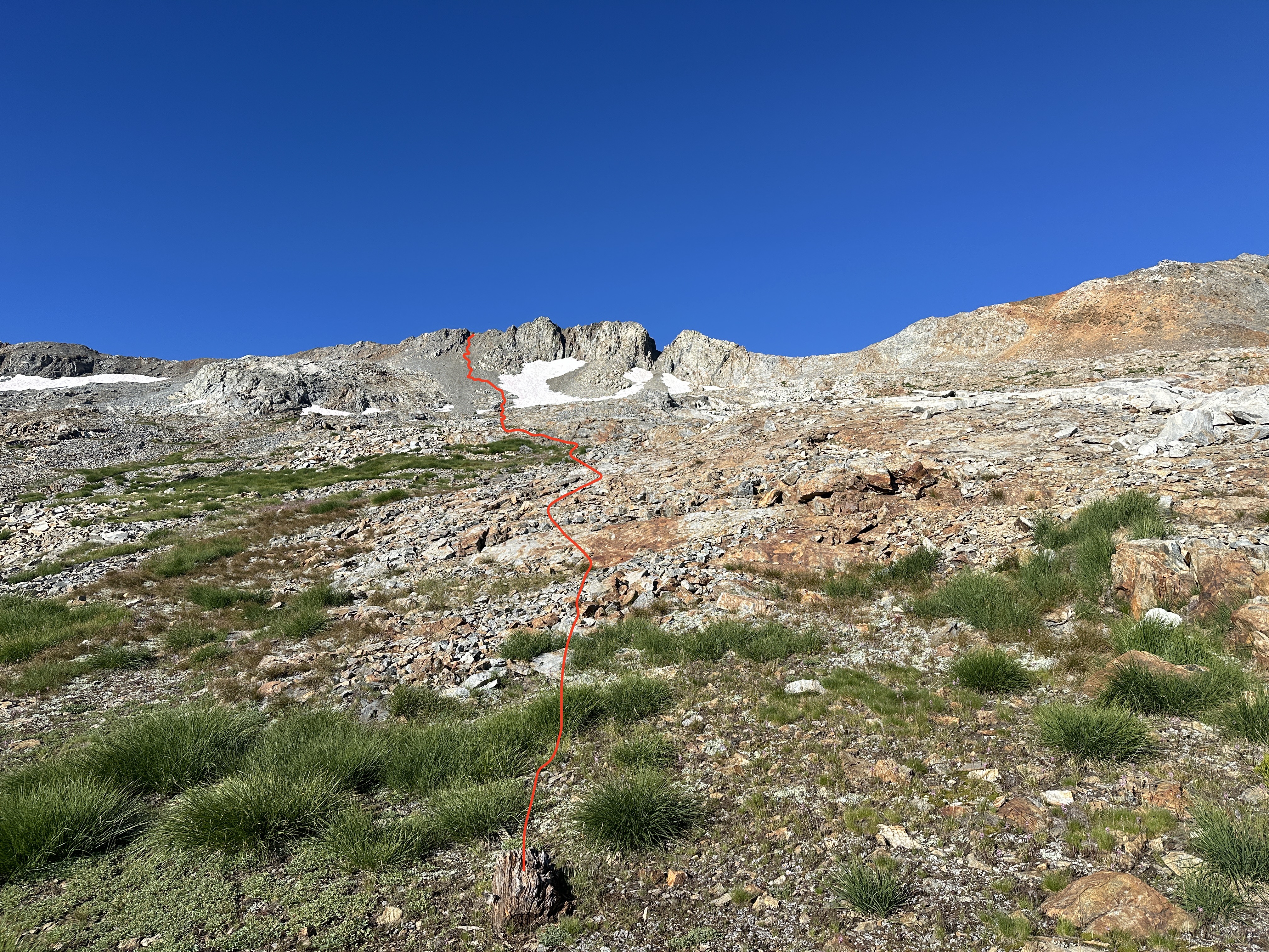
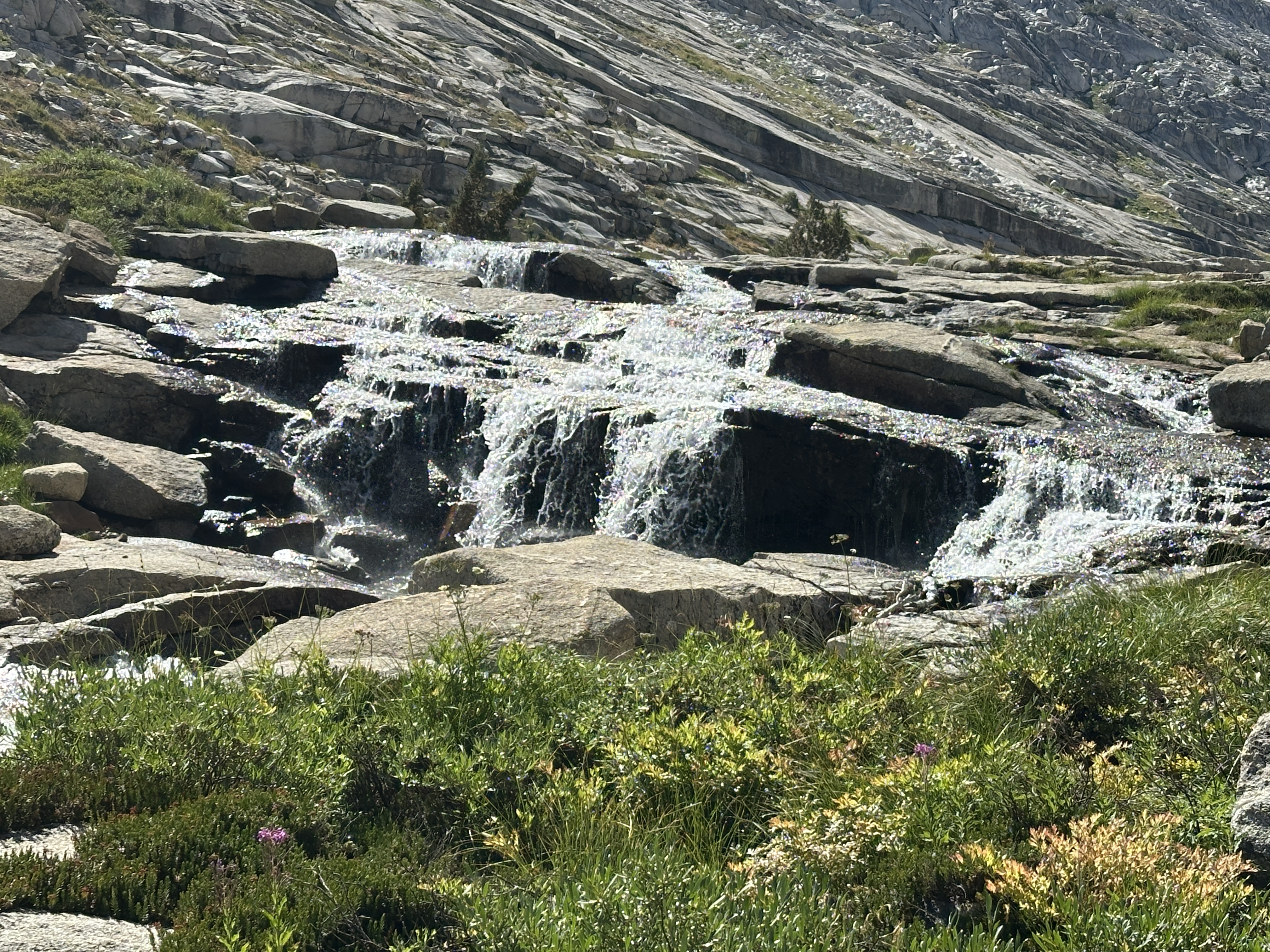
According to my GPS track, we started moving about 8:15AM. The plan was to descend to the trees where we’d pick up an old trail to climb up Colby Pass. The route would take us below The Whale’s Back (shown in better detail later in this blog post) rock feature then up and to the right.
I did not know it at the time. I learned when we stopped near the Colby Pass trail, but “D” had thrown up all the food and water consumed the previous afternoon, over night. We descended about 2,500′ to around 9,000′ in 4.6 miles.
It was actually somewhat steep. We took a short break when we got to the river, where the red line bends hard left.
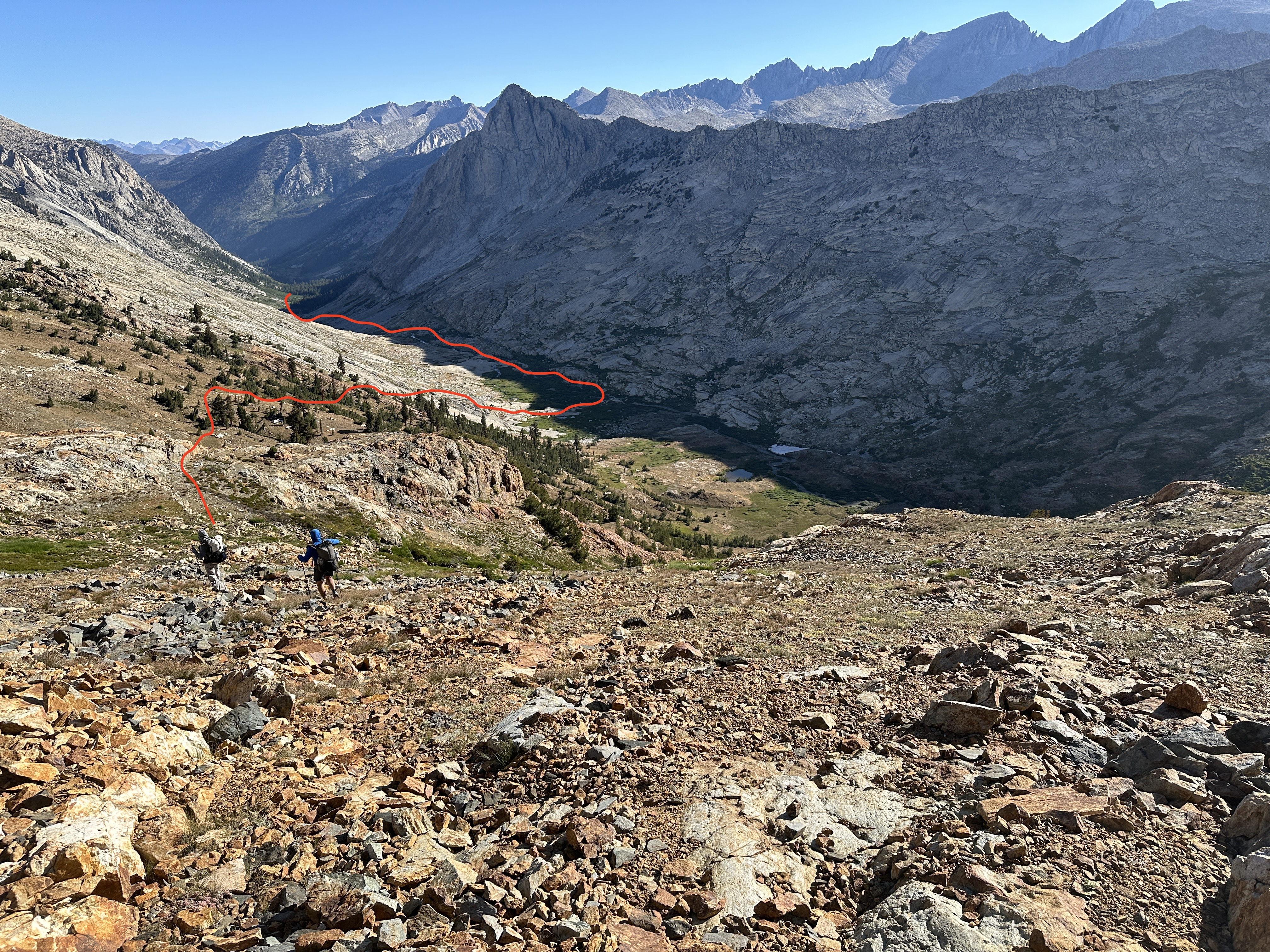

Below: Looking up to the left. We had a mix of walking on broken ground, large talus, slaps, and minor brush bashing.
Things get serious…
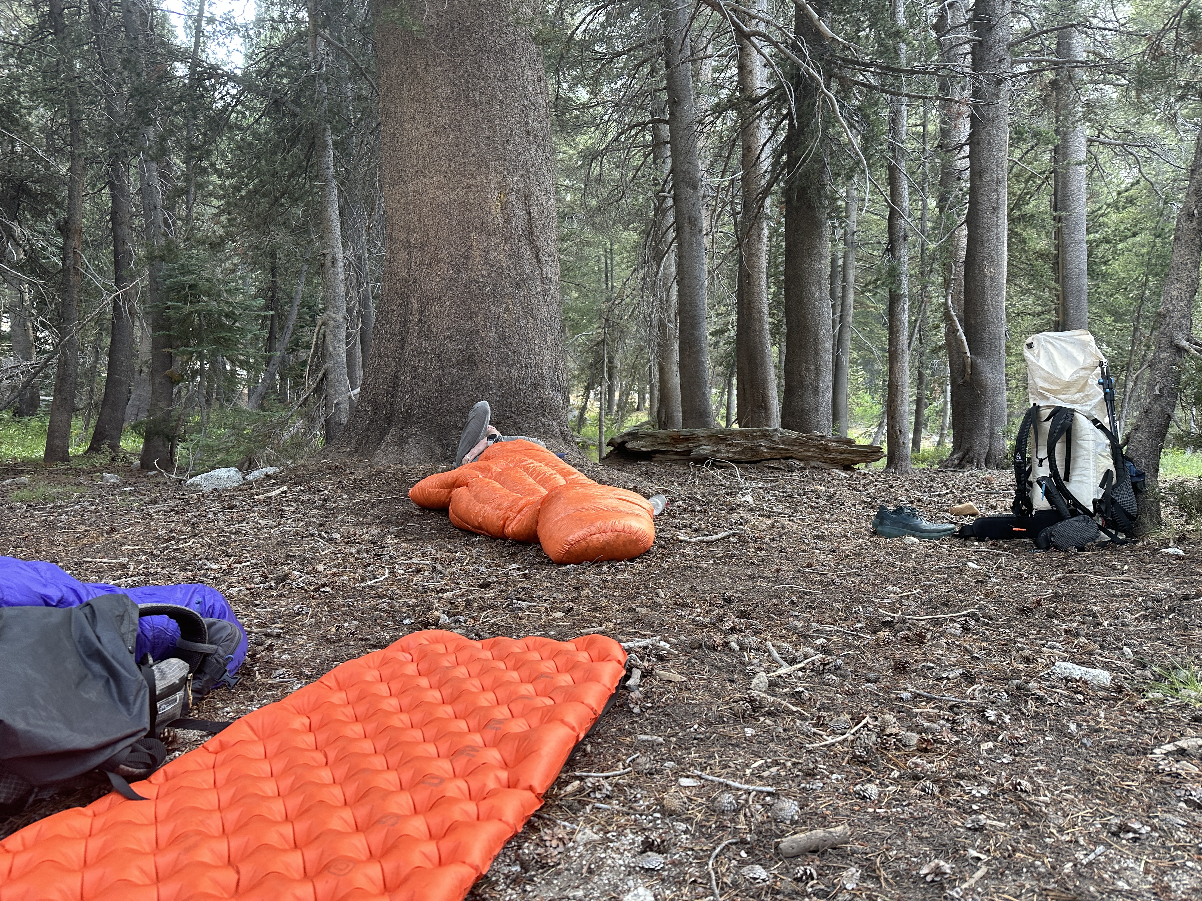
Once down in the trees, near water, we took another break. This is where I learned one of our team, not be this time, was having difficulty. After about a 30 minute break, someone, L I think, asked if we should get ready and go. “D” expressed he needed more time. He as belching and showing signs of (at this point) dry heaves. No problem, we’d wait. We were not tracking time, but I’d estimate another 30 minutes went by, “D”, was laying down, curled up, when all of a sudden he lost all his water and food, and was puking very dark residual, resembling bile. He was also cramping everywhere and shaking.
I’m embarrassed to admit, but I didn’t put my WFA/MOFA skills to work when things were obviously going south. I recognized this at the time, but I also didn’t want to step on toes and felt like my input wasn’t going to be valued anyway. L and J were communicating with D. But little things like recording the time of day for certain observations, taking heart rates, etc., can be valuable to help when it arrives. Noting when symptoms first began, where those symptoms worsen, etc., are all things we are taught in WFA/MOFA course.
It was soon obvious that the trip was not continuing. First there was discussion about whether to rest and recover where we were, or continue downhill through Cloud Canyon to a backcountry ranger station that was on the map. It was about 7 miles away, and sat about 7,500′. It soon became more obvious we’d be better off closer to help. When D tried to walk with his pack, he maybe made it 50′ and was done. That’s when we walked a few yards to the trail maintenance camp area. There were plenty of camp spots and a couple big steel job boxes locked up with what we figured were trail tools inside. We found a nice spot against a big tree for D.
The timing is fuzzy, but probably around 2PM, “J” started satellite device communication with his partner at home. There were calls made to the rangers by his partner. Eventually it came back that in order for assistance to be given, we had to push the SOS button on the garmin device.
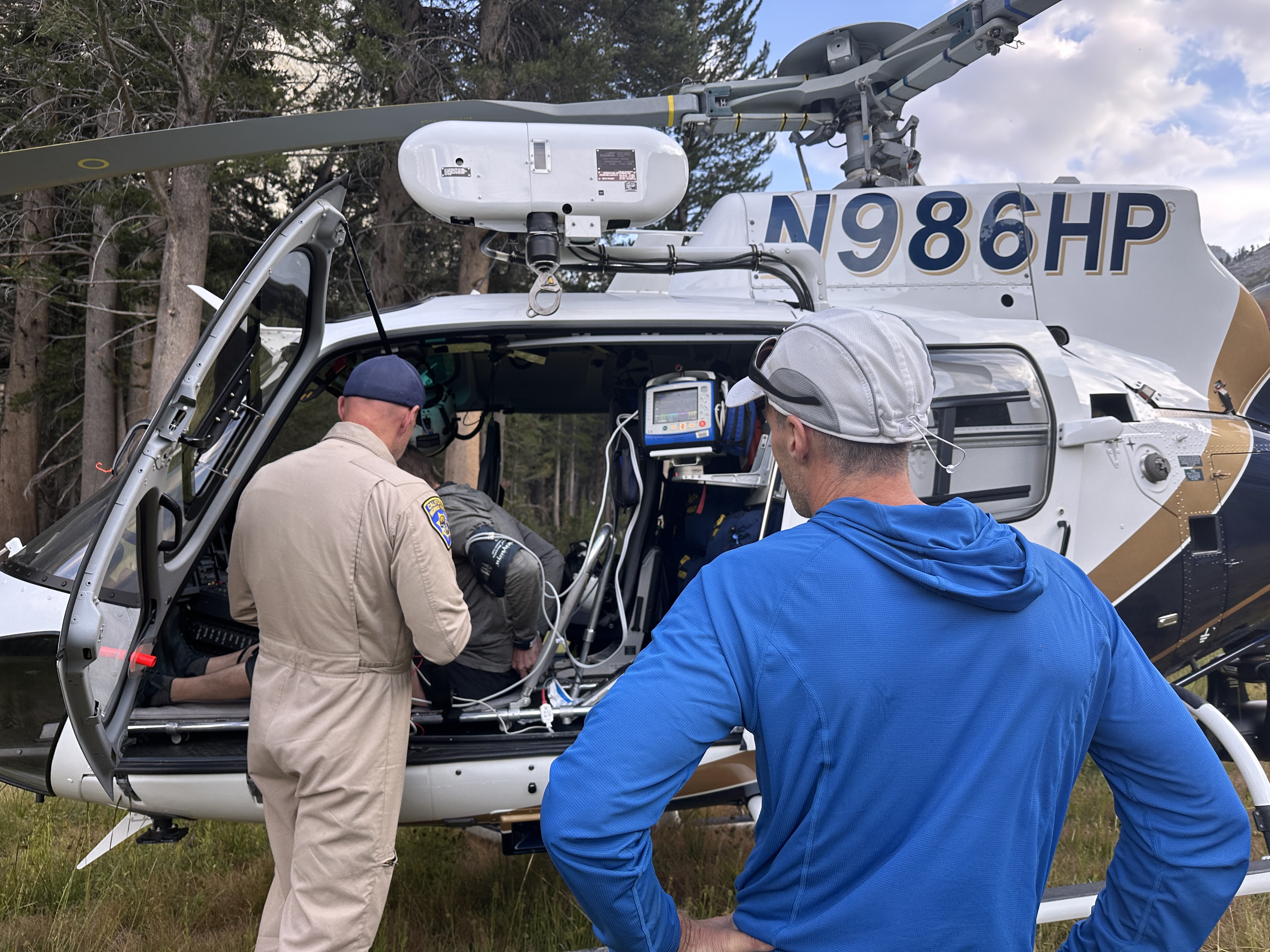
SOS was activated about 4PM. Some quick back and forth by L with emergency services and he got notice a ranger was enroute by foot, from the station we were considering. ETA, 9PM. Just a few minutes after that, L got a message that a chopper was enroute.
At around 6PM, a helicopter appeared overhead, circled and landed. It turns out the California Highway Patrol performs many rescues in the Sierra. One officer said they average one per day during the summer season. They were proud to be flying a new helicopter, with only 300 hours on it. Said they would have announce to us they saw us when they first flew over but the bull horn speaker wasn’t working.
D was able to walk assisted to the helicopter where he was not under great care. Soon he was being flown off to a hospital. He even had a choice of two hospitals. The flight was free because that is how the system is set up.


Huge Relief
It was a huge relief to see D get such quick medical attention. Three of us spent the night and began hiking out to the trailhead the next day. It would take us a day and one-half to exit.
Exit Stratety
Hiking Day #4: Colby Pass intersection to Sphynx Creek.
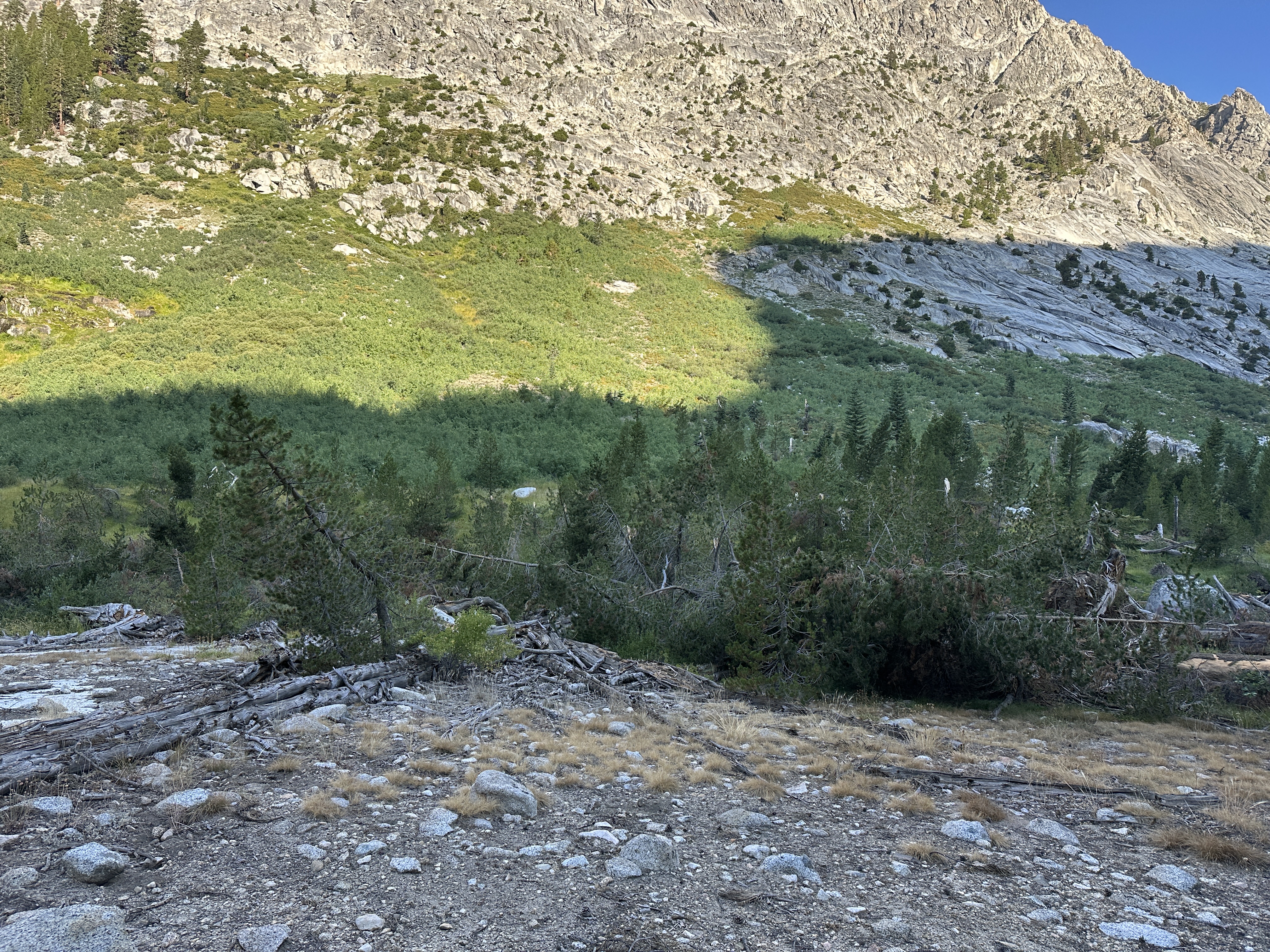
The day after D was evacuated, the three of us set off down Cloud Canyon following the Roaring River. It was 7 miles to the ranger station, which was not staffed when we got there around noon. It was so HOT. Oh my. It was a really pretty hike down. In a valley with a fair amount of brush. We were lucky and didn’t get a lot of bug activity in that area. There was so much avalanche sign with trees sheered off about 10′ from the ground.

After a nice break in the shaded heat at the ranger station we began the ascent on trail to Avalanche Pass. We had to climb to just over 10,000′, a gain of around 2,500′, then descend about 1,500′ to where we hoped would be decent camping. The climb up was hot in most places. It was steepish at first, then mellowed at an easy to flat gradient, before getting steep again near the summit. We were able to get some water along the way. It was a tree’d summit.
We arrived at Sphynx Creek around 5PM. We only had 7 miles remaining, and we’d just hiked 16 miles, 3,150′ gain over 10.5 hours. There was breif talk of zombie walking to the cars, but that was absolutely not appealing to me. It woud have put us at the car about 8PM, then shuttle to the other car at Lodgepole (2 hours), and then to Fresno, another 2 to 2.5 hours.
We ended up camping. It was a fairly buggy spot, but we survived. During the night we all heard the crash of a very large tree. We never saw anything obvious the next morning.

Hiking Day #5: Sphynx Creek to Roads End
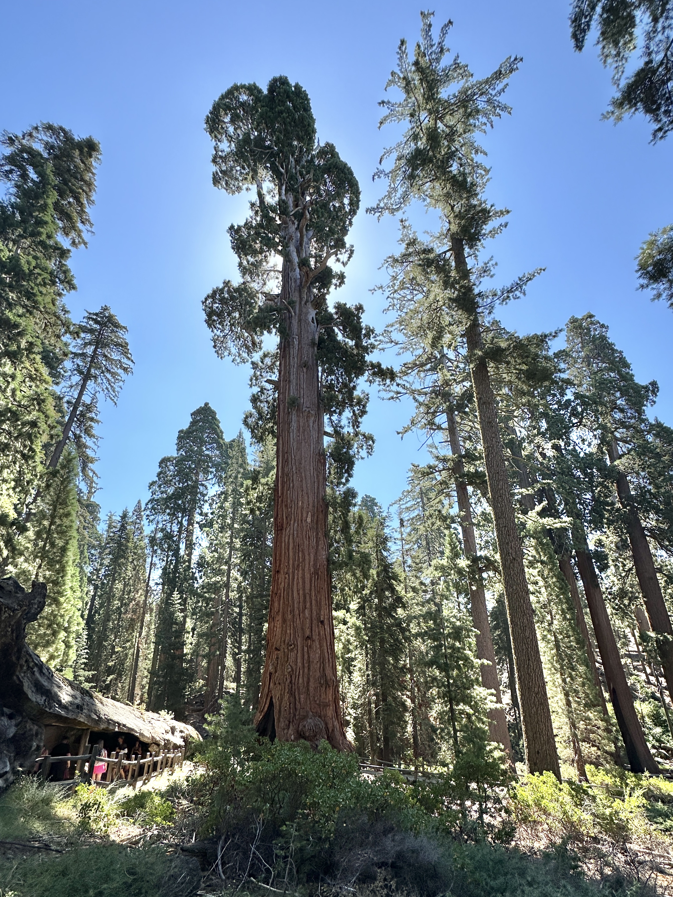
We decided our last day we’d be hiking by 6AM and we were close. A quick coffee for me and J, and then quick food. The hike down descended about 3,600′ in 7.4 miles to Roads End. From there we drove back to Lodgepole, stopping at the Grant Grove to see the large Sequoia’s on the way. I missed getting a photo of General Grant (Large Sequoia), but a few days earlier I captured General Sherman – a much more magnificent specimen.


Wrap Up and Reflection
We were all back in Fresno by 3PM or so. I was a little slower getting on the road. D had been released from hospital after two nights. He’d been in pretty serious condition and no definitive answer. I personally believe it was the combination of exhaustion, dehydration, low electrolytes, and altitude, and once he started going downhill, recovery was not possible. Others in our group believe some sort of stomach bug was involved. One thing for certain, another night in the wilderness would have been very serious for D, likely resulting in very serious health concerns, if not worse.
Writing about the trip has been a way for me to remember and reflect. The incident demonstrates our frailty and how quickly scenarios develop – going from “this sucks” to someone’s health, and potentially life, depend on immediate help.
Could we have avoided this situation? That’s the million dollar question. It’s always easy to critique after the fact. No one can predict when they might be injured or sick. Based on how I do trips in the Mountaineers, and have conducted them privately with friends, I can say there are a few things we should have done much differently. I can’t say they would have changed any outcome. But, I know I’d feel better knowing they were not left hanging.
- We did not have a proper pre-trip discussion and plan beyond the overall route objective and meeting each other. We had bailout routes and options, but we didn’t have the talk about pacing, working/making decisions as a group, making sure everyone had a voice and that voice would be respected.
- I did not speak up with conviction that I was not feeling great. I passed it off as something to do with the smoke, which I believed at the time. Late on day 3 I even rejected help because by that time, I was, as I put it to “L”, in a very dark space. We had a shared responsibility at that point below Copper Mine. Me to accept and ask for help. For the team to take a stronger stance with me.
- We set off a bit fast for the elevation. Three of the group were fine with the pace. I kept up at first, but in doing so, I set myself back.
- I think the three I hiked with have an experience halo from having done previous big trips at altitude with no ill effects and figured this trip would go the same.
- I was often arriving a few minutes after others to summit passes and decision points, with the decision already made. In many cases this was okay, they knew where they were going, but it did not make me feel included as a team member. As a result, when asked how I was doing, I’d just respond with “fine, just moving slow”. I needed to be more honest that I felt like this most of the time. I didn’t want to be considered a whiner on the trip. But it was also seemed obvious, the rest of my group wasn’t really tuned into the fact that I was struggling, until that late on the 2nd day when I completely bonked. And even then, it’s a bit iffy considering I was left behind in the dark at a time when I was most vulnerable to tripping/collapsing. And this is also reflected back to 3PM at Lonely Lake. When someone starts saying things like, I’m not sure I can continue, it really needs to be listened too.
- I don’t think we had a fully honest post trip debrief.
- I think the heat played a big role. This trip would be better completed later in the year when it is a bit cooler. But with the Sierra, it’s impossible to predict wildfires and smoke issues. Getting closer to August seems better.
If you landed on this post first, the full story begins here in post #1 of 5.


Wow, Ron quite a trip. Great post trip insights. Amazing and difficult trip with amazing pictures.
Thanks for the pics and the details commentary.
Richard Kennedy
LikeLiked by 1 person
Wow, Ron quite a trip. Great post trip insights. Amazing and difficult trip with amazing pictures.
Thanks for the pics and the details commentary.
Richard Kennedy
LikeLike
Thank you, Richard. It was quite the trip. Glad you enjoyed the writeup. And to think the Sierra is getting its first snow this weekend. Yeesh!
LikeLike